Where is Chippewa County, Michigan?
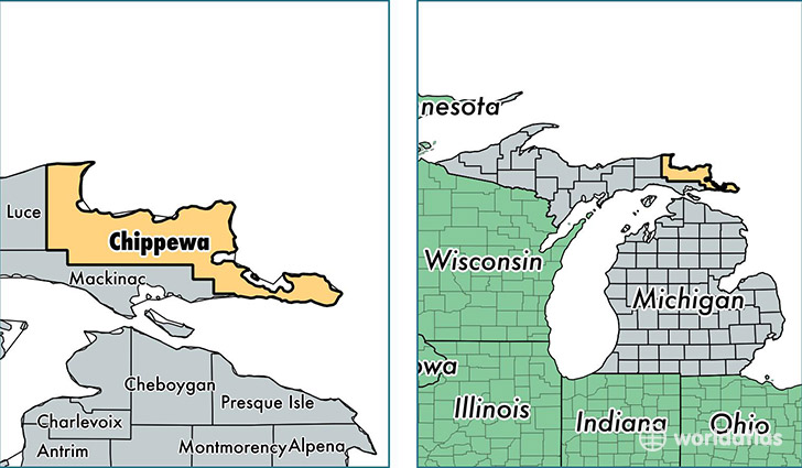
Chippewa County is a county equivalent area found in Michigan, USA. The county government of Chippewa is found in the county seat of Sault Sainte Marie.
With a total 6,988.8 sq. km of land and water area, Chippewa County, Michigan is the 206th largest county equivalent area in the United States. Home to 38,321 people, Chippewa County has a total 21135 households earning 41637 on average per year.
Chippewa County, Michigan - Quick Facts
| FIPS Code | 26033 |
| Area Codes | 906 |
| Time Zone | EST |
| Major Cities | Sault Sainte Marie (population: 19,870), Kincheloe (population: 6,677), Brimley (population: 3,162), Rudyard (population: 1,965), Pickford (population: 1,867), Dafter (population: 1,157), Drummond Island (population: 1,068), De Tour Village (population: 773), Goetzville (population: 583), Kinross (population: 520) |
| Land Area | 14,796 sq miles |
| Water Area | 1,558 sq miles |
| Household Income | $41,637 |
| Housing Units | 21,135 |
| Median Home Value | $101,600 |
| High School Grads | 90% of population |
| Holders of Bachelors Degrees | 19% of population |
| Retail Spending | $9,521 per capita |
| Food & Accomodation Sales | $189,886 per capita |
This page was last updated on June 30, 2016.