Where is Kent County, Maryland?
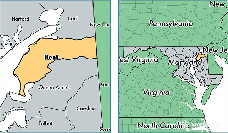
Kent County is a county equivalent area found in Maryland, USA. The county government of Kent is found in the county seat of Chestertown.
With a total 1,070.82 sq. km of land and water area, Kent County, Maryland is the 2521st largest county equivalent area in the United States. Home to 19,820 people, Kent County has a total 10612 households earning 56259 on average per year.
Kent County, Maryland - Quick Facts
| FIPS Code | 24029 |
| Area Codes | 410 |
| Time Zone | EST |
| Major Cities | Chestertown (population: 12,904), Rock Hall (population: 2,652), Worton (population: 2,300), Galena (population: 2,097), Kennedyville (population: 1,038), Betterton (population: 377), Still Pond (population: 309), Massey (population: 237) |
| Land Area | 7,653 sq miles |
| Water Area | 277 sq miles |
| Household Income | $56,259 |
| Housing Units | 10,612 |
| Median Home Value | $258,200 |
| High School Grads | 87% of population |
| Holders of Bachelors Degrees | 30% of population |
| Retail Spending | $9,917 per capita |
| Food & Accomodation Sales | $36,003 per capita |
This page was last updated on June 30, 2016.