Where is Franklin County, Kansas?
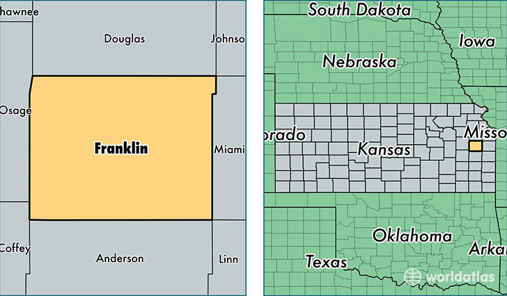
Franklin County is a county equivalent area found in Kansas, USA. The county government of Franklin is found in the county seat of Ottawa.
With a total 1,494.78 sq. km of land and water area, Franklin County, Kansas is the 1850th largest county equivalent area in the United States. Home to 25,611 people, Franklin County has a total 11077 households earning 49543 on average per year.
Franklin County, Kansas - Quick Facts
| FIPS Code | 20059 |
| Area Codes | 785 |
| Time Zone | CST |
| Major Cities | Ottawa (population: 16,116), Wellsville (population: 4,077), Pomona (population: 2,192), Richmond (population: 1,058), Princeton (population: 957), Williamsburg (population: 892), Rantoul (population: 778), Lane (population: 654) |
| Land Area | 9,888 sq miles |
| Water Area | 572 sq miles |
| Household Income | $49,543 |
| Housing Units | 11,077 |
| Median Home Value | $119,700 |
| High School Grads | 91% of population |
| Holders of Bachelors Degrees | 20% of population |
| Retail Spending | $8,921 per capita |
| Food & Accomodation Sales | $27,910 per capita |
This page was last updated on June 30, 2016.