Where is Miami County, Indiana?
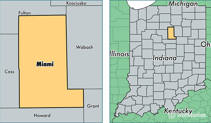
Miami County is a county equivalent area found in Indiana, USA. The county government of Miami is found in the county seat of Peru.
With a total 977.43 sq. km of land and water area, Miami County, Indiana is the 2665th largest county equivalent area in the United States. Home to 35,954 people, Miami County has a total 15273 households earning 42023 on average per year.
Miami County, Indiana - Quick Facts
| FIPS Code | 18103 |
| Area Codes | 765,574 |
| Time Zone | EST |
| Major Cities | Peru (population: 23,498), Bunker Hill (population: 4,852), Macy (population: 2,149), Denver (population: 1,688), Amboy (population: 1,422), Mexico (population: 454), Miami (population: 228), Deedsville (population: 84) |
| Land Area | 13,882 sq miles |
| Water Area | 374 sq miles |
| Household Income | $42,023 |
| Housing Units | 15,273 |
| Median Home Value | $84,100 |
| High School Grads | 83% of population |
| Holders of Bachelors Degrees | 11% of population |
| Retail Spending | $6,423 per capita |
| Food & Accomodation Sales | $25,837 per capita |
This page was last updated on June 30, 2016.