Where is Stephenson County, Illinois?
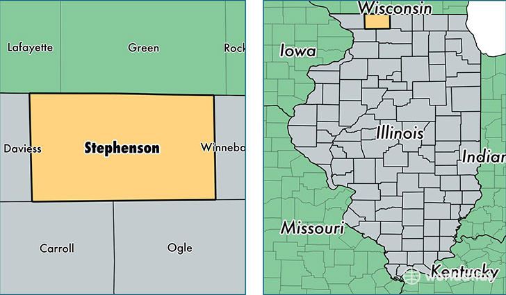
Stephenson County is a county equivalent area found in Illinois, USA. The county government of Stephenson is found in the county seat of Freeport.
With a total 1,463.56 sq. km of land and water area, Stephenson County, Illinois is the 1955th largest county equivalent area in the United States. Home to 46,435 people, Stephenson County has a total 21888 households earning 43472 on average per year.
Stephenson County, Illinois - Quick Facts
| FIPS Code | 17177 |
| Area Codes | 815 |
| Time Zone | CST |
| Major Cities | Freeport (population: 31,152), Lena (population: 4,292), Davis (population: 3,500), Pearl City (population: 1,952), Orangeville (population: 1,409), Rock City (population: 1,112), Dakota (population: 1,062), Winslow (population: 853), Ridott (population: 798), German Valley (population: 789) |
| Land Area | 17,929 sq miles |
| Water Area | 564 sq miles |
| Household Income | $43,472 |
| Housing Units | 21,888 |
| Median Home Value | $101,800 |
| High School Grads | 90% of population |
| Holders of Bachelors Degrees | 18% of population |
| Retail Spending | $10,285 per capita |
| Food & Accomodation Sales | $44,798 per capita |
This page was last updated on June 30, 2016.