Where is Cerro Gordo County, Iowa?
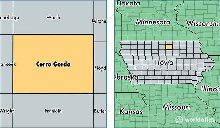
Cerro Gordo County is a county equivalent area found in Iowa, USA. The county government of Cerro Gordo is found in the county seat of Mason City.
With a total 1,489.55 sq. km of land and water area, Cerro Gordo County, Iowa is the 1878th largest county equivalent area in the United States. Home to 43,254 people, Cerro Gordo County has a total 22147 households earning 44795 on average per year.
Cerro Gordo County, Iowa - Quick Facts
| FIPS Code | 19033 |
| Area Codes | 641 |
| Time Zone | CST |
| Major Cities | Mason City (population: 29,591), Clear Lake (population: 9,306), Rockwell (population: 1,561), Ventura (population: 767), Thornton (population: 678), Plymouth (population: 667), Meservey (population: 436), Swaledale (population: 344), Dougherty (population: 253), Rock Falls (population: 93) |
| Land Area | 16,700 sq miles |
| Water Area | 568 sq miles |
| Household Income | $44,795 |
| Housing Units | 22,147 |
| Median Home Value | $110,800 |
| High School Grads | 92% of population |
| Holders of Bachelors Degrees | 21% of population |
| Retail Spending | $20,200 per capita |
| Food & Accomodation Sales | $83,915 per capita |
| Universities and Colleges | Kaplan University-Mason City Campus, La James College of Hairstyling and Cosmetology |
This page was last updated on June 30, 2016.