Where is Lanier County, Georgia?
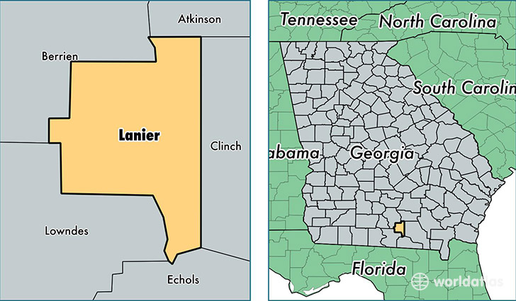
Lanier County is a county equivalent area found in Georgia, USA. The county government of Lanier is found in the county seat of Lakeland.
With a total 517.45 sq. km of land and water area, Lanier County, Georgia is the 3019th largest county equivalent area in the United States. Home to 10,373 people, Lanier County has a total 4250 households earning 39452 on average per year.
Lanier County, Georgia - Quick Facts
| FIPS Code | 13173 |
| Area Codes | 229 |
| Time Zone | EST |
| Major Cities | Lakeland (population: 6,766), Stockton (population: 1,089) |
| Land Area | 4,005 sq miles |
| Water Area | 185 sq miles |
| Household Income | $39,452 |
| Housing Units | 4,250 |
| Median Home Value | $111,800 |
| High School Grads | 76% of population |
| Holders of Bachelors Degrees | 12% of population |
This page was last updated on June 30, 2016.