Where is Walton County, Florida?
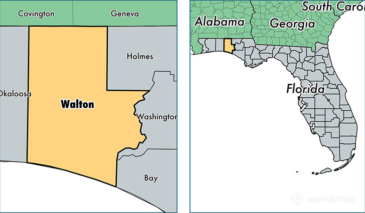
Walton County is a county equivalent area found in Florida, USA. The county government of Walton is found in the county seat of De Funiak Springs.
With a total 3,210.54 sq. km of land and water area, Walton County, Florida is the 560th largest county equivalent area in the United States. Home to 61,530 people, Walton County has a total 46534 households earning 43640 on average per year.
Walton County, Florida - Quick Facts
| FIPS Code | 12131 |
| Area Codes | 850 |
| Time Zone | CST |
| Major Cities | Defuniak Springs (population: 23,721), Santa Rosa Beach (population: 11,985), Freeport (population: 8,070), Miramar Beach (population: 6,137), Laurel Hill (population: 3,682), Argyle (population: 48), Rosemary Beach (population: 13) |
| Land Area | 23,757 sq miles |
| Water Area | 1,038 sq miles |
| Household Income | $43,640 |
| Housing Units | 46,534 |
| Median Home Value | $159,500 |
| High School Grads | 85% of population |
| Holders of Bachelors Degrees | 24% of population |
| Retail Spending | $13,387 per capita |
| Food & Accomodation Sales | $312,686 per capita |
This page was last updated on June 30, 2016.