Where is Crittenden County, Arkansas?
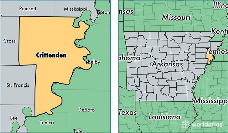
Crittenden County is a county equivalent area found in Arkansas, USA. The county government of Crittenden is found in the county seat of Marion.
With a total 1,648.21 sq. km of land and water area, Crittenden County, Arkansas is the 1625th largest county equivalent area in the United States. Home to 49,548 people, Crittenden County has a total 21473 households earning 37751 on average per year.
Crittenden County, Arkansas - Quick Facts
| FIPS Code | 5035 |
| Area Codes | 870 |
| Time Zone | CST |
| Major Cities | West Memphis (population: 25,617), Marion (population: 15,557), Earle (population: 3,129), Proctor (population: 1,942), Crawfordsville (population: 1,702), Turrell (population: 936), Gilmore (population: 200), Edmondson (population: 102), Clarkedale (population: 42) |
| Land Area | 19,131 sq miles |
| Water Area | 610 sq miles |
| Household Income | $37,751 |
| Housing Units | 21,473 |
| Median Home Value | $99,500 |
| High School Grads | 79% of population |
| Holders of Bachelors Degrees | 14% of population |
| Retail Spending | $14,399 per capita |
| Food & Accomodation Sales | $65,142 per capita |
This page was last updated on June 30, 2016.