Where is Lawrence County, Alabama?
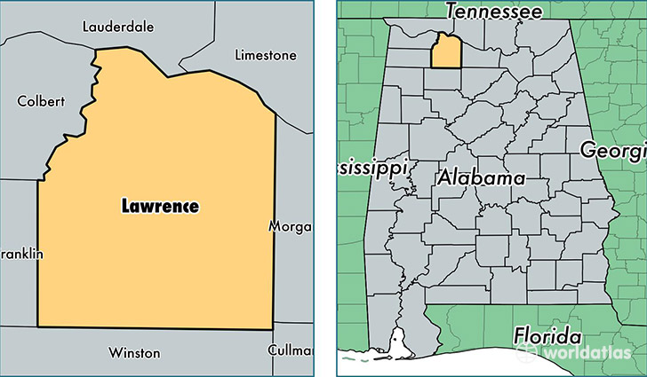
Lawrence County is a county equivalent area found in Alabama, USA. The county government of Lawrence is found in the county seat of Moulton.
With a total 1,857.54 sq. km of land and water area, Lawrence County, Alabama is the 1390th largest county equivalent area in the United States. Home to 33,477 people, Lawrence County has a total 15083 households earning 38551 on average per year.
Lawrence County, Alabama - Quick Facts
| FIPS Code | 1079 |
| Area Codes | 256 |
| Time Zone | CST |
| Major Cities | Moulton (population: 13,767), Trinity (population: 8,136), Town Creek (population: 6,352), Danville (population: 5,126), Hillsboro (population: 2,898), Courtland (population: 1,842), Mount Hope (population: 1,292) |
| Land Area | 12,926 sq miles |
| Water Area | 691 sq miles |
| Household Income | $38,551 |
| Housing Units | 15,083 |
| Median Home Value | $94,200 |
| High School Grads | 77% of population |
| Holders of Bachelors Degrees | 12% of population |
| Retail Spending | $4,889 per capita |
| Food & Accomodation Sales | $22,719 per capita |
This page was last updated on June 30, 2016.