Where is Sherman County, Kansas?
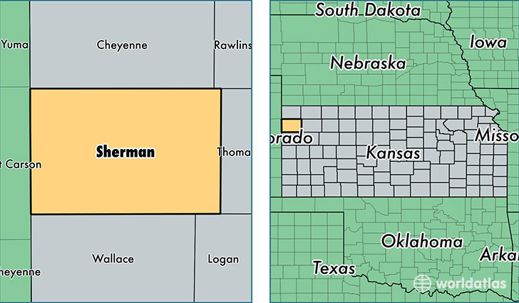
Sherman County is a county equivalent area found in Kansas, USA. The county government of Sherman is found in the county seat of Goodland.
With a total 2,735.74 sq. km of land and water area, Sherman County, Kansas is the 711th largest county equivalent area in the United States. Home to 6,110 people, Sherman County has a total 3120 households earning 38634 on average per year.
Sherman County, Kansas - Quick Facts
| FIPS Code | 20181 |
| Area Codes | 785 |
| Time Zone | MST |
| Major Cities | Goodland (population: 5,569), Kanorado (population: 331), Edson (population: 151) |
| Land Area | 2,359 sq miles |
| Water Area | 1,056 sq miles |
| Household Income | $38,634 |
| Housing Units | 3,120 |
| Median Home Value | $74,200 |
| High School Grads | 89% of population |
| Holders of Bachelors Degrees | 16% of population |
| Retail Spending | $18,781 per capita |
| Food & Accomodation Sales | $11,006 per capita |
This page was last updated on June 30, 2016.