Where is Rawlins County, Kansas?
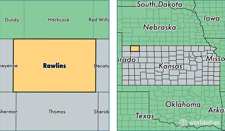
Rawlins County is a county equivalent area found in Kansas, USA. The county government of Rawlins is found in the county seat of Atwood.
With a total 2,770.19 sq. km of land and water area, Rawlins County, Kansas is the 698th largest county equivalent area in the United States. Home to 2,584 people, Rawlins County has a total 1450 households earning 43482 on average per year.
Rawlins County, Kansas - Quick Facts
| FIPS Code | 20153 |
| Area Codes | 785 |
| Time Zone | CST |
| Major Cities | Atwood (population: 1,638), McDonald (population: 326), Herndon (population: 262), Ludell (population: 188) |
| Land Area | 998 sq miles |
| Water Area | 1,070 sq miles |
| Household Income | $43,482 |
| Housing Units | 1,450 |
| Median Home Value | $66,700 |
| High School Grads | 91% of population |
| Holders of Bachelors Degrees | 23% of population |
| Retail Spending | $6,413 per capita |
| Food & Accomodation Sales | $727 per capita |
This page was last updated on June 30, 2016.