Maps of Seychelles

Seychelles is an island country located in the western Indian Ocean, northeast of Madagascar and about 1,600 kilometers east of mainland Africa. Covering a total area of 446 km2 (172 mi2), the country consists of an archipelago of 115 islands (only 8 are permanently inhabited). It should be noted that the country's constitution states a total of 155 islands because it considers numerous other tiny islets, rocks, and reefs, to be distinct.
Granitic Islands
The Granitic Islands, composed mainly of granite rock, are the largest and oldest islands in Seychelles. They are located in the northeastern part of the archipelago. Mahé is the largest of the Granitic Islands and also the most populous. It is home to the country's capital, Victoria. This region features rugged mountain ranges with Morne Seychellois, located on Mahé, as the highest point in the country at 905 meters (2,969 feet) above sea level. The lowest point in the country is the Indian Ocean, at sea level, which borders the islands.
Coralline Islands
The Coralline Islands are primarily made up of coral. These islands are flatter than the Granitic Islands, with elevation rarely exceeding 10 meters (33 feet) above sea level. Aldabra Atoll, the largest atoll in the world and a UNESCO World Heritage Site, is part of this group and stands as an exceptional geographical feature due to its sheer size and lagoon. Unlike the Granitic Islands, the Coralline Islands have fewer permanent inhabitants due to their remote location and lower elevations.
Amirantes Group
Positioned to the south of the Granitic Islands, the Amirantes Group includes a mix of coral islands and atolls. These islands are generally flat, with white sandy beaches that merge into the surrounding Indian Ocean. Desroches Island is the largest island in this group, and like most islands in the Amirantes, it is characterized by its shallow lagoons and broad reef systems.
Outer Islands
The Outer Islands are situated to the south and east of the main archipelago and are primarily coral islands. They include the Southern Coral Group, Alphonse Group, and the Farquhar Group. Due to their vast distance from the main islands, these islands are less populated and less frequented. Their geography is marked by low-lying terrains, expansive lagoons, and extensive coral reefs.
Districts of Seychelles Map

Seychelles has 26 administrative districts. In alphabetical order, these are Anse aux Pins, Anse Boileau, Anse Etoile, Anse Royale, Au Cap, Baie Lazare, Baie Sainte Anne, Beau Vallon, Bel Air, Bel Ombre, Cascade, English River, Glacis, Grand' Anse (on Mahe), Grand' Anse (on Praslin), Inner Islands, Les mamelles, Mont Buxton, Mont Fleuri, Plaisance, Pointe Larue, Port Glaud, Roche Caiman, Saint Louis, Takamaka. The 26th district is the Outer Islands which was recognized as a district in recent years by the country's tourism department.
Three districts English River, Mont Fleuri, and Saint Louis (shown on the map above) together comprise the national capital of Victoria.
Where is Seychelles?

An archipelagic island country in the Somali Sea region of the Indian Ocean, Seychelles is located in the Southern and Eastern Hemispheres of the Earth. Itis located around 1,600 km off the eastern coast of Kenya in mainland Africa. It is located to the northeast of Madagascar, another island country of Africa. Other major islands near Seychelles include Comoros and Mauritius to the south, and Maldives to the east.
Regional Maps: Map of Africa
Outline Map of Seychelles

The blank outline map above shows some of the major islands of Seychelles. The largest among them is the island of Mahe. The above map can be downloaded for free and used for educational purposes or coloring.

The outline map shows the major islands of Seychelles including the largest island of Mahe. These islands are spread across a vast area of 1,336,559 sq. km.
Key Facts
| Legal Name | Republic of Seychelles |
|---|---|
| Flag |
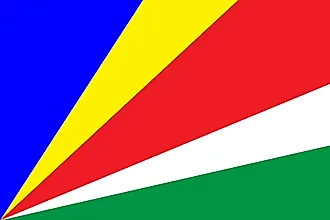
|
| Capital City | Victoria |
| 4 37 S, 55 27 E | |
| Total Area | 455.00 km2 |
| Land Area | 455.00 km2 |
| Water Area | N/A |
| Population | 97,625 |
| Currency | Seychelles rupees (SCR) |
| GDP | $1.70 Billion |
| GDP Per Capita | $17,401.72 |
This page was last updated on October 23, 2023