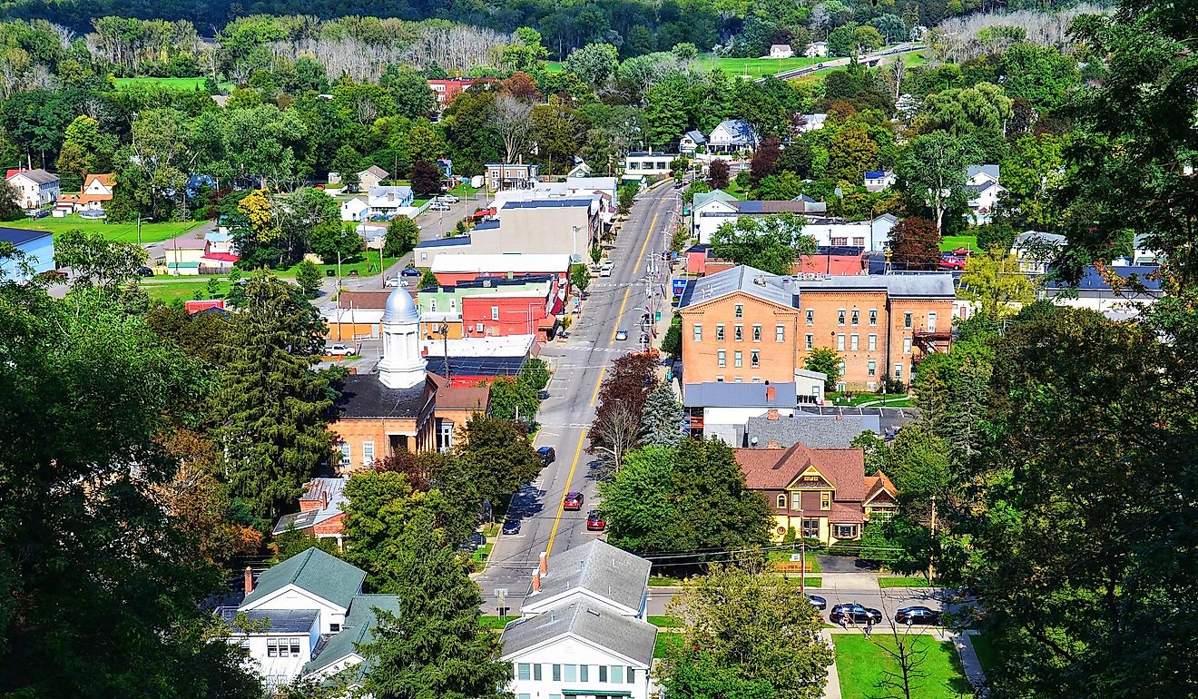
9 Safest Small Communities To Settle In Pennsylvania
There’s a quieter side of Pennsylvania that doesn’t show up in tourism ads or crime headlines. It runs through small boroughs and townships where Friday nights mean school games, not sirens, and where neighbors still notice who’s walking the dog after dark.
This guide focuses on nine of those communities: small towns where long-term crime data show aggravated assault and homicide rates staying below both state and national levels. Some grew up around old factories, others around colleges or historic town squares, but they share the same core promise: a place where you can put down roots, know who lives next door, and feel that "going home" also means feeling safe.
Fox Chapel

This town's deliberate design choice has kept it free of retail sprawl for decades. Originally developed as a retreat for Pittsburgh’s industrial elite, the borough remains defined by private wooded lots, gated lanes, and proximity to regional institutions like Shady Side Academy’s 130-acre campus. It operates its own police force and consistently reports violent crime rates far below both state and national averages, with entire years showing no recorded incidents of aggravated assault or homicide. The community enforces land-use ordinances that limit development and preserve trail access across the borough’s steep ravines and wooded corridors.
Beechwood Farms Nature Reserve anchors the eastern edge of town with over 4 miles of walking trails, wetland boardwalks, and an environmental education center operated by the Audubon Society of Western Pennsylvania. The Fox Chapel Golf Club, founded in 1919, maintains a Donald Ross-designed course and a preserved Tudor-style clubhouse. Trillium Trail cuts through dense woodland and runs alongside Squaw Run, where steep banks and spring wildflowers mark the route. Just outside the borough’s limits, the Allegheny RiverTrail Park offers direct access to the riverfront for cycling, rowing, and unpaved walking trails.
Lititz

Lititz was founded in 1756 by the Moravian Church and kept its doors closed to outsiders for more than a century. That long period of isolation shaped a downtown that still reflects its communal origins, brick crosswalks, a central park, and a layout that hasn’t shifted much since the 1800s. The borough reports low violent crime year after year, with rates of aggravated assault and homicide consistently sitting below both state and national averages. Lititz maintains its own police department and a high resident-to-officer ratio, which helps explain its sharp contrast to nearby urban centers. Local governance prioritizes community oversight, especially around events and youth programs.
Lititz Springs Park divides the town in two, running parallel to Main Street and drawing foot traffic year-round. Wilbur Chocolate, once a working factory, now houses The Wilbur Lititz, a hotel and restaurant complex that still sells the original Wilbur Buds in a street-facing shop. Julius Sturgis Pretzel Bakery, founded in 1861, offers hands-on tours and remains one of the few intact 19th-century commercial buildings in the borough. Slate Cafe, tucked behind Main, serves single-origin coffee and operates as a rotating art gallery.
Emmaus

Emmaus was established in 1759 as a closed Moravian settlement and remained under church ownership for nearly a century, giving it one of the few original colonial town plans still intact in eastern Pennsylvania. The borough is bordered by South Mountain and laid out along a narrow grid with limited through traffic, which contributes to its low crime rates. FBI-based data show violent crime well below both state and national averages, with aggravated assault occurring infrequently and no persistent record of homicide. Emmaus operates its own police department and enforces zoning that limits commercial creep from nearby Allentown.
The Emmaus Theatre on South Fourth Street plays second-run films and hosts local film festivals in a single-screen venue dating to the 1920s. Switchback Pizza, built into a converted firehouse, sources ingredients from within the Lehigh Valley and anchors a pocket of businesses near Triangle Park. The Emmaus Farmers' Market operates weekly from early spring through late fall, drawing vendors from Berks and Northampton counties. South Mountain Preserve, managed by Wildlands Conservancy, includes several miles of unpaved trails along the ridgeline and can be accessed from Alpine Street near the borough’s southern edge.
Bellefonte

Bellefonte has produced more Pennsylvania governors than any other town in the state, earning it the nickname "Central Pennsylvania’s cradle of governors." Its courthouse square and surrounding streets remain largely unchanged since the 19th century, with iron railings, limestone foundations, and a preserved grid that reflects its political past. Bellefonte maintains a low violent crime rate across multiple reporting years, with negligible incidents of aggravated assault and virtually no recorded homicides. The borough operates a full-time police department, and its small population allows for consistent neighborhood-level oversight. State College lies just ten miles south, but Bellefonte retains an identity independent from the university corridor.
Talleyrand Park runs along Spring Creek, with a wrought-iron bridge, Victorian-style gazebo, and trout visible from the banks. The Bellefonte Art Museum on North Allegheny Street rotates regional exhibits and houses a permanent Underground Railroad gallery. Big Spring Spirits, built into the former Match Factory complex, distills vodka, gin, and rye on-site and shares a courtyard with a seasonal food truck lineup. My Café Buzz, located on Bishop Street, serves espresso and scratch-made pastries inside a repurposed insurance office.
Murrysville

Murrysville is the only town in the country that has maintained a working gas lantern as part of its official municipal symbol. Installed in 1817 and still in operation, the gas lamp marks the entrance to the Franklin Regional School District campus and signals the borough’s connection to early American infrastructure. Murrysville spans a large geographic footprint with low population density, which helps explain its consistent record of low violent crime. Aggravated assaults are rare and homicides are nearly absent from five-year FBI datasets. The borough maintains its own police department, and patrol coverage extends across all residential neighborhoods, parks, and commercial zones.
Duff Park runs along the southern ridge of Old William Penn Highway and includes hillside trails that connect to the Don Harrison Community Trail system. Rivertowne Brewing, located in the business corridor near Sardis Road, serves small-batch beer brewed in-house with limited distribution outside the region. The Lamplighter Restaurant, near the original gas lamp, has operated since 1969 and functions as both diner and local gathering place. Murrysville Community Park, off Wiestertown Road, offers an amphitheater, sports fields, a splash pad, and access to the Westmoreland Heritage Trail, which stretches east toward Delmont and west toward Trafford.
Mount Lebanon

Mount Lebanon was the first home-rule municipality in Pennsylvania, adopting its own charter in 1975 to formalize the independence it had already functioned under for decades. The borough grew around Pittsburgh’s light rail system and still operates two T-station stops, Washington Road and Dormont Junction, that connect directly to downtown without requiring highway access. Mount Lebanon maintains one of the lowest violent crime rates in Allegheny County, with consistent data showing minimal incidents of aggravated assault and rare, isolated homicides. The municipal police department operates a full-time force with neighborhood patrols and dedicated school resource officers.
Bird Park stretches across Cedar Boulevard with unpaved walking trails, a creek, and a preserve of second-growth woods. The Denis Theatre on Washington Road, once a first-run movie house, is under phased restoration and currently operates community programs in its annex. Uptown Coffee, located two blocks away, serves single-origin espresso and operates a small book-exchange shelf near its back wall. Rollier’s Hardware, open since 1922, sits at the corner of Washington and Shady Drive and functions as both supply store and informal town hub.
Cecil Township

Cecil Township developed as a patchwork of coal towns and farmland, but its more recent identity is tied to the Montour Trail, which cuts directly through the township and draws consistent pedestrian and cycling traffic from across the region. The trail’s presence has helped preserve green buffers between subdivisions, limiting high-density development and concentrating growth near roads already built for it. Cecil reports some of the lowest violent crime rates in Washington County, with multi-year data showing minimal aggravated assaults and no recurring incidents of homicide. The township contracts with its own police department, which patrols all nine villages and surrounding rural roads.
Cecil Park, located off Coleman Road, includes baseball fields, a dog run, and a playground tucked into a wooded hollow. The Tandem Connection, a trailhead café and bike shop on Georgetown Road, serves coffee, pastries, and trail supplies out of a converted freight building. J&D Cellars, a small-batch winery near the Reissing Road entrance to the Montour Trail, offers weekend tastings and live music during summer. Cecil’s section of the trail connects directly to Southpointe, where Town Center Avenue includes shops and restaurants like Jacksons Bar + Bistro, which serves both business travelers and township residents.
Dallas Township

Dallas Township sits at the center of the Back Mountain region and shares its boundaries with Misericordia University, which was founded in 1924 by the Sisters of Mercy and remains one of the few Catholic liberal arts colleges in northeast Pennsylvania. The township’s road system avoids cut-through traffic, and most residential areas are built around cul-de-sacs or former farmland, keeping traffic volume low. Multi-year FBI datasets show consistently low violent crime rates, with aggravated assault averaging well below state thresholds and no sustained record of homicides. Dallas Township Police operate a local station with jurisdiction over residential neighborhoods, school campuses, and rural access roads.
Frances Slocum State Park spans over 1,000 acres and includes a 165-acre lake, unpaved trails, and seasonal kayak rentals from the main lot near Carverton Road. The Back Mountain Trail begins behind Luzerne Shopping Center and extends through Dallas toward Trucksville, following a former rail corridor along Toby Creek. Brace’s Orchard, on Brace Road, operates from mid-July through October and sells peaches, apples, and cider pressed on-site. New Leaf Café, located along Route 309, serves coffee, breakfast, and lunch with seating overlooking a small seasonal nursery and garden shop.
Upper Allen Township

Upper Allen Township contains the entire campus of Messiah University, a private Christian college founded in 1909 that maintains its own nature preserve, academic museums, and athletic facilities open to the public. The township’s geography is defined by the Yellow Breeches Creek and a network of tributaries that separate housing developments from each other, limiting through traffic and commercial congestion. Upper Allen maintains a full-time police department and consistently reports violent crime rates well below both state and national averages. Data across multiple years show almost no homicides and very low rates of aggravated assault. Patrols cover both residential neighborhoods and the commercial corridor along Gettysburg Pike.
Winding Hill Park North includes walking trails, wetlands, and an overlook above the creek valley. The Oakes Museum of Natural History, located inside Jordan Science Center on the Messiah campus, houses full-size African and North American dioramas and a freshwater aquarium system. Duck Donuts on Mill Road prepares made-to-order cake donuts with custom toppings and shares a plaza with Jersey Mike’s and a local yoga studio. Mechanicsburg’s downtown district, less than three miles away, includes The Cracked Pot Coffee Shop, which operates as a nonprofit supporting local employment for adults with disabilities and draws regular traffic from the township.
Taken together, these nine communities form a second Pennsylvania, one defined less by interstates than by creek valleys, school lights, and park paths. Their crime numbers confirm what front porches, local police logs, and long-timers already know: daily life here tends to stay quiet, watchful, and predictable. For anyone measuring home in statistics as much as scenery, they mark the safest corners of the Commonwealth for families, workers, and retirees.