Arabat Bay
Bays refer to any coastal body of water that has a connection to the main water body. These can include oceans, lakes, or even larger bays. While there are a variety of formations, Arabat Bay stands out for its preference amongst tourists. The spit that lines the bay hosts shallow and salty lagoons and provides a comfortable summer location in its Crimean location. With a rich history, its position in the Sea of Azov gives it a unique placement relative to the rest of the world. Because the Azov Sea has little to the south, its western shore gained acclaim for its Arabat Spit, part of the bay itself.
Location

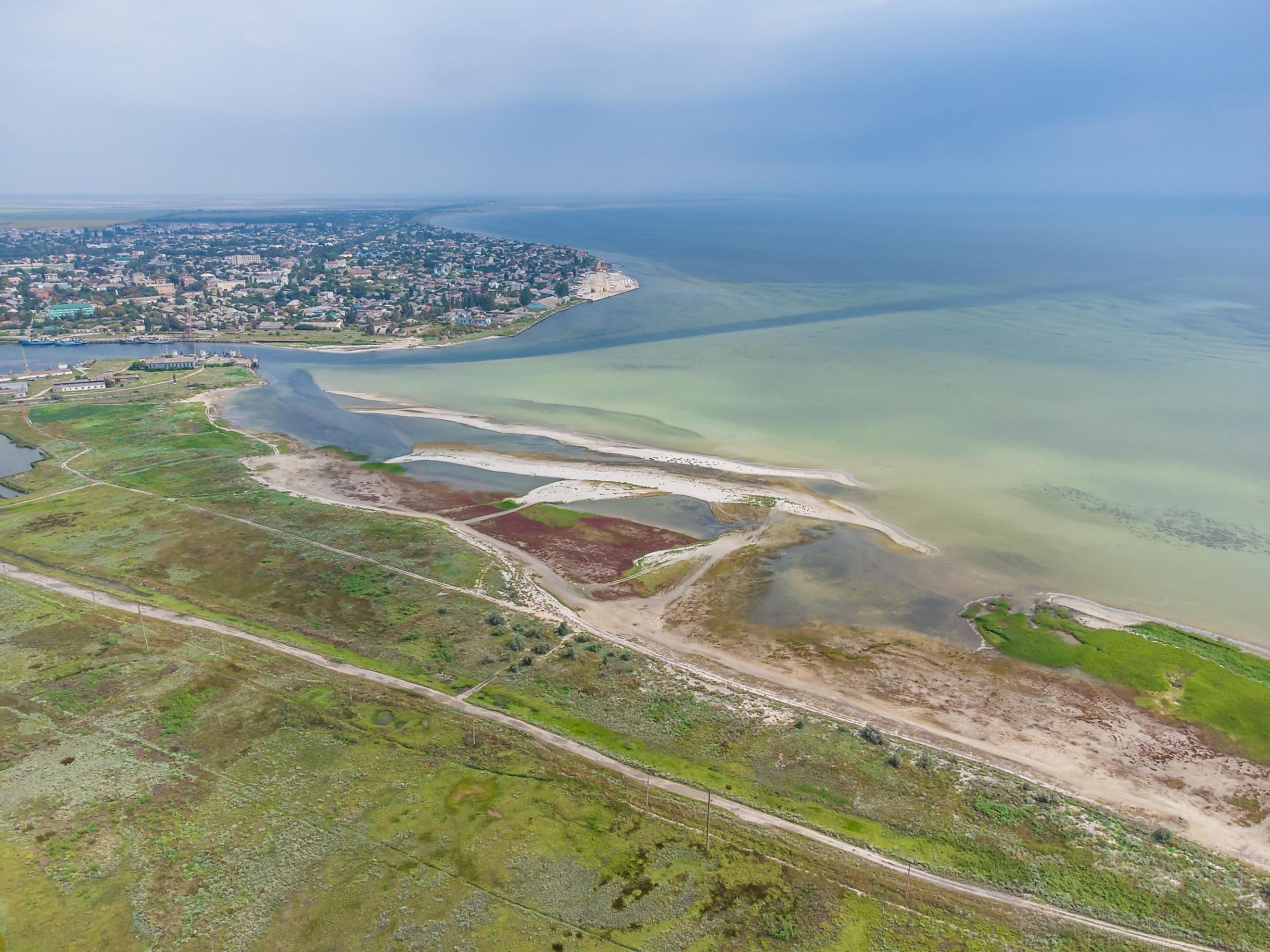
Positioned on the southwestern side of the Sea of Azov, it flows between the northeastern shores of the Crimean Peninsula and the Henichesk Strait to the north. It is 22 km long and reaches as wide as 40 km. At its most narrow, the bay is a mere 270 m. Overall, it comprises a 395 km2 area. It resides along the northwestern coastline of the Kerch Strait and is otherwise bordered by the Crimean coast.
Geography

The geography of the area is unique. The Arabat Spit forms the patch in between the bay and the land mass and has a fond nickname of "Putrid Sea", also called Syvash. It's home to a lake system replete with marshes, extending as far as the Perekop Isthmus. While there is rail and road access on the northern end of the Syvash, most prefer the friendly waters of the Bay of Arabat. It's noteworthy that the Syvash protects the bay, regulating the ecosystem.
Climate
The climate in the Arabat Bay region mirrors the Sea of Azov's continental patterns. During most of the year, the air temperature falls between 9°C and 11°C. At the peak of the warm season, in July, the temperature can reach 23.5°C to 24.5°C. During the cold seasons, usually starting in January, the general temperature is 0°C to 6°C.
While the air is generally warm, water temperatures drop significantly in the cold season. In summer, the temperatures at the surface rise to between 25°C and 30°C. In winter, the sea freezes. The shortest duration is at the Kerch Strait while it can freeze for up to four months at its coldest location.
Flora and Fauna
Positioned in the Sea of Azov, Arabat Bay has flora and fauna that coincide with the area's climate. It's home to a special marine ecological system, with over 80 fish species and an additional 300 invertebrates living in the waters. The predominant species include crustaceans, worms, molluscs, and mullets. These support the floral ecosystem, which includes approximately 600 types of phytoplankton in the sea.
Its shores include a variety of marshes and estuaries, and most have national reserve status. This helps protect the flora, such as water lilies and the sacred lotus. It also provides a supportive biome for pelicans, cormorants, and waterfowl. Because the area touches land, the Arabat Bay also includes land-based wildlife boar, weasels, and wild felines.
History
The sedimentation in the Bay of Arabat developed during the years spanning 1,000 and 1,200 AD, and it evolved into an area with a vast economy and tourism attractions. During the 17th century, the Turkish Empire created a fortress to guard this area. After the Peace Treaty of Küçük Kaynarca in 1774, the area grew popular for Ukrainian settlers.
This Arabat Fortress remains intact in Arabat Bay. Since then, the area developed a combination of military settlements and rural housing. While fishing is prevalent, its main source of commerce was the approximate 24,000 tonnes of salt produced throughout the 19th century.
Eventually, the Sea of Azov became a port of the inland Ukrainian Sea. Since that time, its ports are responsible for substantial trade for grain, metals, salt, and wood. The ports remain open year-round using icebreakers to keep trade accessible.


