Where is the Juan de Fuca Plate?
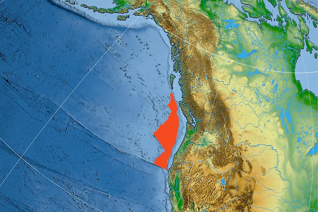
The Juan de Fuca is a tectonic plate west of the North American continent between the North American plate and the Pacific plate. The tectonic plate formed when the Farallon plate broke up during the Oligocene. The Gorda and Explorer microplates are the other remnants of the Farallon.
Geology of the Juan de Fuca
The tectonic plate consists of an oceanic lithosphere originating from the Juan de Fuca ridge close to the region the plate is subducting the North American continental plate. The oldest lithosphere is found at the southern end and is approximately nine million years old while the youngest is located at the Nootka Fault and is thought to be around six million years old. Both the Gorda and Explorer plates are less than six million years old.
The Cascade Range
The Cascade Range is a series of volcanic arcs formed by the partial subduction of the Juan de Fuca Plate as it moves beneath the American plate. The range stretches along the West Coast of the continent from California to British Columbia. Many of the mountains in the Cascade are small volcanoes but a few including Mount St. Helens are notably large. Volcanic activities define the Pacific Northwest Ring of Fire that experiences frequent earthquakes. The earthquakes occur when stress is released at the subduction point while the volcanic eruptions occur when high temperature and pressure force molten materials in the mantle to escape.The Juan de Fuca, Gorda, and Explorer plates are moving away from each other. The Explorer plate started drifting five million years ago while Gorda began drifting two million years later. The plates move along the subduction zone.
Earthquakes in the Subduction Region
The subduction region is prone to earthquakes, but the last major quake was in 1700. The evidence of the 8.7 to 9.2 earthquake is visible in the ghost forests along the Copalis River in Washington State. Carbon dating of the trees revealed that they were killed in 1700 when the quake sunk the land causing the area to be flooded by salt water. Records in Japan also indicated that islands in the country were hit by a tsunami in the same year, which was likely caused by the earthquake. In 2008, about 600 tremors originating from the subduction zone were experienced in 10 days prompting fears of a major earthquake.