Where Is The Great Salt Desert?
The Great Salt Desert, also known as Dasht-e-Kavir, is the desert at the center of the Iranian plateau. Occupying an area of about 30,000 sq mi and measuring about 500mi by 200mi, the Dasht-e-Kavir is the twenty-sixth largest desert in the world. It stretches from Dasht-e Lut to the Alborz mountain ranges. The desert is partitioned between various Iranian provinces including Yazd, Isfahan, Tehran, Semnan, and Khorasan.
About 3,000 years ago during the post-glacial era, the Kavir had a vast series of lakes. The Asian monsoon reached central Iran and brought heavy summer rain which formed numerous lakes in the Iranian plateau. Over time the lakes dried up leaving salt layers which resulted in the formation of beautiful salt domes in the desert.
Features of the Desert
The desert features numerous unique natural structures which were formed hundreds of years ago. Some of the structures in Dasht-e Kavir include a salt marsh, area of sand dunes, and even a national park.
1) Kavir Buzurg
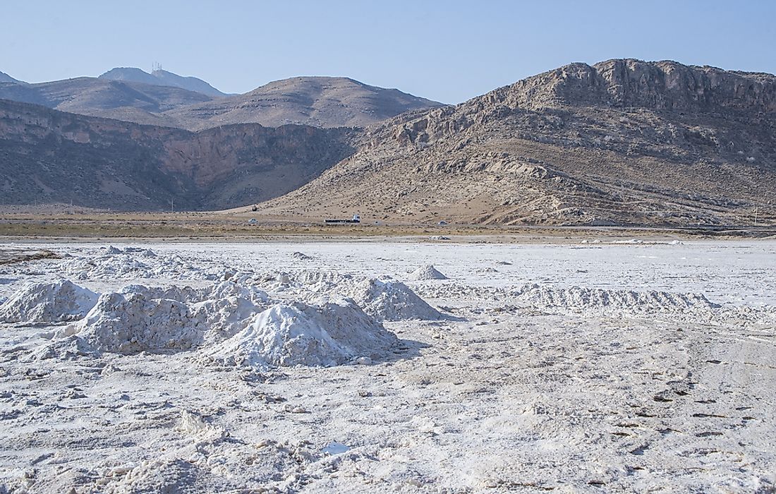
The Kavir Buzurg is a great salt marsh which is in the middle of Dasht-e Kavir. It occupies an area of about 199 miles by 99 miles, and it is separated from the other salt marshes by surrounding sandy hills. The region is a rain-shadow desert which gets little moisture. Once the water from the wetlands evaporates, it leaves salt crusts which cover the dark saline mush. Although travelers can penetrate the salt crusts, the journey through Kavir Buzurg can be quite dangerous. Kavir Buzurg is almost uninhabited with some people living in the surrounding mountains.
2) Rig-e Jenn
Rig-e Jenn is a broad region of sand dunes at the center of the Great salt desert right on the border of Isfahan and Semnan provinces. All the ancient caravan travelers never traveled to this region since they believed that evil spirits haunted Rig-e Jenn. Currently, some of the neighboring villages and towns still believe this myth. Even Sven Hedin avoided Rig-e Jenn during his explorations of the Iranian deserts in the 1900s. Alfons Gabriel, an Australian geographer, crossed the southern parts of this region on his way to Arusan from Ashin during the 1930s.
3) Kavir National Park
Kavir National Park is a protected ecological region which occupies an area of about 1,500 square miles in Northern Iran. It is on the western end of Dasht-e Kavir. A large semi-circular rock known as Siahkuh is at the center of Kavir national park. It is known as little Africa because of the presence of safari-like wildlife including Asiatic cheetahs, gazelles, Indian wolves, Persian leopards and striped hyenas. The Namak Lake on the boundaries of the park is a salt marsh and water gets into the lake from the northern side through River Qom.
The Climate of the Dasht-e-Kavir
The desert experiences an arid type of climate, and it receives little rain in winter, but the surrounding mountains provide enough runoff which creates the seasonal marshlands and lakes. During the summer the temperature can go as high as fifty degrees Celsius with it averaging at 22 degrees Celsius in January. The desert is covered with pebbles and sand, seasonal lakes, riverbeds, and marshes. The high temperature causes high vaporization that leaves the mud grounds and wetlands with large salt crusts.


