Ural Mountains
The Ural Mountains are a narrow mountain range that runs about 2,500 kilometers through western Russia, starting from the Arctic Ocean’s coast to northwestern Kazakhstan. The mountains are important for two main reasons. First, they form the popular boundary separating Eurasian landmass into two continents; Europe and Asia. Secondly, they are some of the world’s oldest mountains, dating back 300-250 million years ago. Although erosion has lowered the mountains’ elevations considerably, they are still unusually high for their ages. The range’s highest point is Mount Narodnaya, rising 1,895 meters. The mountains are rich in numerous natural resources, including coal, metal ore, and precious stones, contributing significantly to Russia’s mineral sector.

Origin Of The Name
Several names were used by Russians to refer to the Ural Mountains, most stemming from the Russian term for stone or rock. The term “Urals" first appeared in the 16th and 17th centuries, primarily describing the southern portion of the range. By the 18th century, it was used to denote the entire mountain range. This name may have origins in a Bashkir word meaning “stone belt.” According to Bashkir legend, Ural was a hero celebrated for his remarkable deeds. Upon his death, his community placed stones on his grave, which eventually formed the expansive Ural Mountains. In Russian, the range is called Uralskie Gory.
Geography

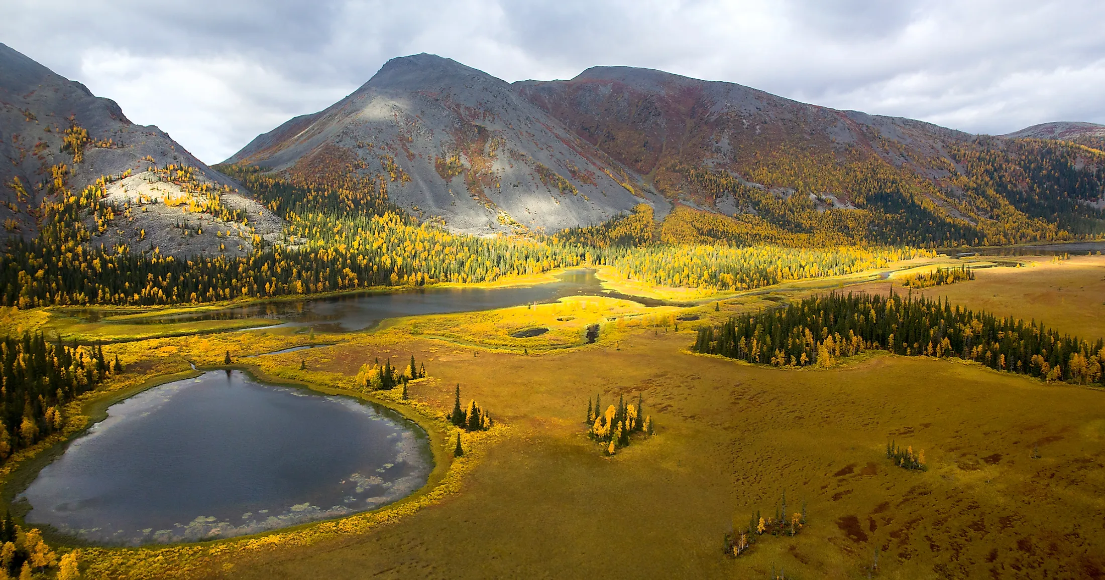
The Ural Range is a narrow mountain range extending approximately 2,500 kilometers south to north from the Ural River to the Pay-Khoy Ridge. On the north, the mountain chain continues to Novaya Zemlya and Vaygach Islands. The Ural Mountains form Uralian orogenic belt’s major portion. This orogenic belt stretches 3,500 kilometers from the Aral Sea to the Novaya Zemlya. The Urals are relatively narrow, with the width varying from 32 to 145 kilometers.
The Ural Range is divided into five major sections; Southern, Central, Northern, Sub-Arctic (Nether-Polar), and Arctic (Polar). The Polar Urals, the northernmost section, extends about 400 kilometers from north to south between Mount Konstantinov Kamen and Khulga River. They cover about 25,000 square kilometers, with most mountains rising to 1,000-1,100 meters. However, Mount Payer, Polar Urals’ highest peak, rises 1,499 meters above sea level.

The Polar Urals seamlessly transition into the Nether-Polar Ural, extending 225 kilometers southward to Shchugor. This segment features broader and taller peaks, including the range’s tallest point, Mount Narodnaya, which stands at 1,895 meters above sea level. Additional prominent peaks in the area include Manaraga at 1,662 meters and Karpinsky at 1,878 meters. Both the Polar and Nether-Polar Urals are characterized by the presence of permafrost.
The Northern Ural extends 560 kilometers further south from River Usa. This section contains several ridges topping 1,000 meters, with Mount Telposiz as the highest peak, rising 1,617 meters above sea level. However, most summits are flat and are peneplain remnants. Extensive weathering in this section has resulted in a “sea of stone” formation on mountain slopes. The Central Urals are the range’s lowest section, extending 320 kilometers south to the Ufa River. Mount Sredny Baseg is the highest peak in Central Ural, rising 994 meters.

Southern Urals form the mountain range’s last portion. This section extends 550 kilometers to the Ural River and comprises complex relief with several ridges and valleys, with the ridges rising to 1,200 meters. Mount Yamantau is the highest peak at 1,640 meters. The Southern Urals terminate at the Mughalzhar Hills.
Drainage And Climate

Numerous rivers originate from the Ural Mountains, with the majority draining into the Caspian Sea and the Arctic Ocean. The Pechora River drains parts of Polar, Nether-Polar, and Northern Urals before emptying into the Barents Sea. Its major tributaries include Usa, Shchugor, and Ilych. The Ob River system drains the eastern slope and empties into the Kara Sea. Ob basin’s main rivers include Tavda, Tura, Iset, and Tobol, with most of these rivers frozen for most parts of the year. The Kama and Ural River basins belong to the Caspian Sea drainage basin. The Kama receives its water from Belaya, Chusovaya, and Vishera. The Urals also contains several deep lakes, with the Central and Southern Urals’ eastern slopes having the highest number of lakes. Some of the largest lakes are Tavatuy, Itkul, Turgoyak, and Uvildy.
The lakes' and rivers’ locations are closely related to climate and topography. The Urals’ climate is mainly continental, with the elongated mountain ridges absorbing most sunlight. The regions west of the Urals are much warmer in winter than the eastern region because of the warm Atlantic wind on the west and cold Siberian air on the east. July is the warmest month, with temperatures rising to 50 degrees Fahrenheit. The western areas also receive the most rainfall, at 1,000 mm in the Northern Urals.
Flora And Fauna

The Urals feature a variety of landscapes characterized by steppes and forests. The southern and southeastern sections are predominantly covered by steppes, with meadow steppes prominent on lower slopes. These areas host mountain and zigzag cloves, dropwort, and meadow grass. Forests in this region are diverse, with coniferous taiga forests dominating the western and eastern parts, while deciduous forests prevail in the south. The Northern Urals are home to conifers like Siberian pine, Siberian fir, Siberian spruce, and Scots pine. In contrast, the Southern Urals boast forests with varied compositions, whereas the Polar Urals are characterized by sparse, low-lying forests. Both forests and steppes support wildlife including brown bears, elk, wolves, foxes, lynxes, and squirrels.


