What Is A Bifurcation Lake?
Most lakes drain in one direction, often outflowing into one drainage basin. However, some lakes drain in more than one direction and flow into more than one drainage basin. These lakes are referred to as bifurcation lakes. In such cases, it is almost impossible to define the exact location of the drainage divide, since it is located in the middle of the lake. These lakes may have more than one inflow, such as rivers or streams. A selection of notable examples of bifurcation lakes around the world is highlighted below.
Wollaston Lake
Wollaston Lake is the world’s largest bifurcation lake, covering an area of approximately 1,035 sq mi (including islands). It is also the largest lake located entirely in the Canadian province of Saskatchewan. Wollaston Lake is situated approximately 340 miles northeast of Prince Albert and is drained by two rivers: the Fond du Lac River and the Cochrane River. The Fond du Lac River is located on the northwestern part of the lake and drains into Lake Athabasca, before flowing through the Mackenzie River System and ultimately emptying into the Arctic Ocean. The Cochrane River, which drains most of the lake’s water (90%), is located on the northeastern part of the lake, and flows into Reindeer River and then through the Churchill River system before finally emptying into the Hudson Bay. Wollaston Lake’s major inflow is the Geikie River.
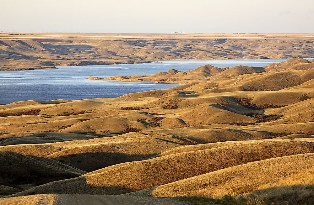
Lake Diefenbaker
Lake Diefenbaker is a bifurcation Lake in the Canadian province of Saskatchewan. Rather than a natural lake, Lake Diefenbaker is a reservoir that was formed by the construction of two dams, the Qu'Appelle River Dam and Gardiner Dam, across the Qu'Appelle River and the South Saskatchewan River, respectively, which act as the lake’s primary outflows. The lake is approximately 140 miles long and has about 500 miles of shoreline. Lake Diefenbaker is the largest body of water in South Saskatchewan and serves as a major source of water for domestic irrigation and household use.
Vesijako
Vesijako is a bifurcation lake in Finland, located in Padasjoki, within the Päijänne Tavastia region. The name Vesijako is a Finnish word that means "drainage divide." Vesijako and its neighboring lake, Lummene, each has two outflows. The waters from Lummene either flow east into Lake Paijanne or west into Lake Vesijako, through Vehkajarvi. The waters from Vesijako either flow east to the Gulf of Finland, through Paijanne, or flow to a chain of lakes such as Kukkia, Kuohijarvi, Iso-Roine, and Hauhonselka, which collectively form the Kokemaenjoki basin. Water from the Kokemaenjoki basin ends up in Lake Mallasvesi.
Isa Lake
Isa Lake is a bifurcation lake located in Yellowstone National Park, within the US state of Wyoming, and straddles the Continental Divide at Craig Pass. Isa Lake is one of the only two natural lakes that drain into two different oceans, the other being Wollaston Lake. The eastern side of Isa Lake is drained by the Lewis River, which ultimately empties into the Pacific Ocean, while the western side is drained by the Firehole River, which ultimately empties into the Gulf of Mexico.
Bontecou Lake
Bontecou Lake is an artificially created bifurcation lake located in the US state of New York, within the towns of Washington and Stanford, in Dutchess County. The lake straddles the drainage divide between the Tenmile River to the east and Wappinger Creek to the west. The outflow on the western side is known as Tamarack Swamp Creek. Bontecou Lake is oblong in shape and covers an area of between 46 and 55 hectares.


