Which Countries Border Poland?
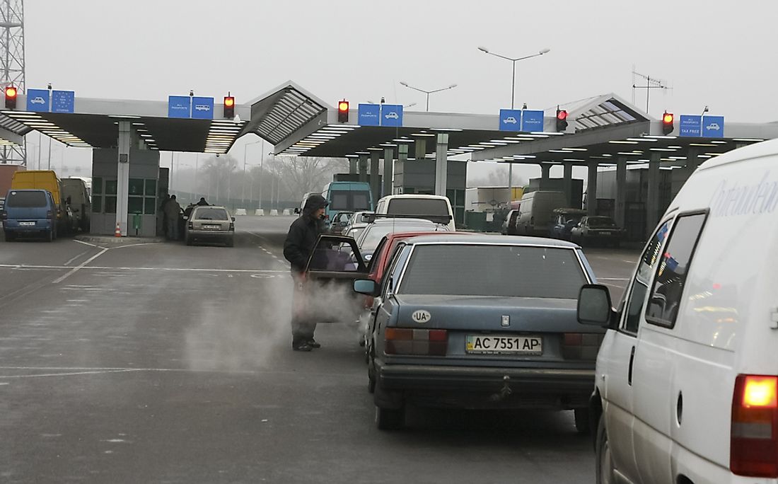
Different sources state that the land border of Poland is either 2181 miles or 2225 miles in length. Seven countries border Poland that it shares its land boundaries. These are Germany, Russia, Lithuania, Ukraine, Slovakia, the Czech Republic, and Belarus. The Poland-Czech Republic border is the longest of the bordering countries, while the Poland-Lithuania border is the shortest. There are numerous border crossings found along the border, and with the country becoming part of the EU in 2004, its border crossings with Slovakia, Lithuania, Germany, and the Czech Republic (fellow EU countries) were removed, following provisions of the Schengen Agreement. Border controls still exist along the country’s border with Russia, Belarus, and Ukraine.
Ukraine-Poland Border
Ukraine lies on the eastern border of Poland. The two countries share a long land border which represents Poland’s longest eastern border. The length of the border ranges between 332 miles and 329 miles, based on different sources. About 8 million people are living along the border. The border acts as an entry point of the Schengen Area, in which the issue of visas should qualify cross-border movements by Ukrainians. The border has the most crossings of any eastern border of the European Union. There is a rise in smuggling activities along the border, warranting the heavy police presence on the border.
History Of Ukraine-Poland Border
The border was first established as part of the 1920 Treaty of Warsaw after the 1919 Polish-Ukrainian War. Ukraine would later become part of the Soviet Union in 1921, transforming the border into the Polish-Soviet border. The cross-border movement was restricted during this period, as the border had a heavy police presence. The Poland-Ukraine border was reestablished after the collapse of the Eastern Bloc, with the two countries formally recognizing the border between them in May 1992. Cross-border movement on the border soared soon after that, with an estimated 3 million people crossing each year. The cross-border movement peaked in 2006 when about 20 million crossings were recorded.
Belarus-Poland Border
Poland shares a land border with Belarus, a country that is situated northwest of Poland. The Poland-Belarus border stretches a length of 258 miles. However, some estimates have the length of the border being between 247.7 miles and 260 miles. The border starts at the Poland-Lithuania-Belarus tri-point and moves southwards to the Ukraine-Poland-Belarus tri-point. There are a total of 13 border crossings found along the border, most of which having rail and road as the modes of transition. Several rivers either cross or follow the border including Swislocz, Czarna Hancza, and Narew rivers.
History Of Belarus-Poland Border
The border was first demarcated in August 1945 under the Border Agreement between the Soviet Union and Poland. The current border was established in 1946 between Poland and the Soviet Union and has not been revised even after the collapse of the Eastern Bloc. Since 2004, the border is also recognized as the EU-Belarus border.
Russia-Poland Border
Russia borders Poland through Russia’s exclave of Kaliningrad Oblast. The border has a length of 130 miles and follows a near-straight line. The border starts at the Lithuania-Poland-Russia tri-point and ends at the Baltic Sea. The Poland-Russia border is one of the busiest borders in Eastern Europe, with cross-border traffic increasing exponentially. There are five active border crossings on the Poland-Russia border, all of which are road crossings.
History Russia-Poland Border
The Poland-Russia border has been in existence for centuries. The end of WWI saw the establishment of a border between the Soviet Union and the Second Polish Republic in line with the Treaty of Riga. The border was demarcated adequately after the WWII, in agreements between Poland and the Soviet Union. However, some changes in the border were made in 1951 after the two countries agreed on a territorial exchange. The border was retained even after the collapse of the Soviet Union. The border is considered as part of the EU-Russia border since 2004 when Poland became a member of the European Union.
Lithuania-Poland Border
Lithuania is located on the northeastern border of Poland. The border is the shortest of all Poland’s international borders, having a length of 65 miles. The border region is referred to as the Suwalki gap by NATO military planners. The name is in reference to the narrow region near the town of Suwalki that is difficult to defend against a military invasion. The border starts at the Poland-Lithuania-Belarus tri-point and extends northwards to the Poland-Lithuania-Russia tri-point.
History Lithuania-Poland Border
The Lithuania-Poland border was recognized by the two countries in 1990 after the independence of Lithuania. Before Lithuania’s independence, the border still existed but was then shared between Poland and the Soviet Union. This border was established after the WWII and replaced the older border that existed between Lithuania and the Second Polish Republic in the early 20th century. Since the two bordering countries are signatories of the Schengen Agreement, there exist no border controls along the border.
Germany-Poland Border
Germany is the bordering eastern country of Poland. The border between the two countries is 290 miles in length. The border starts at the Germany-Poland-Czech Republic tri-point and moves north until it reaches the Baltic Sea. The border was established in 1945, soon after the end of the Second World War. The regions along the border are highly populated, with about one million people residing along the border. According to provisions of the Schengen Agreement, border controls along the border were removed by both countries to allow free cross-border movements.
History Germany-Poland Border
The traditional border between the two countries was based on the courses of the Neisse and Oder rivers, and this partitioned the medieval Slavic and German tribes. However, the border shifted severally over the centuries, and it was not until the 1500s that it stabilized. The border was dissolved in the 18th century after the surrounding regions became part of the Prussian Kingdom, which later became part of the German Empire. The border was reestablished after the Treaty of Versailles that saw the emergence of Poland as an independent country. The two countries recognized the border in 1990 German-Poland Treaty, soon after the collapse of the Eastern Bloc and subsequent unification of West and East Germany.