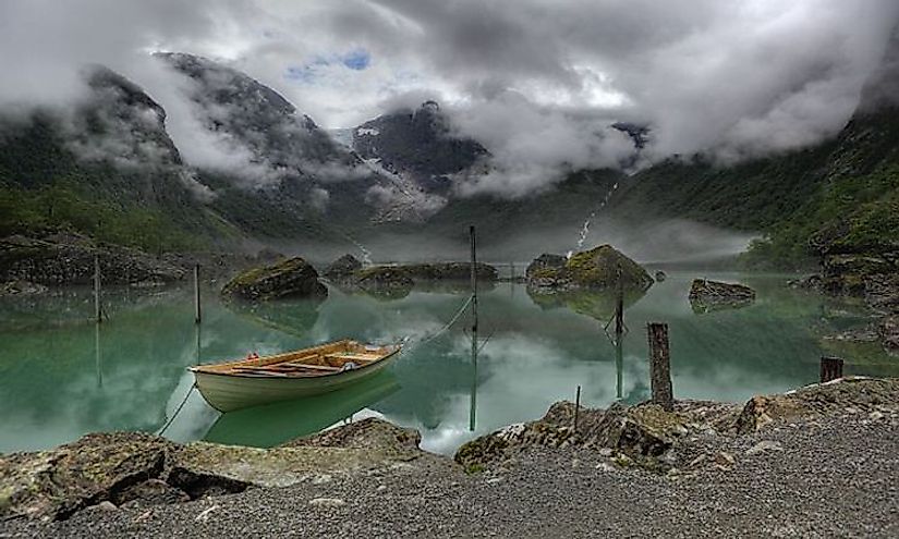
The National Parks Of Norway
The Kingdom of Norway consists of the Scandinavian Peninsula, the Svalbard archipelago, and Jan Mayen Island. The geography of Norway consists of 3% arable land, 37% of various kinds of forests and 60% of mountains, bogs or lakes which is non-arable land. From 1900 to 2003 the biodiversity of Norway especially near construction activity has immensely deteriorated from 48% to 12%.
The History Of National Parks In Norway
Up until 100 years ago, the ecosystems of Norway were under no immediate threat. The first initiative to have protected areas was voiced by Yngvar Nielsen, the leader of the Norwegian Mountain Touring Association (DNT) in 1904. DNT continued to campaign for land protection cases through 1923 to 1938. However, in the 1954 natural protection act established legal criteria for setting up protected areas. The act led to the establishing of Norway's first two national parks in 1962 to 1963 and also the formation of Governmental Natural protection council as a consultative body for the government of Norway. In 1964 the council suggested to establishing of 16 more national parks which took 25 years for 15 of the suggestions to be approved. In 2001 the second generation of Norway’s national parks was established together with border expansion for the previously established parks. After the beginning of the industrial Era in the 1960's the protected areas were established as a way to regulate the construction of roads, vacation homes, hunting, fishing, and plant gathering. This trend plummeted in the last decade and preservation of rare flora and fauna together with environmental research and maintaining reference have added on the need for establishing protected areas.
The 3 Biggest National Parks Of Norway
There are 44 national parks in Norway, 37 of which are on the mainland of the nation and seven on Svalbard.
Sør-Spitsbergen National Park
Located at the southern end of the Island of Spitsbergen in the Svalbard archipelago is Sør-Spitsbergen national park of Norway and was established in 1973. It is the largest national park in Norway covering an area 13,286 square kilometers. The park has a 65% region of ice cap with much of the rest being tundra. The Sør-Spitsbergen national park has some bird sanctuaries for the protection of islands that have grassy vegetation, regions with bare rock and freshwater ponds. Bird Life International identified the park as an Important Bird Area and Isøyane Bird Sanctuary was acknowledged as a wetland of international importance.
Nordvest-Spitsbergen National Park
The Nordvest-Spitsbergen national park, established 1973 is situated on the arctic archipelago of Norway in Svalbard and is the country's second largest national park with a total area of 9,914 square kilometers. The park's fauna consists of the Arctic fox, colonies of sea birds and the Svalbard reindeer. The park is also a hibernating ground for walrus and polar bears. Due to the numerous bird colonies, the park was declared an Important Bird Area by BirdLife International. The park has some of the remains of the hot springs volcano.
Forlandet National Park
Located in the Svalbard archipelago of Norway the Forlandet National park is the third largest park in Norway covering an area of 4,647 square kilometers. The park was established in 1973 and is recognized as the world's most northerly population of common guillemot and range of stone seals. The park is acknowledged as a wetland of international significance and also identified as an Important Bird Area by BirdLife International.
Significance Of The National Parks In Norway
The idea of National Parks in Norway is not as old as it is in other countries and they were established to serve a dual purpose of conserving the country’s natural habitats and for recreational purposes. For instance, Rondane National Park the country’s first National Park was not named a national park until 1962. These National Parks are tourist’s attraction sites, and the Norway promotes both tourism in general and ecotourism besides improving the quality and development of tourism. Norway aims to increase the area for parks and reserves to cover at least 15% of the land area. The government has indicated interest in preserving marine ecosystems that include the fjords in the west of the country, and the Archipelago in the southwestern part of Oslo.
The National Parks Of Norway
| Rank | Name | County(s) | Est. | Area |
|---|---|---|---|---|
| 1 | Sør-Spitsbergen | Svalbard | 1973 | 13,286 km2 (5,130 sq mi) |
| 2 | Nordvest-Spitsbergen | Svalbard | 1973 | 9,914 km2 (3,828 sq mi) |
| 3 | Forlandet | Svalbard | 1973 | 4,647 km2 (1,794 sq mi) |
| 4 | Hardangervidda | Buskerud, Hordaland, Telemark | 1981 | 3,422 km2 (1,321 sq mi) |
| 5 | Nordre Isfjorden | Svalbard | 2003 | 2,954 km2 (1,141 sq mi) |
| 6 | Saltfjellet–Svartisen | Nordland | 1989 | 2,102 km2 (812 sq mi) |
| 7 | Reinheimen | Oppland, Møre og Romsdal | 2006 | 1,969 km2 (760 sq mi) |
| 8 | Blåfjella–Skjækerfjella | Nord-Trøndelag | 2004 | 1,924 km2 (743 sq mi) |
| 9 | Varangerhalvøya | Finnmark | 2006 | 1,804 km2 (697 sq mi) |
| 10 | Dovrefjell–Sunndalsfjella | Møre og Romsdal, Oppland, Sør-Trøndelag | 1974 | 1,693 km2 (654 sq mi) |
| 11 | Breheimen | Oppland, Sogn og Fjordane | 2009 | 1,671 km2 (645 sq mi) |
| 12 | Børgefjell | Nord-Trøndelag, Nordland | 1963 | 1,447 km2 (559 sq mi) |
| 13 | Øvre Anárjohka | Finnmark | 1975 | 1,390 km2 (540 sq mi) |
| 14 | Nordenskiöld Land | Svalbard | 2003 | 1,362 km2 (526 sq mi) |
| 15 | Jostedalsbreen | Sogn og Fjordane | 1991 | 1,310 km2 (510 sq mi) |
| 16 | Sassen–Bünsow Land | Svalbard | 2003 | 1,230 km2 (470 sq mi) |
| 17 | Jotunheimen | Oppland, Sogn og Fjordane | 1980 | 1,151 km2 (444 sq mi) |
| 18 | Indre Wijdefjorden | Svalbard | 2005 | 1,127 km2 (435 sq mi) |
| 19 | Forollhogna | Sør-Trøndelag, Hedmark | 2001 | 1,062 km2 (410 sq mi) |
| 20 | Rondane | Hedmark, Oppland | 1962 | 963 km2 (372 sq mi) |
| 21 | Reisa | Troms | 1986 | 803 km2 (310 sq mi) |
| 22 | Øvre Dividal | Troms | 1971 | 750 km2 (290 sq mi) |
| 23 | Stabbursdalen | Finnmark | 1970 | 747 km2 (288 sq mi) |
| 24 | Junkerdal | Nordland | 2004 | 682 km2 (263 sq mi) |
| 25 | Lomsdal–Visten | Nordland | 2009 | 682 km2 (263 sq mi) |
| 26 | Femundsmarka | Hedmark, Sør-Trøndelag | 1971 | 573 km2 (221 sq mi) |
| 27 | Rohkunborri | Troms | 2011 | 571 km2 (220 sq mi) |
| 28 | Folgefonna | Hordaland | 2005 | 545 km2 (210 sq mi) |
| 29 | Langsua | Oppland | 2011 | 537 km2 (207 sq mi) |
| 30 | Hallingskarvet | Buskerud, Hordaland | 2006 | 450 km2 (170 sq mi) |
| 31 | Skarvan and Roltdalen | Nord-Trøndelag, Sør-Trøndelag | 2004 | 441 km2 (170 sq mi) |
| 32 | Sjunkhatten | Nordland | 2010 | 417 km2 (161 sq mi) |
| 33 | Ytre Hvaler | Østfold | 2009 | 354 km2 (137 sq mi) |
| 34 | Færder | Vestfold | 2013 | 350 km2 (140 sq mi) |
| 35 | Lierne | Nordland | 2004 | 333 km2 (129 sq mi) |
| 36 | Seiland | Finnmark | 2006 | 316 km2 (122 sq mi) |
| 37 | Dovre | Oppland | 2003 | 289 km2 (112 sq mi) |
| 38 | Làhku | Nordland | 2012 | 188 km2 (73 sq mi) |
| 39 | Rago | Nordland | 1971 | 171 km2 (66 sq mi) |
| 40 | Ånderdalen | Troms | 1970 | 125 km2 (48 sq mi) |
| 41 | Øvre Pasvik | Finnmark | 1970 | 119 km2 (46 sq mi) |
| 42 | Fulufjellet | Hedmark | 2012 | 83 km2 (32 sq mi) |
| 43 | Møysalen | Nordland | 2003 | 51 km2 (20 sq mi) |
| 44 | Gutulia | Hedmark | 1968 | 23 km2 (8.9 sq mi) |


