How Many Emirates Are There in the United Arab Emirates?
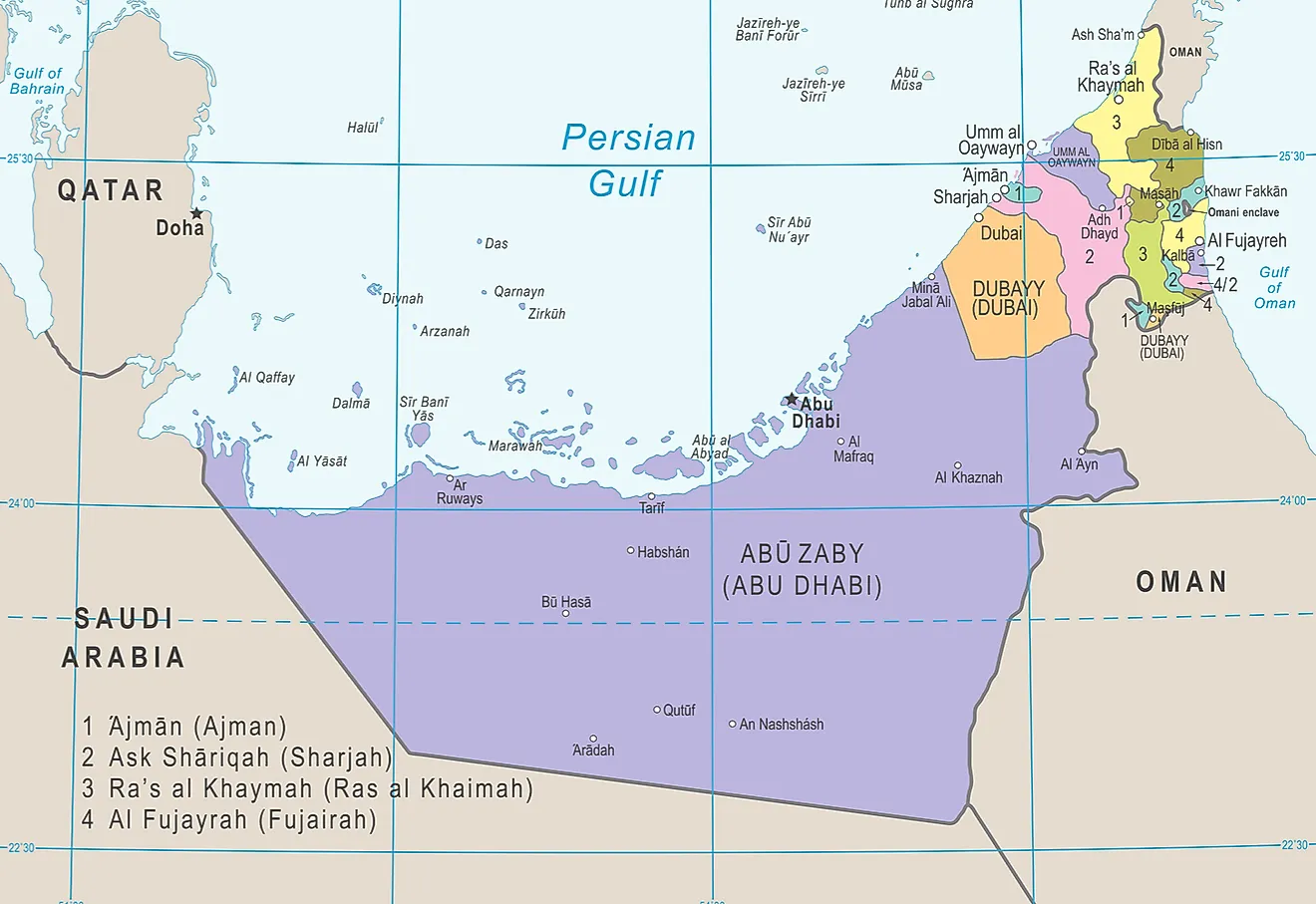
The United Arab Emirates (UAE), commonly known as the Emirates, is a Federal monarchy nation in the Western parts of Asia. The United Arab Emirates is in the southeastern part of Arabian-peninsula of the Gulf of Persian. The United Arab Emirates was formed on December 2, 1971, after all the emirates united under one ruler. Each emirate is governed by a Monarch government, and together these rulers create the federal supreme council. One of the rulers of the seven Emirates is usually elected as the Sultan of the country. The seven emirates which make up the United Arab Emirates include:
The Seven Emirates of the United Arab Emirates
1) Abu Dhabi
Abu Dhabi, which is the capital and the largest emirate in the country, is approximately 26,000 sq mi in size. Abu Dhabi occupies about 87% of the federation’s land. With a population of over 2.3 million as at 2012, Abu Dhabi is the most highly populated emirate in UAE. Abu Dhabi contributes about 60% of the nations GDP and selecting Abu Dhabi as the administrative and political capital back in December 1971, helped navigate the country towards achieving great developments.
2) Ajman
Occupying an area of approximately 100 sq miles, Ajman is the smallest emirate in the country in size. Surrounded by Sharjah, the emirate was named after the city of Ajman. Situated on the coast of the Gulf of Persia, Ajman controls two agricultural exclaves known as Masfut and Manama. Over 95% of the population in the Emirates lives in Ajman city which is part of the Dubai-Ajman-Sharjah metropolitan region. Sheikh Humaid is the ruler of Ajman Emirate.
3) Dubai
Before the formation of the United Arab Emirates, Dubai was a British protectorate. The capital of this Emirate is Dubai city, and over the last few decades, it has become an international aviation hub and a significant global city. The leader of Dubai is Mohammed bin Rashid. Oman, Ajman, and Ras-al-Khaimah emirates surround Dubai.
4) Fujairah
Fujairah is on the Wadi Ham, a crucial trade route which has been used for over a century now. Unlike the other Emirates with their coastlines on the Gulf of Persia, Fujairah is the only emirate with its coastline on the Oman Gulf. Sheikh Hamad has been the leader of Fujairah since 1974, and his cabinet is made up of immediate family members.
5) Ras al-Khaimah
Ras al-Khaimah emirate gained their independence from Sharjah in 1909 after the appanage. The name Ras al-Khaimah means "headland of the smaller huts," and it’s attributed to the various structures which existed here. Occupying an area of about 650 sq miles, Ras al-Khaimah is in the northern regions of the Federation. Ras al-Khaimah had a total of 97,529 emiratis as at 2010, and it has two sections; the Nakheel and the old Ras-al-Khaimah.
6) Sharjah
Occupying an area of about 1000 sq mi, Sharjah had a population of over 1,400,000 as at 2015. Other than the capital, Sharjah has numerous minor towns like Khor Fakkan, Dibba Al-Hisn, and Kalba. Sharjah is under a constitutional monarchy led by Sultan Al-Qasimi who has ruled the emirate since 1972.
7) Umm al-Quwain
Located in the northern region of the country, this is the least populated emirate in the country. Occupying an area of approximately 290 sq mi, Umm al-Quwain had a population of 72,000 as at 2017. Umm al-Quwain has numerous crucial archeological interests with the main findings in Ed-Dur and Tell Abraq suggesting contact with Mesopotamia as early as the 5th millennium BC.