14 Cool Places to Explore on Google Earth
The view from far above grants us an entirely different outlook on the Earth's features. Google Earth offers a safe peek at the sites of mysterious disappearances, nuclear disasters, unapproachable or distant locations, secret government bases, diamond mines, and even the outlines of the past crater strikes. The unique perspective offered by the satellite imaging has inspired artists (and, possibly, aliens) to create new landmarks that could never be appreciated from any other angle.
Desert Breath Pattern Art

27.380583, 33.631839
Red Sea Governorate, Egypt
Located in a desolate Egyptian desert, not far from the shores of the Red Sea, this 1 million square foot spiral design is, in fact, an art project called Desert Breath. In March 2007, Danae Stratou, Alexandra Stratou, and Stella Constantinides created this artwork meant to celebrate the desert landscape. Since the first pictures you can find on their site, the grand art has significantly eroded and no longer looks quite as prominent.
The Badlands Guardian

50.010611, -110.113422
Walsh, Alberta, Canada
The Badlands Guardian is a geomorphological feature situated in the southeast corner of Alberta, Canada. Viewed from the air, it resembles a westward-facing human head wearing a full Indigenous headdress. This area has been traditionally the home of the Siska First Nation, also known as the Blackfoot tribes. The location of the geological feature is very remote and not readily accessible: the Badlands is a deserted and often unfriendly terrain of ravines, hills, and sinkholes. The Earth folds shaping the contour of a giant were formed by the end of the last Ice Age when melting glaciers dissolved clays and light sedimentary soils. These landscapes keep changing even these days, being carved and eroded under the pressure of the wind and heavy rains, forming unique geomorphic features and intriguing topographies.
Airplane Boneyard

32.149989, -110.835842
Tucson, Arizona
The Davis Monthan Air Force Base is where US military planes go to retire. Named "the boneyard," this 4 square mile cemetery of skyborne steel is not accessible for the general public. Still, Google Earth provides a convenient curiosity tour: practically every plane the military has used since World War II, from the B-52 Stratofortress to the F-14 Tomcat. The airplanes from different times have various degrees of decay. Did you know that a retired airplane can make for an innovative and extravagant house? There have been several architectural projects repurposing elements or even entire retired planes as homes.
Guitar-Shaped Forest

-33.867886, -63.987
Córdoba, Argentina
This 2/3 mile long guitar forest was nurtured in the fertile agricultural region of Argentina's pampas. At this size and on the backdrop of plain cultured fields, the guitar-shaped forest is noticeable from both planes and satellites. The guitar forest is a creation of a local farmer Pedro Martin Ureta and his four kids: that planted every tree by hand decades ago. The guitar-shaped forest was intended as a memorial for Pedro's wife, Graciela Yraizoz, who died of an aneurism in 1977. A couple of years later, Pedro remembered his wife's idea to shape the farm after her favorite instrument and decided to honor her memory. With the help of their children, he planted and nurtured roughly 7,000 cypress and eucalyptus trees.
Networked Oil Fields

-37.654461, -68.171228
Rio Negro, Argentina
Not much to be said: it is an oil field being actively developed by YPF. But quite a beautiful sight from above, looking like an elaborate network of nodes and lines.
The White Lion

51.848637, -0.55462
Dunstable LU6 2LD, UK
Coined by some as a "Lion King," this geoglyph, known initially as Whipsnade White Lion, was built in 1933 for an unusual reason. The colossal feline was dug into a chalk hill within the Dunstable downs near the Whipsnade Zoo. Initially, only the outline of the lion could be seen, but it was eventually completed to become the largest geoglyph in the country. The Zoological Society of London conceived the lion project as a landmark to warn passing pilots not to fly low over the zoo to avoid scaring animals. The second purpose of the zoo carving was, of course, advertising for the zoo. Over the years, the lion deteriorated and became overgrown; luckily, in March of 2018, a neighbor donated 50 truckloads of chalk so the zoo could make the lion shine white again.
Electric Blue Potash Mine Bonds

38.483378, -109.681333
Moab, Utah, USA
These ponds are maintained to extract potassium chloride, also known as potash, from the desert landscapes of Utah. Potash is mainly required in the production of potent fertilizers. Most potash forms in areas when inland seas or lakes dry out: as their waters evaporated, they left behind potassium salt deposits. Why does the water have such an unusually vibrant color? The water is dyed bright blue purposely to help it absorb more sunlight and heat and decrease the time it takes for the water to evaporate. As it happens, potash and other salts crystallize out. The evaporation process takes approximately 300 days. At the different stages of evaporation, the ponds can take different colors. Most of the "new" ponds are a bright electric blue. As time passes, ponds display different stages of evaporation as an array of colors, from various hues of blue and turquoise to orange, yellow, and white.
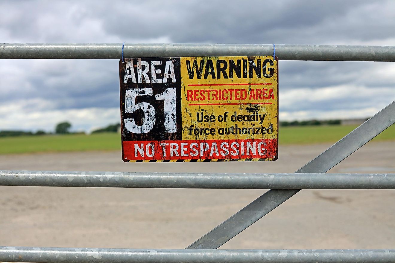
Groom Lake Base, known as Area 51

37.242457, -115.815044
Nevada, USA
Until recently, satellite imagery of this US Air Force military installation was censored. Area 51 became visible on Google Maps only since 2018. But is it the real image or just a cover-up? Who would tell? Area 51 is an active military installation: it is not accessible to the public and is under 24-hour surveillance. Area 51 employees reach the facility by air. They fly in and out via a restricted terminal at McCarran International Airport on one of several unmarked planes allowed to fly through the airspace R-4808N above Area 51. The only officially confirmed use of the base is as a flight-testing facility. Since the 50s, the base was used to develop and test the most advanced aircraft, including stealth and various other innovative technologies. In 1989, Robert Lazar claimed that Area 51 discovered an extraterrestrial technology. Lazar told the reporters that the US government used the facility to examine an alien spacecraft and the remains of an alien pilot; his story was since discredited, but Area 51 remains a symbolic name for every extraterrestrial enthusiast.
Bermuda Triangle

25.001283, -71.000000
Atlantic Ocean
The Bermuda Triangle, an expanse of the ocean known as a Devil's Triangle or Hurricane Alley, is located in the western part of the North Atlantic Ocean. Several aircraft and ships are said to have disappeared under mysterious circumstances or succumbed to an unknown danger. One of the most famous stories happened in 1945: five Navy planes set off from Fort Lauderdale, Florida, in order to conduct training bombing over some nearby shoals. The leading aircraft of the group, known as Flight 19, got helplessly lost; apparently, due to his compass malfunction. All five bombers kept circling aimlessly until they ran low on fuel and were forced to drop into the sea. A rescue plane with its 13-man crew disappeared the same day.
Atacama Giant

-19.949156, -69.633842
Atacama Desert, Chile
The Atacama Giant is an anthropomorphic geoglyph on Cerro Unitas in the Atacama Desert, Chile. It is the largest anthropomorphic figure in the world dated at prehistoric times, from AD 1000 to 1400. It appears to represent a deity; there is also a hypothesis suggesting that the figure was an early astronomical for observing and marking the moon movement; by knowing where the Moon sat, the day and the season could be determined with the precision required for the effective crop cycle. The landscape of Atacama is incredibly rich in unique geoglyphs: nearly 5,000 of these ancient artworks have been discovered to date.
Former Solar Field (now A Lot Of Circles)

34.871778, -116.834192
Daggett, California
The SOLAR Project is, in fact, three consecutive experiments: Solar One, Solar Two, and Solar Tres. They are (now former) solar thermal power plants based in the Mojave Desert, United States, and Andalucía, Spain (the Tres one). Solar One and Solar Two have been discarded since 2009. Solar One was a pilot solar-thermal project: the first test of a large-scale thermal solar power tower plant. In 1995, Solar One was upgraded to become Solar Two: the second ring of 108 larger heliostats was added, totaling 1926. The upgrade gave Solar Two the ability to produce 10 megawatts: enough to power an estimated 7,500 homes. Solar Two was decommissioned in 1999, but the project was considered a success, so the Solar Tres was built in Spain.
Batman Symbol

26.357896, 127.783809
Okinawa, Japan
Batman symbol in Okinawa Japan is real. The iconic white bat marks the home of the Air Force's 44th Fighter Squadron, which is known as the Vampire Bats, according to Kadena spokesman Ed Gulick, but it was unclear who painted it on the roof. It was believed to have been done in the 1980s. A similar painting of a fighting cock can is drawn on the roof of a Kadena building used by the 67th Fighter Squadron.
Heart Lake

45.019120, -76.898557
North Frontenac, Canadá
There are over 30 famous heart-shaped lakes that can be seen all over the world. This particular one has especially charming features: not only its shape is natural yet almost perfect, but it can be seen in a variety of colors depending on the season. If you visit Google Maps right now (at the moment of writing this article, it is January) you will see it in white, in a dark green rapport of trees. In autumn, it appears deep blue in the golden ornament of the fall leaves. The lake is surrounded by the Heart Lake Conservation Area in which trees are planted every year by students from the local elementary schools.
Island in a Lake in an Island in a Lake
69.793000, -108.241000

Northern Canada
The world's largest island-in-a-lake-on-an-island-in-a-lake-on-an-island is a small piece of land in Canada. The nameless island lays across the center of a small lake, which is itself encapsulated by a slightly larger island. That resides inside one of a few long elliptical lakes located 75 miles southward from the coast of Victoria Island. In all likelihood, no human has ever stepped on that island.
Do not forget to check out the second part of this collection here!