Biggest Islands Of The Comoros
The Comoro Islands, also known as Comoros, is an archipelago of volcanic islands located off of the southeast coast of the African continent. The Comoro Islands consists of four main volcanic islands such as Grande Comore, Anjouan, Moheli, and Mayotte. Other smaller islands are Grande-Terre, and Petite-Terre. Together, these volcanic islands cover a total area of 2,361 square kilometers. Three of the four main islands, Ngazidja (Grande Comore), Nzwani (Anjouan), and Moheli are members of an independent country, the Union of the Comoros, and these islands have their names in their local language. Mayotte is the French name given to the fourth island, which has long been disputed between Comoros and France.
History of the Comoros
The Comoro islands are of volcanic origin and arose from the seabeds of the Indian ocean at different points in geological history. Thus, the islands have distinct characteristics dependent on the stage that they were formed. Mayotte is the oldest island, while Grande Comore is the youngest, and frequently shows active signs of a volcano. Mayotte is characterized by eroded mountains and meandering streams. Grande Comore on the other hand, has no streams or permanent rivers, but is instead a massive rock of active volcano that occupies two-thirds of the total area.
The other two islands, Anjouan and Moheli, have volcanic mountains covered with trees, although without any recent volcanic activity. Several rivers and streams flow from the islands into the sea.
People and Culture
Due to the strategic position of the islands near the southeast coast of Africa and the western side of the Indian ocean, maritime trade has taken place here over the centuries. This has contributed in a great deal to the multicultural and multiracial population of the Comoros. This includes Africans, Arabians, Asians, and Europeans. Merchants traveled between the Comoros and a number of ports in the Indian ocean to trade a wide variety of goods such as slaves, exotic woods, and spices.
The Comoros' Largest Islands
The country consists of three major islands, commonly known by their French names. These are the northwestern-most Grande Comore (Ngazidja), Mohéli (Mwali), and Anjouan (Nzwani). These islands are administered by the independent Comoros government while Mayotte continues to be administered by France. Due to political dispute, Mayotte voted against independence from France in 1974 while the rest of the islands gained independence from the French colony in 1975. It is administered by France as an overseas department and became a region of France in 2011 through a referendum.
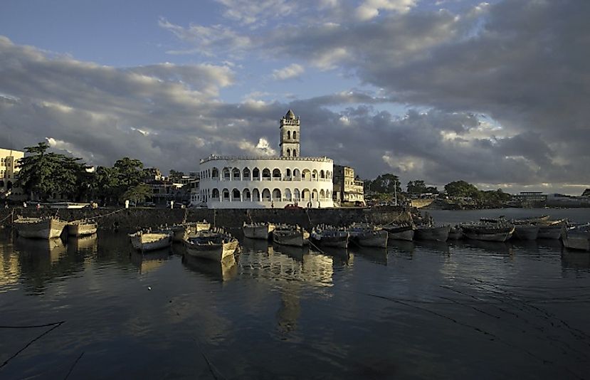
Grande Comore is the largest island of the Comoros, and covers an area of 396 square miles. Locally, it is referred to as Ngazidja, which is derived from Swahili language. It is the youngest island and still volcanically active. The most dominant ethnic group is the Comorian, and had a population of over 300,000 as of 2006. Mount Karthala is the highest point in the island. The national capital of The Comoros, Moroni, is located here.
Anjouan is the second largest island, covering 163 square miles. The island is known locally as Ndzuwani or Nzwani. The main town in the island is Mutsamudu.
Moheli is the third main island of the Comoro Islands. It covers an area of 81 square miles. It is also known as Mwali.
| Rank | Biggest Islands of the Comoros | Area |
|---|---|---|
| 1 | Grande Comore | 396 square miles |
| 2 | Anjouan | 163 square miles |
| 3 | Moheli | 81 square miles |


