Reshaping History: Rediscovering a Thriving Amazonian Civilization (1250-1500) Through Satellite Imagery and Field Exploration
It was long supposed that prior to the arrival of Europeans, the entirety of the Amazon Basin was populated by small, disparate groups, collectively numbering around two million people. But in 2018, a combination of satellite images, drone footage, and boots-on-the-ground inspection revealed a massive yet forgotten civilization that thrived between 1250 and 1500 A.D. and likely adds another 500,000 to one 1 million people to the now outdated population estimates. These unnamed, Pre-Columbian cultures fanned out across much of the Southern Rim of the Amazon (SRA), building networks of roads, fortified villages, and ceremonial geoglyphs, also referred to as "earthworks," deep in what was thought to have been uninhabitable tropical rainforest. Researchers concluded that only a portion of the extensive society has been accounted for and that "the interfluves and minor tributaries of Southern Amazonia sustained high population densities, calling for a re-evaluation of the role of this region for Pre-Columbian cultural developments and environmental impact."
Where Were The Amazonian Geoglyphs Discovered?

The interfluvial (aka terra firme) forests constitute approximately 95% of the Amazon, and yet, they have been largely unexplored. Not only is it physically and logistically difficult to traverse the terrain, but from an archeological standpoint, it was always assumed that pre-Columbian cultures concentrated around major waterways, and thus, terra firme were neglected. However, with the recent discovery of 104 earthworks composing 81 distinct sites in the Upper Tapajós Basin (UTB) of the Brazilian state of Mato Grosso, a clear picture has emerged of the innovative civilization that occupied the SRA.
The recently studied structures continue a 1,100-mile East-West string of earthworks and settlements that stretches from the Southwestern Amazonian moist forests of the Brazilian state of Acre (note: these sites date back to A.D. 100 - 400 and diminished after 1000 A.D.) through the Llanos de Moxos savannas in f, and onwards into the UTB and Upper Xingu seasonal forests of Mato Grosso. Computer modeling, in conjunction with the current archeological findings, suggests that there could be as many as 1,304 geoglyphs and villages spread throughout an estimated 167,000 square-mile section of the SRA.
Why Are the Recent Discoveries In The Southern Amazon Important?
The vast network of interconnected settlements shows that the Amazon was much more populated during the pre-Columbian era than previously suspected – an upward revision of millions of people. The findings also demonstrate that humans have been manipulating the Amazon rainforest to a significant degree for far longer than previously supposed – a fact that could help us to better understand our current environmental impact. The known, 1,000 square-mile SRA sites contain ditched enclosures, large habitation mounds with canals, causeways, fish weirs, water reservoirs, and raised fields, as well as other long-term cultural remnants such as pottery and charcoal/terra preta (i.e., "Amazonian dark earth"). Such advanced societies were spoken of in 16th-century accounts but were generally dismissed until modern technology began to pull back the rainforest's domineering curtain.
How The Lost Amazonian Civilization Is Being Rediscovered

Researchers have been using a combination of satellite images, drone camera flyovers, local tips, and traditional archeological explorations to rewrite the history of the Amazon. The bird's-eye view technologies have been particularly useful in providing perspective on the manipulated landscape. Because more and more of the rainforest has been cleared for agricultural purposes, many of the geoglyphs have become easier to spot and access on foot. Once high-quality sites were identified in these images, researchers would head out to handfuls of selected coordinates for further study. Computer models were then created, plugging in variables such as elevation, soil pH, and levels of precipitation in order to predict where further sites could be hiding. The biggest paradigm shift was the fact that villages did not need to be constructed close to rivers but could sustain themselves inland – where transitional forests are easier to clear and soils are more fertile.
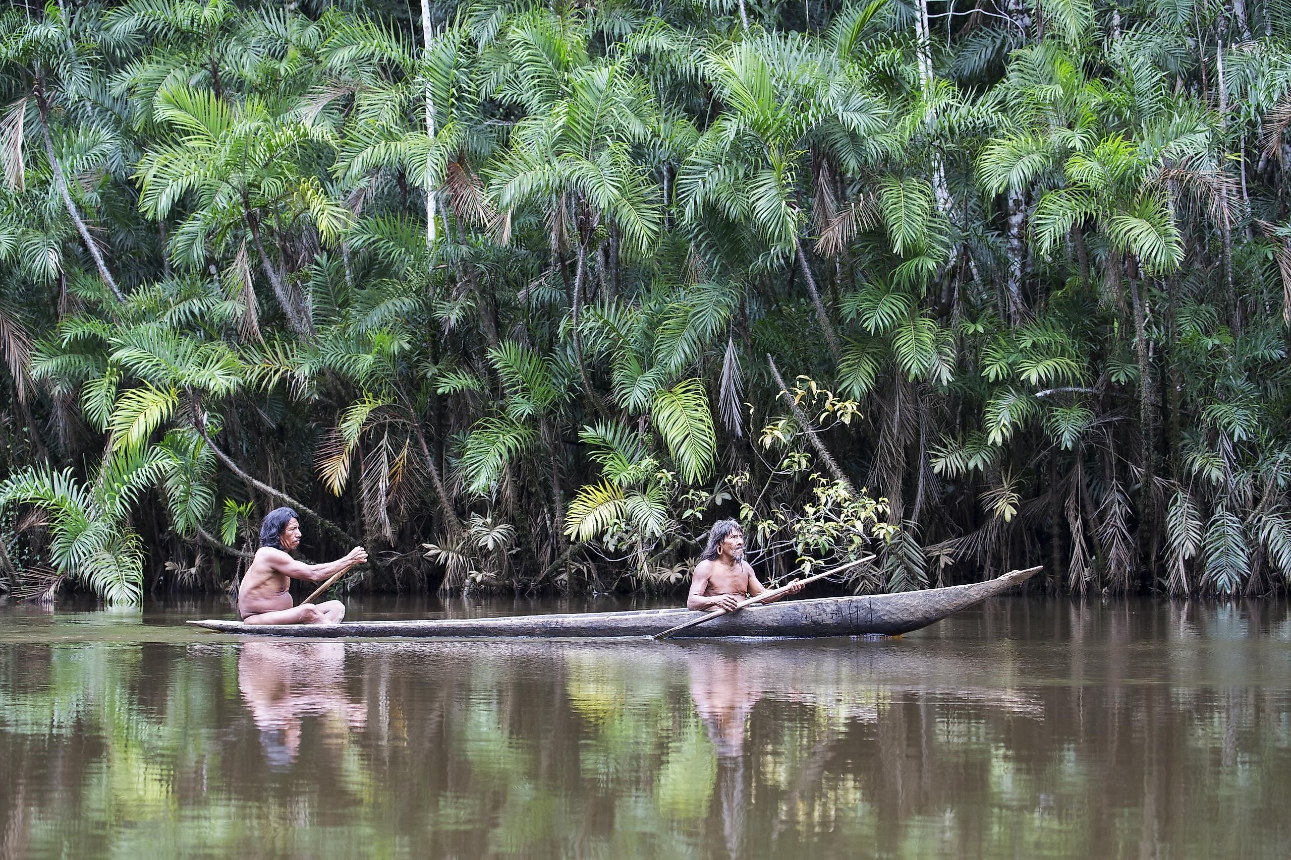
Deep in the Southern Amazon of Brazil and Bolivia, shrouded by swaths of interfluvial forests, ongoing archeological findings are reshaping our view of pre-Columbian history. Prior to 1500 A.D., an earth-building civilization spread across substantial portions of the Southern Rim of the Amazon in areas once thought to be void of sophisticated settlements. For hundreds of years, there were mere rumors of villages connected by wide, straight roads (a challenge even in this day and age), but modern-day surveys have now confirmed exactly that. Sadly, these people were all but erased as a consequence of Spanish campaigns (i.e., a combination of disease and genocide). Thankfully, hundreds, if not thousands, of cultural sites, will bring their story back to life and help to expand our understanding of this mysterious region and the people who have learned to thrive within it over the generations.