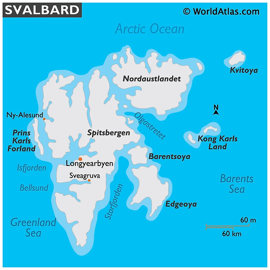
Svalbard Archipelago
Svalbard is an archipelago that is situated in the Arctic Ocean to the north of the European mainland. It is composed of several islands such as Spitsbergen, Nordaustlandet, Edgeøya, Barentsøya, Kvitøya, Kong Karls Land, Prins Karls Forland, Bjørnøya, and Hopen. The archipelago covers a total area of about 61,022 km2, of which 36,502 km2 (about 60%) is covered by glacial ice and permanent snowfields.
Where Is The Svalbard Archipelago?
The archipelago forms the northernmost portion of the Kingdom of Norway. The Islands of the archipelago are located about halfway between the North Pole and the northern part of Norway. The 1920 Svalbard Treaty established Norwegian sovereignty over the Svalbard Islands.
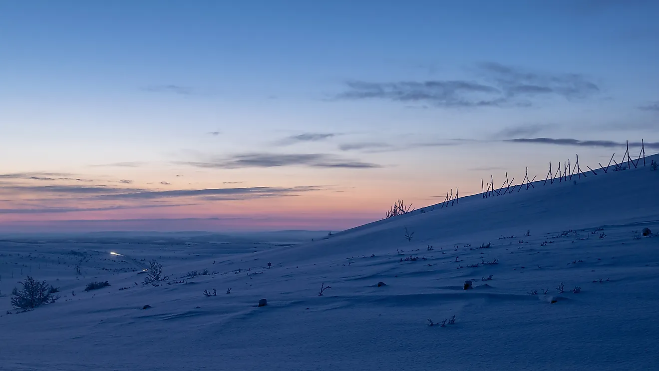
The Svalbard islands feature an Arctic climate with temperatures ranging from 15 °C in the summer months to -40 °C in the winter months. The warm West Spitsbergen Current moderates the climate of the archipelago during the winter months. The warmer waters of the Atlantic keep the surrounding waters of the Svalbard Islands ice-free and navigable for most of the year. Due to its location in the northern part of the Arctic Circle, the Svalbard Islands experience the midnight sun during the summer months and polar night during the winter months.
Geography

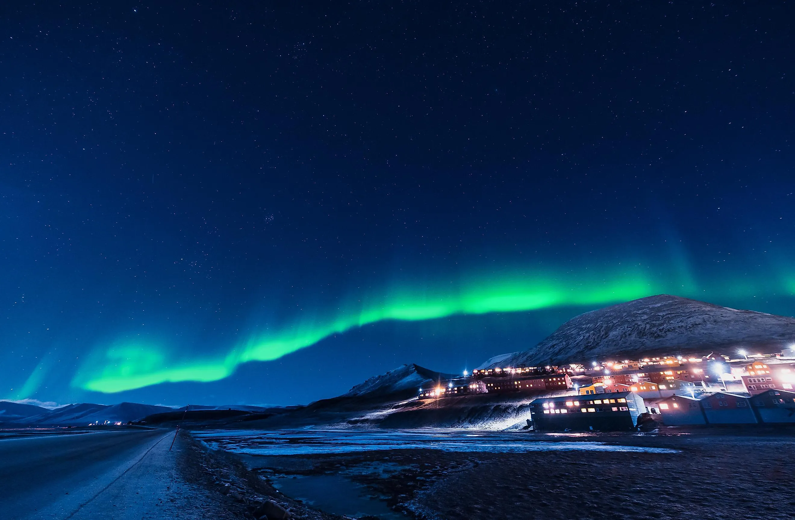
Covering an area of 37,673 km2, Spitsbergen is the largest and the most populous island of the Svalbard archipelago. Spitsbergen is also Norway’s largest island and the only permanently settled island in the archipelago. The island is bounded by the Arctic Ocean, the Greenland Sea, and the Norwegian Sea. Longyearbyen serves as the administrative center and is also the largest settlement on the island. Situated in the northeastern corner of Spitsbergen is Newtontoppen (Newton Peak) which rises to an elevation of 1,717 m and is the highest point in the entire Svalbard archipelago. The Svalbard Global Seed Vault is also located on Spitsbergen.
Covering an area of 14,443 km2, Nordaustlandet is the second-largest island in the Svalbard archipelago. The island is located to the northeast of Spitsbergen and is separated from it by the Hinlopen Strait. A major portion of Nordaustlandet is covered by the two large icecaps, namely the Austfonna and Vestfonna. Situated in the northwestern part of Nordaustlandet in the Gustav V Land is Snøtoppen (The Snow Top) which rises to an elevation of 764 m and is the highest point on the island. The Nordaust-Svalbard Nature Reserve covers the entire uninhabited island of Nordaustlandet.
The western and northern coasts of the islands of Spitsbergen and Nordaustlandet have heavy indentations and contain several spectacular fjords.
The third-largest island in the Svalbard archipelago is Edgeøya, which encompasses an area of about 5,073 km2. It is located in the southeastern part of the archipelago. This Arctic island forms a part of the Søraust-Svalbard Nature Reserve.
Another island of the Svalbard Archipelago is Kvitøya, which forms the easternmost part of Norway and is entirely covered by the massive Kvitøyjøkulen ice cap.
Wildlife

The Svalbard Archipelago is covered by Arctic vegetation and about 165 floral species have been recorded in this entire Norwegian archipelago. It also houses several significant mammals like Arctic fox, Svalbard reindeer, polar bears, walruses, whales, seals, and dolphins. The islands also serve as breeding grounds for a large number of migratory Arctic seabirds like the northern fulmar, black-legged kittiwake, and little auk. About 65.3% of the Svalbard Archipelago is currently protected by seven National Parks, six Nature Reserves, 15 bird sanctuaries, and one geotope protected area.
Brief History

The Islands of the Svalbard Archipelago were first discovered by the Dutch explorer Willem Barentsz in 1596. In the 17th century, the islands were used as a whaling base by several nations. Russian trappers arrived on the islands during the late 17th and the early 18th century. From the 19th century onwards, the islands were used as a significant area for research and explorations to the North Pole. In the early 20th century, coal mining started in the islands.
Coal mining, research, and tourism are some of the major industries in the Svalbard Archipelago. Longyearbyen serves as an important tourist hub and visitors to the islands are offered various recreational activities like kayaking, hiking, walking through glacier-caves, dog-sled safaris, and snowmobile rides.