Barents Sea
Covering an area of 1,405,000 km2, the Barents Sea is a marginal sea of the Arctic Ocean. A marginal sea is a part of the ocean that is partially enclosed by land in the form of peninsulas, archipelagos, or islands. It is located along the northern coasts of Norway and Russia. The sea has been named in the honor of Willem Barentsz, who was a famous Dutch explorer.
Contents:
Where Is The Barents Sea?

The Barents Sea is bounded by the Svalbard archipelago in the northwest, Franz Josef Land islands in the northeast, the Novaya Zemlya archipelago in the east, the Norwegian Sea and the Greenland Sea in the west, and by the Kola Peninsula in the south. It is separated from the Kara Sea by the Kara Strait and the Novaya Zemlya archipelago. The White Sea and the Pechora Sea are two parts of the Barents Sea. The White Sea is a southern arm of the Barents Sea, which separates the Kola Peninsula from the Russian mainland. The Pechora Sea is situated in the southeastern part of the Barents Sea.
Geography Facts

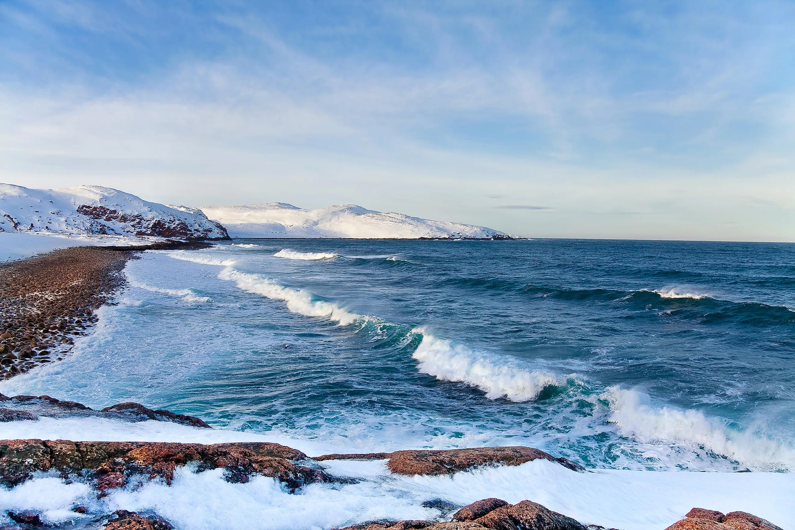
The maximum width of the Barents Sea is 1,050 km and it is about 1,300 km in length. The sea is relatively shallow and has an estimated average depth of 230 m. The sea’s deepest point is 600 m at the Bear Island Trench. The floor of the Barents Sea is mainly covered with sediments and is crisscrossed from east to west by numerous deep trenches, namely the Bear Island Trench and the Northern, Northeastern, and South Cape trenches. The Barents Sea faces a subarctic climate, where the average winter temperature ranges between -25°C and -5°C. The summer temperature ranges between 0°-10°C. The waters of the Barents Sea have a high salinity of 34 parts per 1,000.
The north-flowing ocean currents transport the warm waters of the Atlantic into the Arctic Ocean through the Barents Sea. In addition to the sea ice at its surface, the Barents Sea also receives significant sea-ice from the central Arctic Ocean, blown southward by the wind. During the warm summer months, the ice melts, thereby providing an influx of freshwater to the Barents Sea. The warm Atlantic waters that are brought into the Barents Sea then prevent the formation of the surface sea-ice and are also in turn melting the existing sea ice below. Scientists have discovered ‘hotspots’ where some parts of the Barents Sea have started to closely resemble the Atlantic. This phenomenon has been termed Atlantification. Human-caused global climate change has been accelerating the Atlantification process and this will in turn significantly affect the weather patterns, ocean circulations, and the entire Arctic ecosystem.
Marine Life

The Barents Sea supports the highest seafloor biodiversity, which includes some of the world’s largest deep-water coral reefs and coastal kelp forests. The coral reefs and kelp forests serve as important feeding, breeding and nursing grounds for the rich and diverse marine life. Phytoplankton provides food for the different zooplanktons and other deep-sea invertebrates like sponges, crustaceans, and bivalves living in this sea. About 150 species of fish are found in the sea. Some of the notable fish species include capelin, Norwegian-Arctic cod, salmon, herring, and catfish. The Barents Sea also supports one of the largest colonies of seabirds and about 20 million seabirds belonging to 40 different species are found here during the summer months. The prominent seabird species include the black guillemot, common guillemot, puffin, and razorbill. About 12 species of whales, five species of dolphins, six species of seals, walruses, otters, polar bears, and Arctic foxes are also found in and around the Barents Sea.
Brief History

The Barents Sea was previously known as "Murmanskoye Morye" to the Russians. This name was about the Norwegians who used to sail in the sea waters and therefore the name widely appeared in the 1595 Arctic maps along with other 16th century maps. The sea’s current name was first published in a chart in 1853, in the honor of the famous Dutch explorer, Willem Barentsz. The Barents Sea was one of the more difficult seas for the sailors and ocean rowers to cross and hence they called the sea the “The Devil’s Jaw” or “The Devil’s Dance Floor.” During the Second World War, the historic “Battle of the Barents Sea” was fought here between the Germans and the British.
The Barents Sea serves as an important site for the exploration of petroleum and natural gas and is therefore of great economic importance due to the oil fields that are located in the region. The most important oil and natural gas fields that are located in the Barents Sea include Norway’s Goliat field and Russia’s Shtokman field. The Barents Sea is also a highly productive fishing area. Due to the warm currents of the North Atlantic Drift, the Russian port of Murmansk and the Norwegian port of Vardø, which are located in the southern part of the Barents Sea, remain ice-free throughout the year.