Maps of Indiana
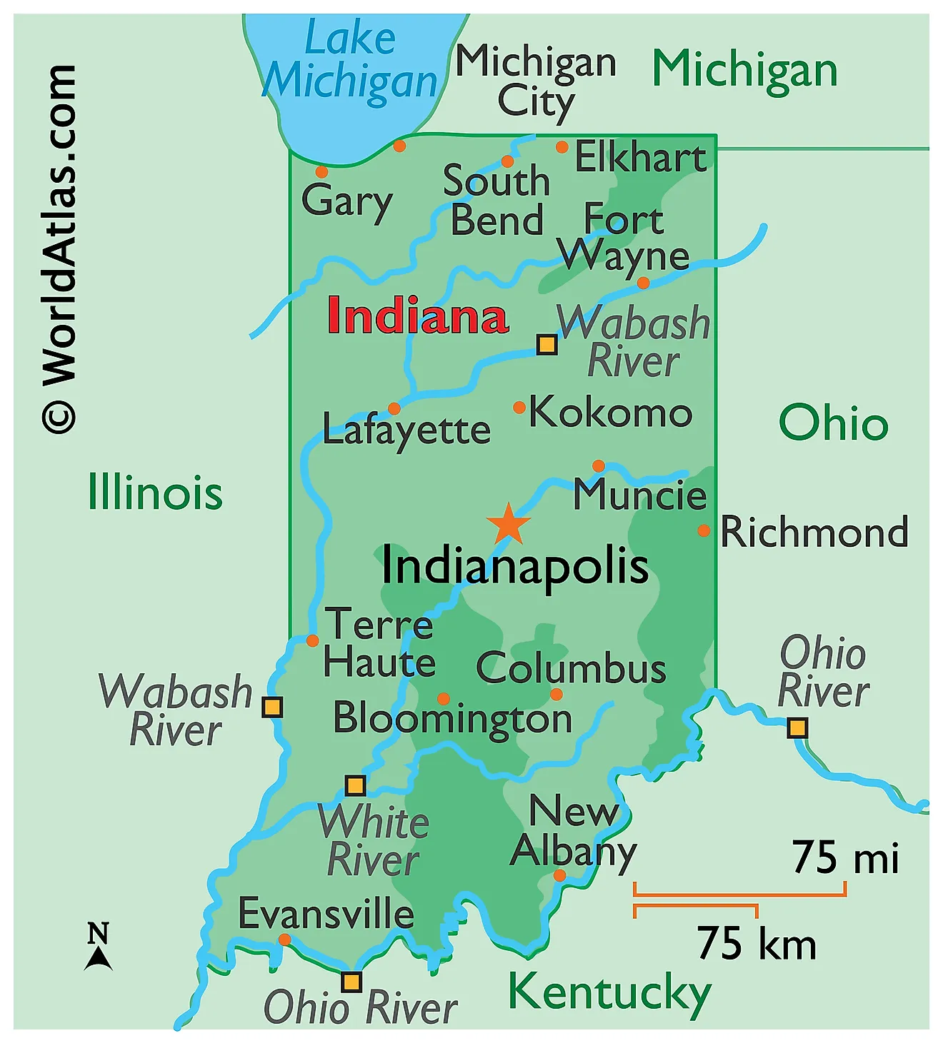
Indiana is a state in the Midwestern United States. Its northern edge is shared between Lake Michigan and the state of Michigan, with Ohio to the east, Kentucky to the south across the Ohio River, and Illinois to the west. The total area of Indiana spans approximately 36,420 square miles (94,326 square kilometers), making it the 38th largest state.

Indiana is a small state with a clear north-to-south structure, and one line explains most of it: the southern limit of the ice sheets. Glaciers covered roughly the northern two-thirds of Indiana during the Pleistocene, flattening the land and burying the bedrock under till. South of that limit the ice never reached, and the old limestone and sandstone country there has been left to erode into hills, caves, and steep-sided knobs. The result is a state that gets progressively more rugged the further south you travel — the opposite of what most people expect.
Where Is Indiana?

Indiana measures about 270 miles from north to south and 140 miles east to west, making it nearly twice as long as it is wide. Its boundaries are a mix of rivers and survey lines: the Ohio River forms the entire southern border with Kentucky, the Wabash defines the lower portion of the western border with Illinois, and the rest are straight lines.
The state's total relief is modest. Elevations range from 1,257 feet at Hoosier Hill in the east-central counties down to 320 feet in Posey County, a spread of only 937 feet. Indiana has about 45 miles of frontage on Lake Michigan, the shortest of the four states bordering it. With roughly 6.9 million residents it is the 17th most populous state, and it is divided into 92 counties.
The Northern Great Lakes Plains

The northern third of Indiana belongs to the Great Lakes Plains, sometimes called the Northern Moraine and Lake Region. Its surface is the youngest in the state, left behind when the Wisconsin-age ice sheet withdrew roughly 14,000 years ago.
Long ridges of debris called moraines run across the region — the Valparaiso Moraine is 17 miles wide where it crosses Lake County — separated by flat outwash plains and marshy lowlands. Because drainage is still poorly organised, this is the one part of Indiana with abundant natural lakes: hundreds of kettle lakes fill depressions where buried ice blocks melted out.

Sun sets over a beach on Lake Michigan in Indiana Dunes National Park.
Along the Lake Michigan shore, wind and wave action have built the Indiana Dunes, some rising more than 190 feet above the water. Successive ancient shorelines — the Glenwood, Calumet, and Tolleston — mark stages when the lake stood higher than it does today. Indiana Dunes became the country's 61st national park in 2019, and despite covering only about 15,000 acres it ranks among the most botanically diverse units in the entire park system.
The Central Till Plains

The broad middle of the state is the Central Till Plains, also known as the Tipton Till Plain. This is the flattest and most agriculturally productive ground in Indiana — a nearly featureless surface of glacial till, deep and lime-rich, that supports the state's corn and soybean belt.
Hoosier Hill, the highest point in Indiana at 1,257 feet (383 meters), lies within this region, in Wayne County near the village of Bethel and only a short distance from the Ohio line. Like several Midwestern high points it is not a summit but a gentle rise in a farm field, surrounded by trees.

The flatness breaks where rivers have cut into the till. Along Sugar Creek at Turkey Run and Shades state parks, streams have sliced through the glacial cover into Mansfield sandstone beneath, carving narrow gorges and cliffs that look nothing like the surrounding farmland.
The Southern Hills and Lowlands

Southern Indiana is the part the glaciers missed, and that single fact accounts for everything about it. Often labelled the Southern Plains and Lowlands, the region is more accurately called the Southern Hills and Lowlands, because hills rather than plains define it. With no blanket of till to smooth things over, streams have been cutting into exposed Mississippian and Pennsylvanian bedrock for hundreds of thousands of years longer than anywhere else in the state.
The region divides into a series of north-south belts alternating between resistant uplands and softer lowlands: the Crawford Upland, the Mitchell Plateau, the Norman Upland, the Scottsburg Lowland, the Muscatatuck Plateau, and the Wabash Lowland in the southwest. Elevations typically run between 400 and 1,000 feet, but local relief can exceed 300 feet.

The most striking landform is the Knobstone Escarpment, a steep siltstone ridge rising as much as 600 feet above the Scottsburg Lowland and running roughly 50 miles north from the Ohio River. It is the most prominent topographic feature in Indiana. The Hoosier National Forest protects around 204,000 acres of this hill country.
Karst and Caves

Marengo Cave National Landmark in Marengo, Indiana.
The Mitchell Plateau, running through Lawrence, Orange, and Harrison counties, is one of the most intensely developed karst landscapes in the United States. Its Mississippian limestone dissolves readily, producing sinkholes by the thousand, disappearing streams, blind valleys, and extensive cave systems.
Indiana Caverns, Wyandotte Cave, Marengo Cave, Bluespring Caverns, and Squire Boone Caverns all lie within this belt. Bluespring Caverns contains one of the longest navigable underground rivers in the country. The same limestone, quarried around Bedford and Bloomington as Indiana Limestone, faced the Empire State Building, the Pentagon, and the Washington National Cathedral.
Rivers

The Wabash River is Indiana's defining watercourse and its official state river. Running about 503 miles from western Ohio across the state to the Ohio River, it is the longest free-flowing river east of the Mississippi — no dams interrupt its main stem below Huntington. Its lower 200 miles form the border with Illinois, and the state's lowest point sits where it meets the Ohio.

The White River, with its East and West forks, is the Wabash's largest tributary and drains much of central and southern Indiana, passing through Indianapolis. The Tippecanoe, noted for its unusually high mussel diversity, joins the Wabash near Lafayette. In the north, drainage runs the other way: the St. Joseph and Maumee flow toward Lake Erie, and the Kankakee west into Illinois, making the northern counties part of the Great Lakes basin rather than the Mississippi's.
Lakes

Indiana's natural lakes are concentrated almost entirely in the glaciated northeast, where more than 400 kettle lakes dot the moraine country. Lake Wawasee in Kosciusko County, at about 3,410 acres, is the largest natural lake wholly within the state.
The largest body of water overall is artificial. Lake Monroe, impounded on Salt Creek southeast of Bloomington in 1965, covers roughly 10,750 acres and supplies drinking water to the region. Patoka Lake, Brookville Lake, and Mississinewa Lake are the other major reservoirs, all built for flood control in the southern and eastern hill country.
Climate

The Sugar Creek runs through Turkey Run State Park.
Indiana has a humid continental climate across most of its area, shading into humid subtropical in the far south. The 270-mile north-south span produces a real difference: the southern counties average about 5 °F warmer than the northern ones, with a growing season roughly a month longer.
Precipitation runs from about 35 inches a year in the north to over 45 inches in the south. Snowfall reverses that pattern, and the northwest corner receives substantial lake-effect snow off Lake Michigan — parts of LaPorte County average over 80 inches a season, several times what falls in the south.
With no significant terrain in any direction, Indiana lies open to both Canadian cold and Gulf moisture. The state averages around 20 to 25 tornadoes a year, most in spring, and river flooding is a recurring hazard along the Wabash and White.
Indiana Geography at a Glance
| Feature | Detail |
|---|---|
| Total area | Approx. 36,420 sq mi (94,326 sq km) — 38th largest state |
| Dimensions | Approx. 270 mi north-south; 140 mi east-west |
| Highest point | Hoosier Hill, 1,257 ft (383 m) — Wayne County, Central Till Plains |
| Lowest point | Ohio-Wabash confluence, 320 ft (98 m), Posey County |
| Bordering states | Michigan, Ohio, Kentucky, Illinois |
| Great Lakes frontage | Approx. 45 mi on Lake Michigan |
| Major regions | Three: Northern Great Lakes Plains, Central Till Plains, Southern Hills and Lowlands |
| Glacial limit | Northern two-thirds glaciated; southern third unglaciated |
| State river | Wabash, 503 mi — longest free-flowing river east of the Mississippi |
| Largest lake | Lake Monroe, approx. 10,750 acres (reservoir) |
| Largest natural lake | Lake Wawasee, approx. 3,410 acres |
| Counties | 92 |
Counties Map
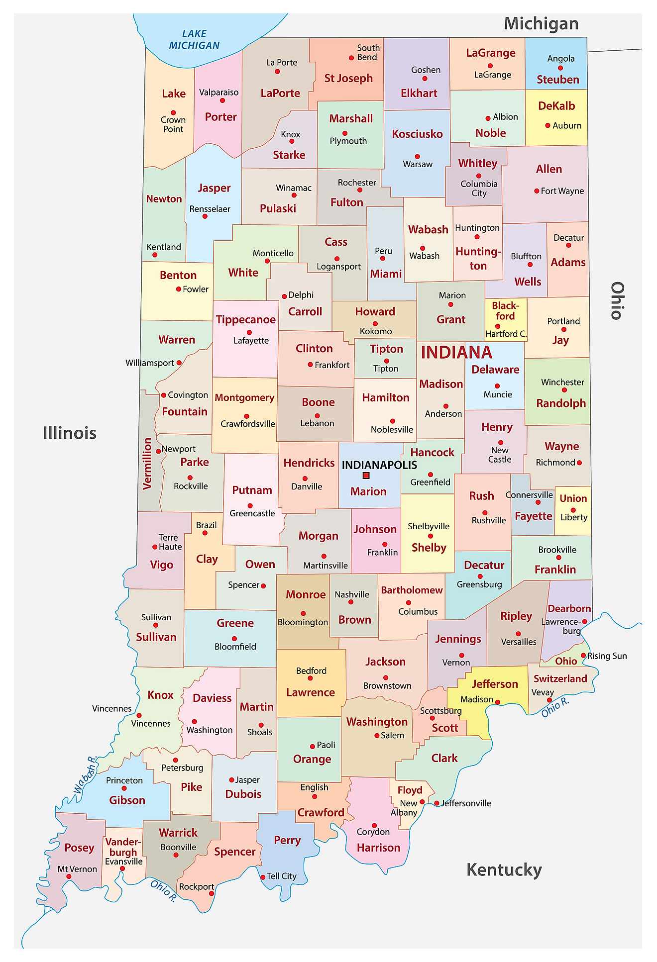
The State of Indiana is divided into 92 counties. In alphabetical order, these counties are: Adams, Allen, Bartholomew, Benton, Blackford, Boone, Brown, Carroll, Cass, Clark, Clay, Clinton, Crawford, Daviess, Dearborn, Decatur, DeKalb, Delaware, Dubois, Elkhart, Fayette, Floyd, Fountain, Franklin, Fulton, Gibson, Grant, Greene, Hamilton, Hancock, Harrison, Hendricks, Henry, Howard, Huntington, Jackson, Jasper, Jay, Jefferson, Jennings, Johnson, Knox, Kosciusko, LaGrange, Lake, LaPorte, Lawrence, Madison, Marion, Marshall, Martin, Miami, Monroe, Montgomery, Morgan, Newton, Noble, Ohio, Orange, Owen, Parke, Perry, Pike, Porter, Posey, Pulaski, Putnam, Randolph, Ripley, Rush, Scott, Shelby, Spencer, St. Joseph, Starke, Steuben, Sullivan, Switzerland, Tippecanoe, Tipton, Union, Vanderburgh, Vermillion, Vigo, Wabash, Warren, Warrick, Washington, Wayne, Wells, White, and Whitley.
With an area of 94,326 sq. km, Indiana is the 38th largest and the 17th most populous state in the USA. Located near the center of the state at the confluence of Fall Creek and the White River is Indianapolis – the capital and most populous city of Indiana. It serves as an administrative, cultural, and economic center of the state. The world's largest children's museum is found in Indianapolis, occupying a 472,900 sq. ft (43,934 sq. m) building across five floors and showcasing a collection of more than 130,000 artifacts.
Where is Indiana?
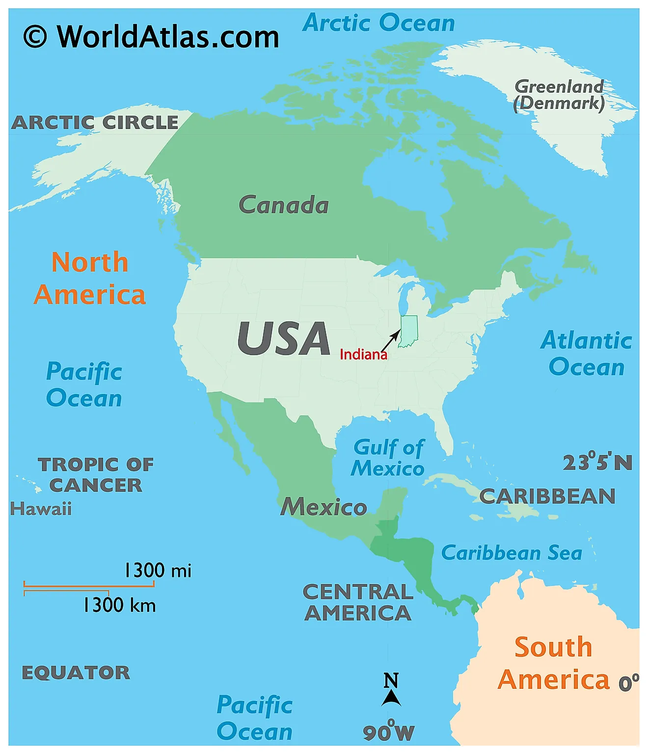
The State of Indiana is located in the East-North-Central (Midwest and Great Lakes) region of the United States. It is geographically positioned both in the Northern and Western hemispheres of the Earth. Indiana is bordered by Michigan in the north; by Ohio in the east; by the Ohio River and Kentucky in the south and southeast; by the Wabash River and Illinois in the west; and by Lake Michigan in the northwest.
Regional Maps: Map of North America
Outline Map of Indiana
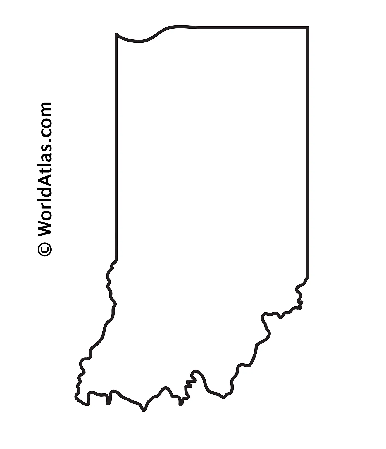
The above blank map represents the State of Indiana, located in the East-North-Central (Midwest and Great Lakes) region of the United States. The above map can be downloaded, printed and used for geography education purposes like map-pointing and coloring activities.
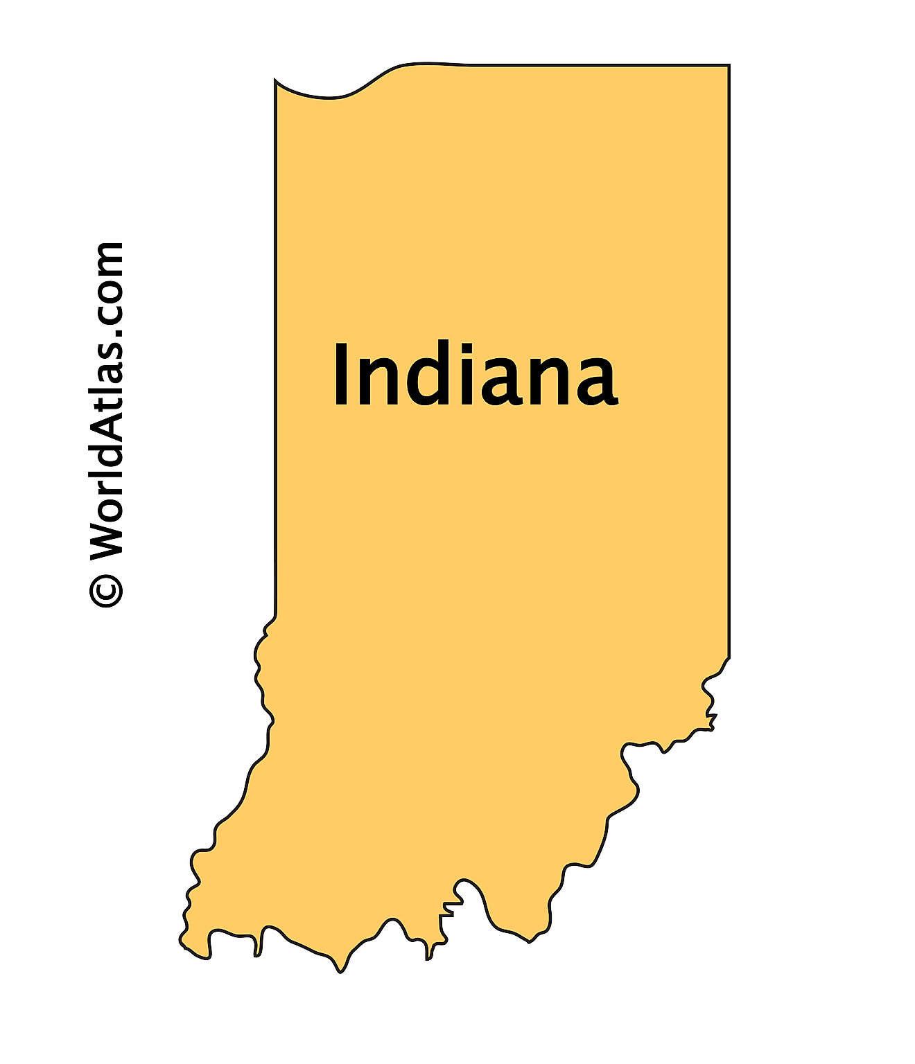
The above outline map represents the State of Indiana, located in the East-North-Central (Midwest and Great Lakes) region of the United States.
Key Facts
| Legal Name | State of Indiana |
|---|---|
| ISO 3166 Code | US-IN |
| Capital City | Indianapolis |
| Major Cities |
|
This page was last updated on September 19, 2026