Galapagos Islands
The Galapagos Islands, also known as the “Columbus Archipelago” or “Isla Galápagos” in Spanish, is an island group in the Pacific Ocean administered by Ecuador. It comprises 18 major islands, three smaller islands, and numerous islets and rocks. These islands, islets, and surrounding areas are rich in endemic species and have been called a “living museum and showcase of evolution.” The islands contributed immensely to scientist Charles Darwin’s evolution theory and natural selection concept. Galapagos National Park, a wildlife sanctuary established in 1935, is a UNESCO World Heritage Site. Santa Cruz Island in the Galapagos archipelago is a site for protecting indigenous species and promoting scientific research.
Contents
- Where Are The Galapagos Islands?
- Geography
- Islands
- Climate
- Brief History
- Human Settlement
- Biodiversity And Protection
Where Are The Galapagos Islands?

Galapagos is an island group located in the eastern Pacific Ocean, approximately 1,000 km off Ecuador's coast. The islands straddle the equator and are located on both Southern Hemisphere and Northern Hemisphere, with the volcanoes Ecuador and Mount Whiton (highest peak on the Galapagos) located on the equator. Administratively, the island group is a province of Ecuador known as Galapagos Province.
Geography

The Galapagos Islands are scattered over an estimated area of 45,000 km2 of the ocean. The islands themselves have an estimated total land area of 7,880 km2. The largest island, Isabela, covers almost three-quarters of the archipelago’s total land area and more than twice the size of the second-largest island.
The archipelago sits at the Galapagos Triple Junction, an area where three tectonic plates meet. The three tectonic plates are the Pacific, Nazca, and Cocos plates. The islands sit specifically on the Nazca Plate and over the Galapagos Hotspot, a volcanic hotspot where mantle plume is melting the Earth’s crust, leading to volcanoes.
The Galapagos Islands are volcanic islands, some of which are still active. The first of the islands formed at least 8 million years ago and possibly earlier, while the younger islands, Fernandina and Isabela, are still forming. Some of the oldest islands have been submerged below the sea. Since the islands developed from lava piles, most are characteristically rugged and arid and consist of high volcanic peaks, cliffs, and craters. The highest point of the Galapagos is Mount Whiton on Isabela Island at 1,707 meters.
Islands

The Galapagos Archipelago is made up of 18 islands spanning at least 1 km2. Eight of the islands have a land area of at least 14 km2. Isabela Island, named after Queen Isabella I of Castile, spans 4,640 km2. Resembling a seahorse, the island was formed following the merging of six volcanoes into one large landmass. Isabella hosts close to 1,750 people.
Santa Cruz Island, located in the middle of the archipelago, is the second-largest island, spanning 986 km2. The oval-shaped island is 32 km long and 40 km wide. Its English name, Indefatigable, was derived from a British ship known as the HMS Indefatigable. The island’s capital, Puerto Ayora, is the most populous town in the Galapagos.
Fernandina Island, named after King Ferdinand II of Aragon, covers 642 km2. It rises 1,476 m above sea level and last erupted on May 13, 2005. A small eruption from a fissure in the side was also recorded in 2009. Punta Espinoza, a narrow strip of land on the island, is considered a biodiversity hotspot.
Santiago, or Saint James, is the fourth-largest island, covering 585 km2 and rising to 907 m. San Cristóbal Island is the fifth-largest island, spanning 558 km2. It is one of the archipelago's oldest islands and the first visited by Charles Darwin in his voyage to the archipelago. Other major islands are Floreana (173 km2), Española (60 km2), Baltra (21 km2), and Genovesa (14 km2). The minor islands include Roca Redonda, Nameless Island, Daphne Major, and South Plaza Islands.
Climate

Although the Galapagos Islands straddle the equator, the Peru (Humboldt) Current greatly influences the archipelago’s weather patterns by bringing cold water to the islands. The current is responsible for most drizzles throughout the year, although the rainfall is very low. El Niño events, occurring every 3-7 years, also influence the weather. During El Niño events, the sea surface becomes warm, sea-level rises, and wave actions become greater, leading to water nutrient depletion.
During the June-December season, known as Gurúa, the sea temperature is around 22 °C (72 °F), with a steady cold wind blowing from the south. There are also frequent drizzles and dense fog, sometimes concealing most islands. December to May is a warm season, with sea temperatures rising to 25 °C (77 °F). During this season, the wind is scarce and rains are sporadic and strong. As altitude increases, temperature decreases, while rainfall increases due to high moisture content on the slopes and summits.
Brief History
Although the Indigenous inhabitants of South America visited the Galapagos Islands during the Pre-Columbian era, they did not establish permanent settlements. The Europeans discovered the archipelago in the 16th century, when Fray Tomás de Berlanga, a Spanish Bishop of Panama, was sailing from Peru to settle a dispute. His vessel drifted to the islands on March 10, 1535. 35 years later, the islands appeared on Abraham Ortelius and Gerardus Mercator’s maps as Insulae de los Galopegos, "Islands of the Tortoise," probably because of the giant tortoises found on the islands.
In 1593, Richard Hawkins became the first English captain to reach the islands. Several Spanish voyagers also passed by the islands while transporting commodities from South America to Spain. English pirates also used the islands as hideouts to rob the Spanish treasure fleets. The Galapagos’ flora and fauna were described in 1793 by James Colnett, who also suggested that the islands could be used for whaling.
Patrick Watkins became the first known resident on the archipelago when he was marooned there between 1807 and 1809. He survived by growing vegetables, hunting, and fishing. The areas around the archipelago became popular whaling ground in the early 19th century, leading to the establishment of a post office where whaleships and whalers stopped to pick up or drop off letters.
Ecuador annexed the Galapagos Islands as part of its territory in February 1832 and gave them the name Archipelago of Ecuador. General Jose de Villamil, Galapagos’ first governor, brought convicts on Floreana Island to populate it. Farmers and artisans later joined the convicts on the islands. Darwin came to the Galapagos when the HMS Beagle surveyed the islands in September 1835.
Human Settlement

Although South Americans were the first people to visit the Galapagos Islands, permanent settlements were only established by the Spanish in the 16th century. By 1959, about 1,000 people called the islands their home. In the 1980s, over 15,000 people inhabited the islands. According to the most recent census, the archipelago has a population of about 25,000 people.
Only five of the Galapagos Islands are inhabited: Isabela, Santa Cruz, San Cristóbal, Floreana, and Baltra. Santa Cruz is the most populated island with 12,000 people, and 99% of the island's population lives in Puerto Ayora. San Cristóbal has about 6,000 people. Isabela, the largest island, has only 1,750 people.
Administratively, the Galapagos Archipelago is part of the Galapagos Province, Ecuador. The province has three cantons: Santa Cruz, San Cristóbal, and Isabella canton. Each canton also covers other islands. Puerto Baquerizo Moreno, a town in San Cristóbal, is the provincial capital. The Galapagos Province is Ecuador’s smallest province by population and 12th smallest by land size.
Biodiversity And Protection

The Galapagos Islands are rich in unique biodiversity, helping in popularizing Darwin’s theory of evolution and natural selection. They are geographically located at the junction of three ocean currents, making them one of the world’s richest marine ecosystems. The archipelago’s extreme location and isolation made plant and animal life on the islands unusual.
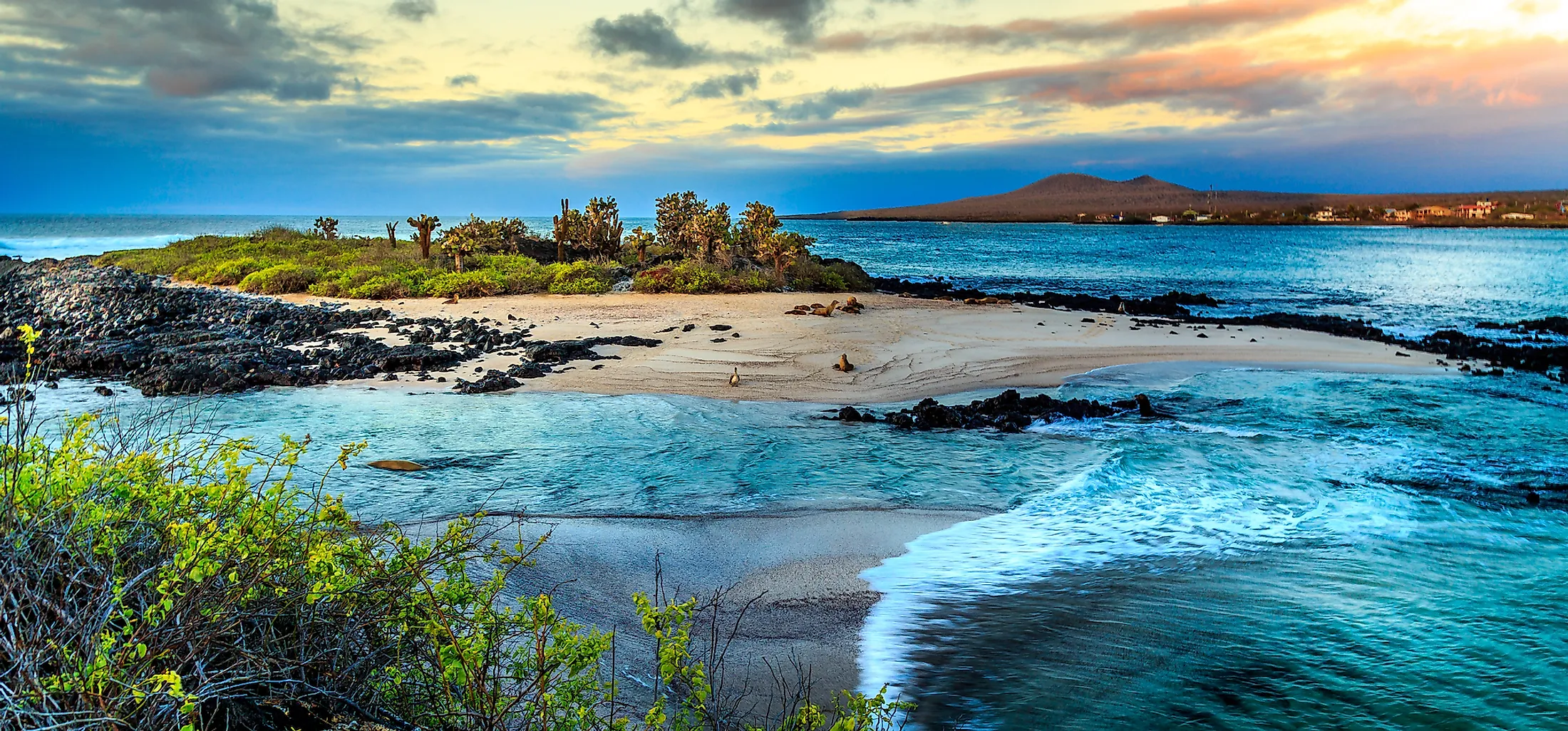
The Galapagos Marine Reserve is an unusual marine ecosystem, with abundant marine animals, including sharks, corals, and marine mammals. It contains endemic species, such as land iguanas, giant tortoises, flightless cormorants, and Darwin’s finches. Other species on and around the archipelago are land snails, mockingbirds, sea lions, sea birds, rays, and whale sharks. The island also has numerous endemic and native plant species, including 500 vascular plants, of which 180 species are endemic.
About 97% of the Galapagos Islands land area is considered a National Park. The Galapagos National Park was declared Natural Heritage for Humanity by UNESCO in 1979, making permanent conservation possible. However, some of the threats on the archipelago include invasive species introduction, illegal fishing, increased tourist activities, and population growth.


