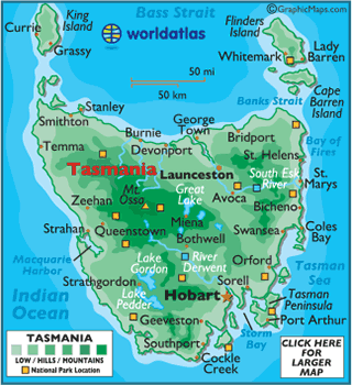
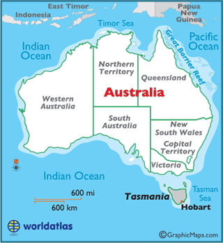
Tasmania
- Coastline: 3,033 miles (4,882 km)
- Land Area:
(land) 26,410 sq miles (68,401 sq km)
(water) 8,632 sq miles (22,357 sq km)
(TOTAL) 35,042 sq miles (90,758 sq km)To convert sq km (kilometers) to sq mi (miles)
use our converter - Land Area: (all countries)
- Land Divisions: There are 20 land districts in Tasmania. They are Arthur, Buckingham, Cornwall, Cumberland, Devon, Dorset, Flinders, Franklin, Glamorgan, Kent, King, Lincoln, Monmouth, Montagu, Montgomery, Pembroke, Russell, Somerset, Wellington, and Westmoreland.
- Horizontal Width: 185.59 miles (298.68 km) from Temma east to St. Helens
- Vertical Length: 138.21 miles (222.43 km) from George Town south to Cockle Creek
Note: Lengths and widths are point-to-point, straight-line measurements from a Mercator map projection, and will vary some using other map projections
- Bordering Countries: (0)
- Geographic Center: About 8.74 miles (14.06 km) south of Miena
- Highest Point: Mount Ossa 5,305 ft. (1,617 m)
- Lowest Point: Indian Ocean 0 m
- Latitude and Longitude
- Relative Location