Maps of Greenland

Covering an area of 2,166,086 sq. km (836,330 sq mi), Greenland (about 80% of which is ice-covered) is the world’s largest (non-continent) island, located between the Atlantic and Arctic Oceans.
As observed on the physical map of Greenland above, the coastline is rugged, mountainous, and for the most part, barren. The land then rises to a sloping icecap that covers (81%) most of the island. In places that ice has been measured at more than 11,000ft (3,350m) thick, countless (mostly small) rocky islands ring the coastline central to south, and much like Norway, fjords are plentiful.
Some scientists have claimed that the Greenland ice sheet may actually conceal three large separate island land masses that have been bridged by glaciers since the last ice age. In 2002, as the ice in the far north began to melt, it left a small island exposed to daylight. Additional islands are expected to be discovered if that melting trend continues.
There are nearly 40 glaciers covering the Greenland landmass, and one of the largest is the Peterman. Recently, a chunk of ice broke off the Peterman; an area of ice 100 sq. miles and 600ft thick. It is now drifting in a remote area called the Nares Strait between Greenland and Canada.
Mountain ranges, either partly or totally buried by ice, fringe the toothy-edged coast. Greenland's highest mountains are the massive ice-covered peaks and exposed cliffs of the Watkins Range that run along it’s eastern coastline. The island's highest point is located there: Gunnbjorn’s Fjeld at 3,700m (12,139 ft). A yellow triangle marks its position on the map.
Believe it, or not, hot springs are a common natural phenomenon in Greenland. In the far south on Uunartoq Island, they're warm enough to swim in. On Disko Island in the far-west, there are thousands of small hot springs.
There are about 20 rivers in Greenland. All ring the coastline and all are small melt water outflows from a nearby glacier on the Greenland ice sheet. There are scattered small (summer lakes) across Greenland, all the result of glacier melt. These lakes drain away quickly, or freeze solid in the winter months.
Municipalities of Greenland Map

Greenland is divided into 5 municipalities (kommuner, sing. kommune). In alphabetical order, these municipalities are: Avannaata, Kujalleq, Qeqertalik, Qeqqata and Sermersooq.
Covering an area of 2,166,086 sq. km, Greenland (about 80% of which is ice covered) is the world’s largest (non-continent) island and the 3rd largest in North America. It is also one of the least densely populated regions in the world. Located at the mouth of Nuup Kangerlua, on Greenland’s south western coast is Nuuk – the capital and the largest city of Greenland. It is the administrative and the largest cultural and economic center of the island country. Nuuk accounts for over one-third of the country’s population.
Where is Greenland?

Greenland, the world’s largest (non-continent) island is located between the continents of North America and Europe in the North Atlantic Ocean. It is geographically considered a part of the North American continent. Greenland is positioned both in the Northern and Western hemispheres of the Earth. It is surrounded by the Arctic Ocean to the north; by the Greenland Sea to the east; by the North Atlantic Ocean to the southeast; Davis Strait to the southwest; Baffin Bay to the west; and Nares Strait and Lincoln Sea to the northwest. Greenland shares its maritime borders with Canada, Iceland and Norway.
Regional Maps: Map of North America
Outline Map of Greenland


Key Facts
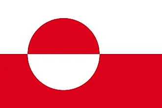
| Legal Name | Greenland |
|---|---|
| Flag |
|
| Capital City | Nuuk (Godthaab) |
| 64 11 N, 51 45 W | |
| Total Area | 2,166,086.00 km2 |
| Land Area | 2,166,086.00 km2 |
| Water Area | N/A |
| Population | 56,225 |
| Currency | Danish kroner (DKK) |
| GDP | $3.05 Billion |
| GDP Per Capita | $54,470.96 |
This page was last updated on February 25, 2021