Tallest Mountains In Greenland
Greenland is an autonomous island country, part of the Danish territory, is found between the Arctic and Atlantic Ocean. 75% of the country is covered by permanent ice sheet while the rest of the area is inhabited by humans. Greenland has an average population of 58,000 people, the least densely populated country in the world. The country occupies an area of 2,166,086 square kilometers including other minor islands around it. The majority of the country is less than 1500 meters above the sea level. The highest elevation is Gunnbjorn Fjeld at 12,139 feet. The highest mountains in the country includes:
Gunnbjorn Fjeld
Gunnbjorn Fjeld is the tallest mountain and the highest elevation in the Greenland. The mountain measures 12,139 feet (3700m) in height. The mountain is also the tallest in the north of the Arctic Circle. The name Gunnbjorn, also known as Hvitserk, literally means “whiteshirt.” The mountain is located in the Watkins Range on the east coast containing several summits above 3500 m. Gunnbjorn Fjeld is uninhabited because of its remote location, and access is mainly done by ski-equipped planes or helicopters.
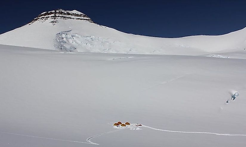
Mont Forel
Mont Forel is in King Christian IX Land in the municipality of Sermersooq. The mountain is part of the Schweizerland range. Mont Forel was named by Alfred De Quervain, a Swiss geophysicist after crossing Greenland ice cap in 1912. The mountain is the highest peak outside of Watkins Range with an elevation of 11,024 feet (3383m). The peak is a popular climbing destination alongside the Watkins Range. Mont Forel was first climbed in 1938 by Andre Roch, Swiss explore. The mountain is one of the tourist attraction sites especially for tourists coming from Iceland and Denmark.
Ejnar Mikkelsen Range
Ejnar Mikkelsen Range is also in the King Christian IX Land on the eastern part of Greenland. The range forms part of the Watkins Range on the eastern side. It was named after Ejnar Mikkelsen, a Danish explorer. The highest point on Ejnar Mikkelsen Range is 10,769 feet (3,282.7m). The mountain is very massive and has its summit marked by black rock needle. Ejnar Mikkelsen Range was first climbed by Andrew Ross in 1970 and was again climbed again in 1998 by Roland Aeschimann together with His Swiss team.
Borgetinde
Borgetinde is a mountain range within the King Christian IX Land. The name Borgetinde means ‘Castle Pinnacles’ in Danish. The range is part of the Sermersooq Municipality regarding administration. This mountain is along the nunatak together with other high mountains and is located on the Eastern side of Ejnar Mikkelsen Range. The highest elevation of Borgetinde Range is 10,719 feet (3265m) and has a reputation among alpinists. The climate in and around the peak is Tundra with an average annual temperature range of -21oC and 0oC.
Highest Point Of The Crown Prince Frederick Range
Crown Prince Frederick Range was first surveyed in 1934 by Sir Martin Lindsay during the British Trans-Greenland Expedition. It was then named after Crown Prince Fredrick of Denmark who later crowned King Fredrick IX. The highest point of Crown Prince Frederick Range is 10,683 feet and is uninhabited. The region is mainly a polar climate with temperatures ranging between -2oC and -20oC.
Conclusion
Other mountains that are above 10,000 feet include Summit Camp (10,522ft) and Trillingerne High Point (10,404ft). Both the mountains are within the Lindbergh Range within the municipality of Sermersooq.
Tallest Mountains In Greenland
| Rank | Tallest Mountains in Greenland | Elevation |
|---|---|---|
| 1 | Gunnbjorn Fjeld | 12,139 feet |
| 2 | Mont Forel | 11,024 feet |
| 3 | Ejnar Mikkelsen Fjeld | 10,769 feet |
| 4 | Borgetinde | 10,719 feet |
| 5 | Highest Point of the Crown Prince Frederick Range | 10,683 feet |
| 6 | Summit Camp | 10,522 feet |
| 7 | Snebordet | 10,404 feet |
| 8 | Highest Point of Trillingerne | 9,909 feet |
| 9 | Petermann Peak | 9,646 feet |
| 10 | Jaetteborg | 9,579 feet |


