Maps of Maldives

Maldives is an archipelagic nation with a total land area of 298 sq. km in the Indian Ocean. It is Asia's smallest country. Here, over 1,110 islands are grouped into a double chain of 26 atolls. The islands of the country are dispersed across about 90,000 sq. km of the ocean. This fact makes Maldives one of the world's most geographically dispered nations.
The double chain of atolls of Maldives can be observed on the physical map of the country above. They lie across the Equator on both the Northern and Southern hemispheres of the Earth.
The atolls of Maldives sit atop a submarine ridge. This ridge rises from the bed of the ocean and runs for 960 km (600 mi) in the north-south directions. The atolls are composed of sand bars and live coral reefs.
Gan is the country's largest island and is located in the Laamu Atoll.
The topography of each of the islands vary from mostly sand to marshy wetlands.
Its highest point, an unnamed point on Wilingili Island, is only 7.87 ft. (2.4 m); while its lowest is the Indian Ocean (0 m).
Atolls of Maldives Map

Maldives can be divided into 21 administrative atolls (atholhuthah, singular - atholhu). In alphabetical order, they are as follows:
Addu (Addu City), Ariatholhu Dhekunuburi (South Ari Atoll), Ariatholhu Uthuruburi (North Ari Atoll), Faadhippolhu, Felidhuatholhu (Felidhu Atoll), Fuvammulah, Hahdhunmathi, Huvadhuatholhu Dhekunuburi (South Huvadhu Atoll), Huvadhuatholhu Uthuruburi (North Huvadhu Atoll), Kolhumadulu, Maale (Male), Maaleatholhu (Male Atoll), Maalhosmadulu Dhekunuburi (South Maalhosmadulu), Maalhosmadulu Uthuruburi (North Maalhosmadulu), Miladhunmadulu Dhekunuburi (South Miladhunmadulu), Miladhunmadulu Uthuruburi (North Miladhunmadulu), Mulakatholhu (Mulaku Atoll), Nilandheatholhu Dhekunuburi (South Nilandhe Atoll), Nilandheatholhu Uthuruburi (North Nilandhe Atoll), Thiladhunmathee Dhekunuburi (South Thiladhunmathi), Thiladhunmathee Uthuruburi (North Thiladhunmathi)
Located at the Kaafu Atoll's southern edge, Male is the capital and largest city of Maldives.
Where is Maldives?

The Maldives is an island country of South Asia located in the Arabian Sea region of the Indian Ocean. It is located about 700 km (430 mi) off the coast of mainland Asia and to the southwest of India. The islands of Maldives straddles the Equator with parts of the country lying in both the Southern and Northern Hemispheres of the Earth.
Regional Maps: Map of Asia
Outline Map of Maldives

The above map of represents the islands of Maldives, a country in the Indian Ocean with picturesque landscapes and stunning beaches. The map can be downloaded, printed, and used for map-pointing activities, etc.

A stretch of islands and atolls of various sizes in the Arabian Sea portion of the Indian Ocean comprise the country of Maldives. The outline map above represents this island nation.
Key Facts
| Legal Name | Republic of Maldives |
|---|---|
| Flag |
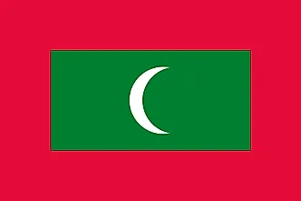
|
| Capital City | Male |
| 4 10 N, 73 30 E | |
| Total Area | 298.00 km2 |
| Land Area | 298.00 km2 |
| Water Area | N/A |
| Population | 530,953 |
| Currency | Rufiyaa (MVR) |
| GDP | $5.73 Billion |
| GDP Per Capita | $10,790.50 |
This page was last updated on November 9, 2020