Maps of Hong Kong

Hong Kong occupies a total area of 1,108 sq. km in the eastern Pearl River Delta of the South China Sea. As seen on the physical map of Hong Kong, it also has several offshore islands including Lantau Island (the largest one), Hong Kong Island, Lamma Island, Cheung Island, Po Toi Island, and others.
Almost all of the available land in Hong Kong is hilly to mountainous with steep slopes. There are very steep mountains that drop into the sea, with some exceeding 2,500 ft. (764 m).
The highest point in Hong Kong is Tai Mo Shan (marked on the map), whose summit peaks at 3,143 ft (958 m). It is located in Tsuen Wan in the New Territories.
Lowlands cover less than one-fifth of Hong Kong's area. In the north, Yuen Long and Sheung Shui plains are the only regions featuring extensive lowlands.
The land is lower on the northern edges of Hong Kong Island, and in the north along the border with China.
The only major river is the Sham Chun which flows in the north of Hong Kong and drains into Deep Bay.
At 0 m, the South China Sea is the lowest elevation in Hong Kong.
Districts of Hong Kong Map

Hong Kong (officially, Hong Kong Special Administrative Region of the People’s Republic of China) is divided into 18 districts. These districts are: Islands, Kwai Tsing, North, Sai Kung, Sha Tin, Tai Po, Tsuen Wan, Tuen Mun, Yuen Long, Kowloon city, Kwun Tong, Sham Shui Po, Wong Tai Sin, Yau Tsim Mong, Central and Western, Eastern, Southern and Wan Chai.
With an area of 1,104 sq. km, and a population of over 7.5 million people, Hong Kong is one of the most densely populated regions of the world. Hong Kong is one of the world’s leading financial center and also the most significant economic and commercial ports.
Where is Hong Kong?

Hong Kong is a region in Eastern Asia. It is located on the east of the Pearl River Estuary on south coast of China. It is situated both in the Northern and Eastern hemispheres of the earth. The region is bordered by Guangdong province of China in the north and by South China sea in the east, south and west.
Hong Kong Bordering Countries: China.
Regional Maps: Map of Asia
Outline Map of Hong Kong

The above blank outline map represents Hong Kong including the mainland territory and islands of Hong Kong. The map can be downloaded, printed, and used for map-pointing or coloring activities.

Located on the Pearl River Delta, Hong Kong is a special administrative region of China. The above map represents Hong Kong.
Key Facts
| Legal Name | Hong Kong Special Administrative Region |
|---|---|
| Flag |
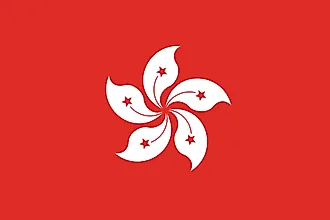
|
| Total Area | 1,108.00 km2 |
| Land Area | 1,073.00 km2 |
| Water Area | 35.00 km2 |
| Population | 7,507,400 |
| Largest City |
Hong Kong (7,684,801) |
| Currency | Hong Kong dollars (HKD) |
| GDP | $366.03 Billion |
| GDP Per Capita | $48,755.84 |
This page was last updated on February 24, 2021