Kenai River
The Kenai is the longest river in Southcentral Alaska's Kenai Peninsula, which flows for 132 km from the Kenai Mountains to the Cook Inlet of the Pacific Ocean. The river is also known for its waters' turquoise and blue hues, caused by silt in the glacial runoff that feeds its flow. The Kenai River is referred to as Kahtnu in the indigenous Dena'ina language.
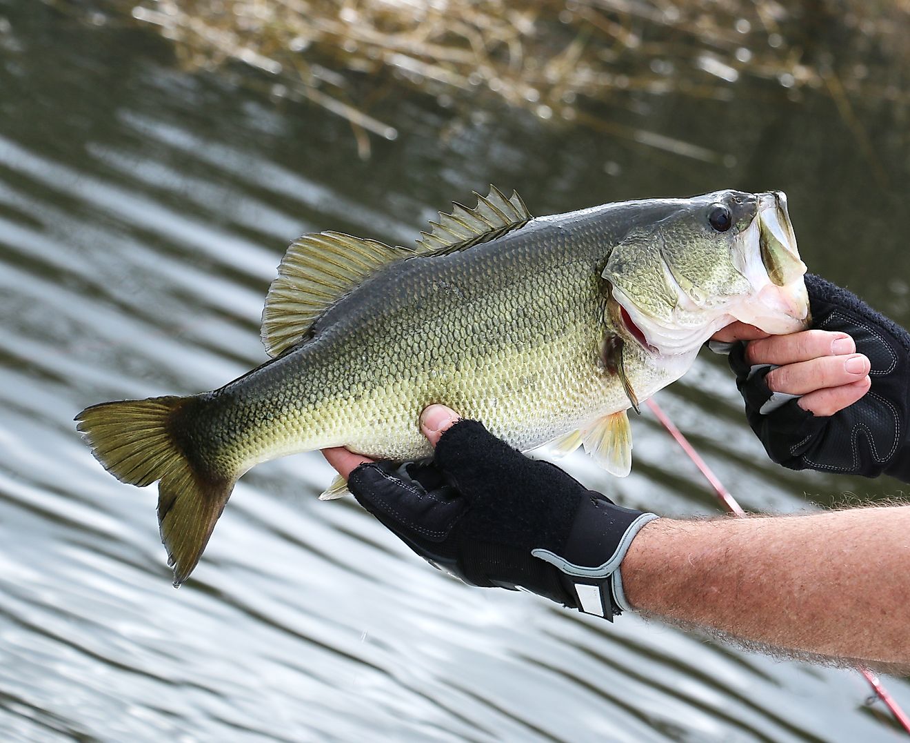
The Kenai River is easily accessible via the state's highway system, unlike many more remote areas. With prized fish species like salmon and trout available to anglers, the Kenai River has become a center for sport fishing along its slower-moving sections. As a result, it is the most heavily fished river in the state. Other stretches of the river, including its fast-moving section with whitewater rapids, have become popular with adventure sports enthusiasts. No motorized boats are permitted on the Upper Kenai River, which has been designated as a drift-only corridor.
Course Of Kenai River

The Kenai River begins to gather its flow from many different sources from the western edge of the Chugach Mountains, including runoff from glaciers of the Harding Ice Field, as well as the usual rain and snow and underground aquifers that run through porous rocks. The meltwater and runoff gather into Kenai Lake in the Kenai Mountains, and the flow narrows to a river near Cooper Landing, a former gold mining outpost.
The river's flow slows to slack water for about 9.5 km before crossing an area of gravel riffles (intermittent gravel structures that develop on the riverbed in intervals) and then continues in a slightly faster flow downhill. There are mild Class I and II rapids along this section. After another 9.5 km, it flows into the much steeper drop of Kenai River Canyon, and the river turns into class II-III whitewater rapids. After a section of rapids, the river slows once more for about 8 km before entering Skilak Lake, another glacial body of water. Up to this point, the region is known as the Upper River.

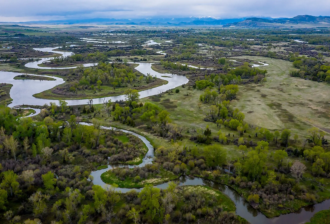
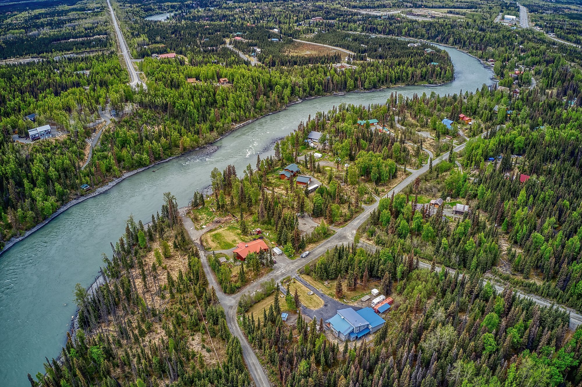
From Skilak Lake, the gradient of the river’s flow downhill increases to about 3.3ft per mile for a stretch of about 17 km before dropping to the area known as the Naptown Rapids. The section of Class III rapids extends for about 1.6 km at a level of difficulty that requires power-motored craft and a high level of experience to navigate. The Russian River is a tributary of the Kenai River, flowing through the Chugach National Forest from its origins in mountain lakes until it runs into the Kenai. Much of the riverbed consists of pebbles washed down the mountainside. There are many larger boulders in the river past the Naptown Rapids into the region called Mid-River, and the river flows faster downstream. The Mid-River section continues for just over 31 km.
The Sterling Highway bridge in the Alaskan city of Soldotna marks the transition into the Lower River region. For approximately 34 km, the final section of the river flows more gently. As it flows through woodlands, the color changes from its original turquoise blue. One of the Kenai's tributaries, the Killey River, flushes a massive amount of silt and debris in the river near the Sterling Highway crossing, causing cloudy waters for its final stretch. The river empties into the Cook Inlet in the town of Kenai.
Climate Of Kenai River

The Kenai Peninsula experiences a continental subarctic climate, with cool summers and very cold, snowy winters. Average temperatures for the Kenai Peninsula range from lows of -16.6°C in January, the coldest month, to 11.5°C in July, the warmest. Average highs may reach 21°C, with average winter low temperatures of about -24.5°C. Skies are often cloudy, particularly during the summer months. Due to the high elevations of the Upper Kenai River and the presence of glaciers, and glacial winds, other weather disruptions can occur at any time. Precipitation varies over a typical year. The rainiest month is usually September, with an average rainfall of 124 mm over 12.6 days. The driest month is March. Snow is common from November until mid-March, with the most snowfall typically in December at over 400 mm.
Ecology Of Kenai River

The Kenai River flows through the Chugach National Forest and then Kenai National Wildlife Refuge, called Yaghanen, by the indigenous Dena'ina people. The landscape ranges from ice fields and glaciers to thick spruce and cottonwood boreal forests that gradually thin downhill into coastal wetlands. The area has a high level of biodiversity unusual for its high latitude and is home to moose, brown and black bears, lynx, wolves, and trumpeter swans, among other species. An abundance of fish in the river has created its reputation as an angler's haven, including five species of salmon during spawning season, as well as year-long native rainbow trout and more.

The Kenai River is an essential part of the ecology of king salmon and other fish species. King salmon spend part of their lives in salt water, returning in thousands from mid-May and mid-June and again in July to breed. While sport fishing permits are issued, there are periods when many portions of the Kenai River are closed to fishing to protect the habitat. Kenai River red and white salmon, pink salmon, steelhead and lake trout, Dolly Varden, as well as northern pike, can be found in the Kenai River.
Brief History Of Kenai River

With its rich sources of fresh water, hunting, and fishing, the Kenai Peninsula was inhabited soon after the last glaciers retreated enough to support life. Archaeological evidence has been found of the Riverine Kachemak people, who lived in the area from about 1000 B.C. to A.D. 1000, followed by the Late Prehistoric Dena'ina. Later cultures are known as the Dena'ina Athabascan people, who still hunt and fish in the area in the 21st century.
In 1870, the US purchased Alaska from Russia, and Fort Kenay was abandoned. Commercial fishing was established in the town of Kenai, a thriving business by the 1920s. In the 1940s, government-sanctioned homesteading, whereby people could obtain land free by living and working on it, and encouraged settlement. A dirt road was established in 1951, and in 1957, oil was discovered about 32 km northeast of Kenai. Along with offshore oil discoveries in the Cook Inlet, it led to a period of rapid growth in the town and peninsula. The Kenai River became popular for ecotourism and shooting the rapids in the 1970s. Tourism, including fishing and whitewater rafting, is a significant activity along the river's course. Commercial fishing remains a staple of the area's economy, with many cannery and processing plants throughout the region.