7 Most Scenic Drives in Illinois
River bluffs, wooded ravines, and long stretches of shoreline shape some of Illinois’s most scenic drives. From tree-lined backroads in the countryside to cliffs rising above the Illinois River Valley, the terrain shifts gradually across the state. Highways follow the edge of Lake Michigan in Chicago and curve along the Mississippi near Galena and Savanna, where noticeable elevation changes reshape the drive. These routes move through river valleys, bluff country, and forested hills, revealing landscapes that unfold steadily from behind the wheel. Here are seven of the most scenic drives across Illinois.
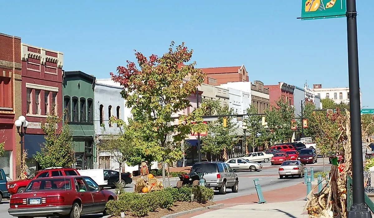
North Shore along Sheridan Road

A stretch of Sheridan Road from Rogers Park through the North Shore to Waukegan traces Chicago’s northern lakefront for roughly 36-41 miles, alternating between tight residential corridors and open stretches with filtered views of Lake Michigan. The drive begins at Juneway Terrace and immediately bends northward, where mature trees often arch overhead, creating a shaded canopy effect. Early on, the road curves past Calvary Cemetery, with glimpses of the lake to the east before entering Evanston’s stately residential districts. From Wilmette to Lake Forest, Sheridan Road becomes a gently winding, two-lane, scenic corridor with intermittent lake views, stone walls, ravines, and historic homes set back from the road. The alignment includes mild curves and subtle elevation shifts as it crosses ravines carved toward the lake. In Lake Forest, near Deer Path Inn, traffic thins and the road straightens slightly before reaching Waukegan’s lakefront. Late spring through early fall offers the clearest lake views.
Route 31 from Aurora to West Dundee

Illinois Route 31 follows the west bank of the Fox River for 20-22 miles between Aurora and West Dundee, closely tracing many of the river’s natural bends. In Aurora, the road is primarily four lanes and more urban in character. North of Batavia, it transitions to mostly two lanes through Geneva and St. Charles, where riverside parks, pedestrian bridges, and occasional overlooks appear at regular intervals. The terrain is generally gentle, with gradual elevation changes as the roadway rises slightly above the Fox River floodplain in places. Curves are modest and flow naturally with the river’s shape rather than forming sharp turns.
Between St. Charles and South Elgin, wooded valley slopes and occasional limestone bluffs, often more prominent on the opposite bank, add visual depth to the drive. Approaching West Dundee, especially around St. Charles, the river bends noticeably, and the roadway follows along. The Fox River Trolley Museum in Elgin displays railroad cars and trolleys dating back to 1887. The drive continues about 8 miles to West Dundee, where this segment ends. In winter, conditions are typically manageable for a state highway, though bridges may ice before the main roadway.
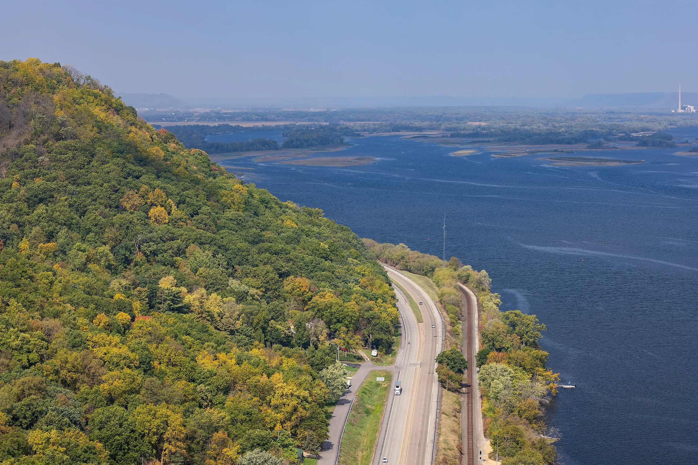
Illinois River Road National Scenic Byway: Starved Rock to Peoria segment

The stretch of the Illinois River Road National Scenic Byway from Starved Rock State Park near Aurora Canyon to Peoria is one of the most scenic segments of the route. It is primarily via IL-29 and offers a concentrated river drive of roughly 57-63 miles. From near Spring Valley southward, IL-29 runs close to the Illinois River, often within sight of backwaters, wetlands, and broad floodplain fields. The road is generally two lanes, with long, open sightlines broken by gentle curves that follow the river’s contour. Elevation changes are subtle except near bluffs and park areas, where short climbs provide wider views of the valley.
Peter Toth's Indian Sculpture in Hopewell, one of the artist's carvings of Native Americans across the United States, is located on a hill overlooking the Illinois River. Approaching Peoria, the landscape becomes more urban, culminating in Grandview Drive, a bluff-top stretch with elevated views over the river. Theodore Roosevelt once called that short stretch “the world’s most beautiful drive.” Expect light to moderate traffic increasing near Peoria.
Meeting of the Great Rivers Scenic Route

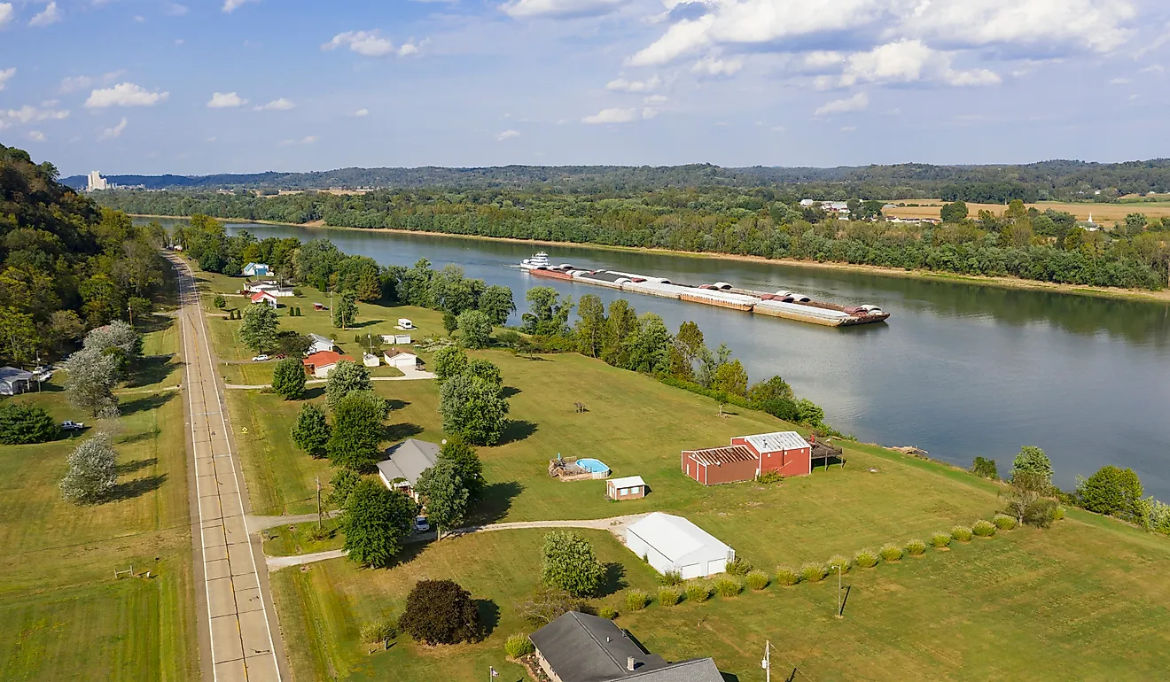
This 33-mile segment follows the Mississippi River between Hartford and Pere Marquette State Park, near where the Missouri and Illinois Rivers join it. The drive begins in Hartford, at the intersection of Illinois Route 3 and New Poag Road. The Lewis and Clark (Camp River Dubois) State Historic Site is located there and interprets the expedition. The route runs primarily along Illinois Routes 3, 143, and 100 between Hartford and Pere Marquette State Park. The drive is defined by limestone bluffs rising sharply above the Mississippi River, especially between Alton and Grafton along IL-100, with long, sweeping curves and elevated vantage points overlooking wide river channels.
Much of the route hugs the base of bluffs or rides just above the waterline, offering steady river views, barge traffic, and wooded slopes. The National Great Rivers Museum near Alton features a scale hydraulic model depicting how the locks work and a barge-piloting simulator. As you approach Grafton, especially around Pere Marquette, the scenery becomes more rustic, with noticeable elevation gains into the park’s interior. Autumn is striking for foliage along the bluffs, though it also draws heavier traffic. On the flip side, winter brings potentially icy grades near Pere Marquette, calling for caution on shaded bluff sections.
Galena to Savanna

For the Great River Road enthusiasts, the Galena to Savanna Drive is a solid alternative if you want to skip the Meeting of the Great Rivers. The signed scenic route follows much of Illinois Route 84, meandering along the Mississippi River with river bluffs, threading through the small village of Hanover, and snaking through scenery with dozens of twists and turns. Follow U.S. 20 from East Dubuque through Galena, then turn south onto Illinois Route 84, continuing through Hanover and down through Savanna.
Expect significant elevation changes, especially around the Mississippi Palisades, keeping in mind that you are in the Driftless Area, where the landscape was missed by glaciers during the last Ice Age. From Galena, stroll briefly along the town’s historic Main Street, admiring the area's Victorian-era architecture. The road passes Long Hollow Scenic Overlook, which offers wide countryside views and picnic tables. L & J Bootlegger Saloon sits in Hanover before the road continues toward Mississippi Palisades State Park. The route then continues toward Savanna, a town with access to hiking and biking trails.
The Shawnee Hills Wine Trail

The Shawnee Hills Wine Trail runs through one of the first regions in Illinois recognized for its winemaking. Spanning roughly 40 miles through southern Illinois, the Shawnee Hills Wine Trail follows portions of IL-127, IL-51, and smaller connecting roads through the rolling terrain of the Shawnee National Forest. The drive is defined by consistent elevation changes, wooded ridgelines, and open farmland transitions. The roads are generally two lanes, with moderate curves and occasional steeper grades as they cross low ridges and valleys. Visibility is typically good, though drivers should be more careful on the tree-lined stretches.

The route can begin in Murphysboro, often called Illinois’ BBQ capital, and transition into the rolling hills of Highway 127. Expect decent elevation changes, woodlands, and the rural charm of southern Illinois. Alto Vineyards sits in Alto Pass before the route continues to Jonesboro toward the Lincoln Memorial Picnic Grounds, where one of the seven Lincoln-Douglas debates took place. The road continues through the countryside on Highway 51, eventually crossing onto Makanda Road, which brings you into the village of Makanda, the gateway to the Giant City State Park.
Lake Shore Drive

Lake Shore Drive offers an urban-nature contrast that is rare elsewhere in the Midwest. On one side is the wavy blue of Lake Michigan, vast and restless. On the other is a long row of skyscrapers, their glass and steel faces glinting in the shifting light. Lake Shore Drive begins at the junction of Marquette Drive and Jeffery Drive on Chicago’s South Side and terminates at Hollywood Avenue in the Edgewater neighborhood on Chicago’s North Side. The multilane highway features gentle S-curves, particularly around Grant Park and near Oak Street Beach, with ample lake views to the east and Chicago’s skyline rising to the west.
The 13-15-mile road is mostly flat, engineered for steady flow, with gradual banking on major curves. McCormick Place sits along the route, the largest convention center in the Western Hemisphere. The Museum Campus, a few miles farther, brings together three of the Windy City's leading institutions: the Field Museum of Natural History, the Shedd Aquarium, and the Adler Planetarium. Continuing north, Lakefront Park runs alongside the drive. Expect significant congestion during rush hours, especially near downtown interchanges.
At the end of the day, a drive through Illinois often feels unexpected, especially because of the misconception that there’s nothing here but endless plains. From routes that snake through forested areas, such as the Shawnee National Forest, where rocky bluffs, wild canyons, and hardwood forests hold sway, to those that parallel the Illinois River or trace Lake Michigan’s shoreline, these routes reveal a more varied Illinois landscape.