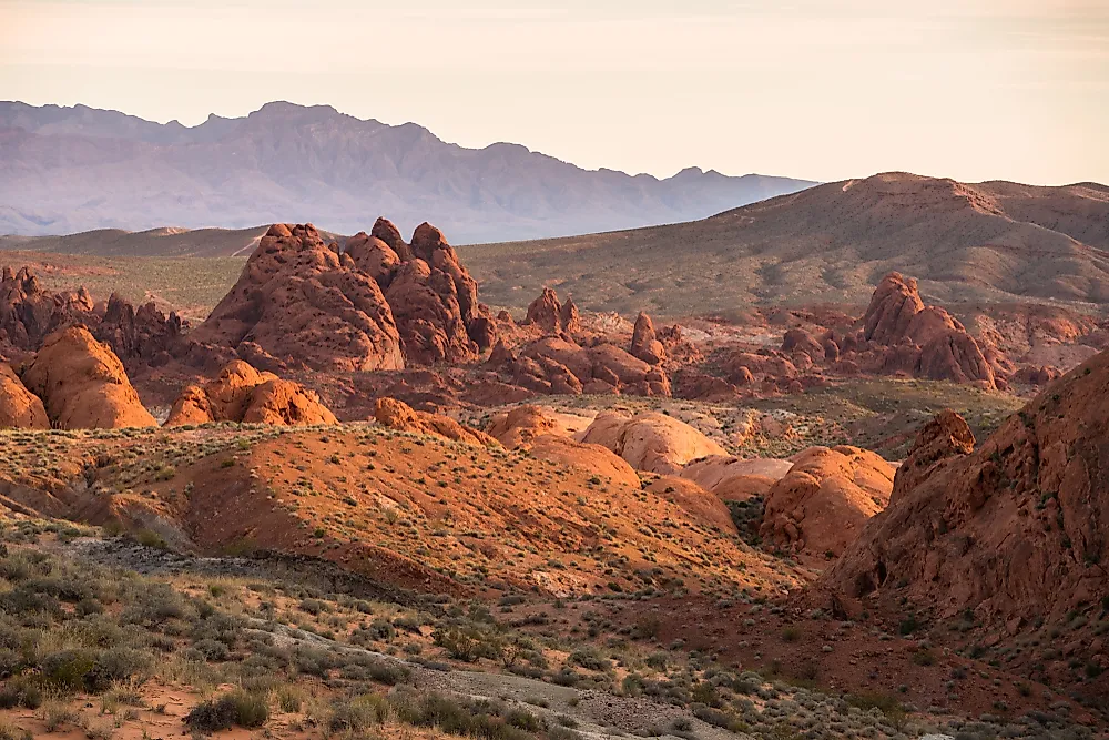
9 Best Hikes In Montana
Montana is one of the largest states in size in the United States, contrasted by its incredibly small population. These features make Montana an ideal place for hikers, backpackers, and outdoor enthusiasts. Montana's landscape is breathtaking and unique, with several of the best national parks in the world, including the infamous Yellowstone National Park and Glacier National Park. Trekking through this majestic world is the best way to experience its many natural wonders first-hand. Plan a trip to this incredible state and visit some of best trails Montana has to offer!
Natural Bridge Falls, Big Timber

Natural Bridge Falls gains its name from an ancient natural feature that took early visitors' breath away. The old natural bridge was once an ancient rock formation that stretched over the rapid floods of the Boulder River. Unfortunately, the bridge collapsed in the 1980s, but the area is still a majestic and beautiful site to explore on foot.
Located in Gallatin National Forest, 5 miles outside the East Boulder Junction, this park is ideal for hikers of any skill level. The Natural Bridge Hike is only 1.1 kilometers or approximately .7 miles, but the surrounding park has more trails to explore. The Absaroka Beartooth Wilderness borders Yellowstone National Park and is an excellent place for a seasoned hiker to explore for a few hours.
M and L Trails, Missoula

The M and L trails are two of the most popular in the Missoula area. These trails do not follow the same path but usually travel together because their tracks share several unique features.
The M trail gets its name from the giant M drawn on the cliffside with concrete. Built by Montana State University students in the early 1900s, the M underwent several modifications before finally being immortalized with concrete in 1968. This hike takes travelers up the slopes of the majestic Mount Sentinel just outside Missoula. This one and ¾ mile hike is a great way to spend the afternoon and gain a breathtaking view of the surrounding landscape.
The L trail, affectionately known as the L to locals, is north of the M across the Clark Fork River. Unlike the M, a relatively mild hike up Mount Sentinel, the L trail is far more complicated. The cliffs offer a front-row seat to the Lower Rattlesnake region of Missoula. Like the M, the L stands for Loyola Sacred Heart High School. The hike is notoriously steep right from the start and typically takes just over an hour to hike to the top.
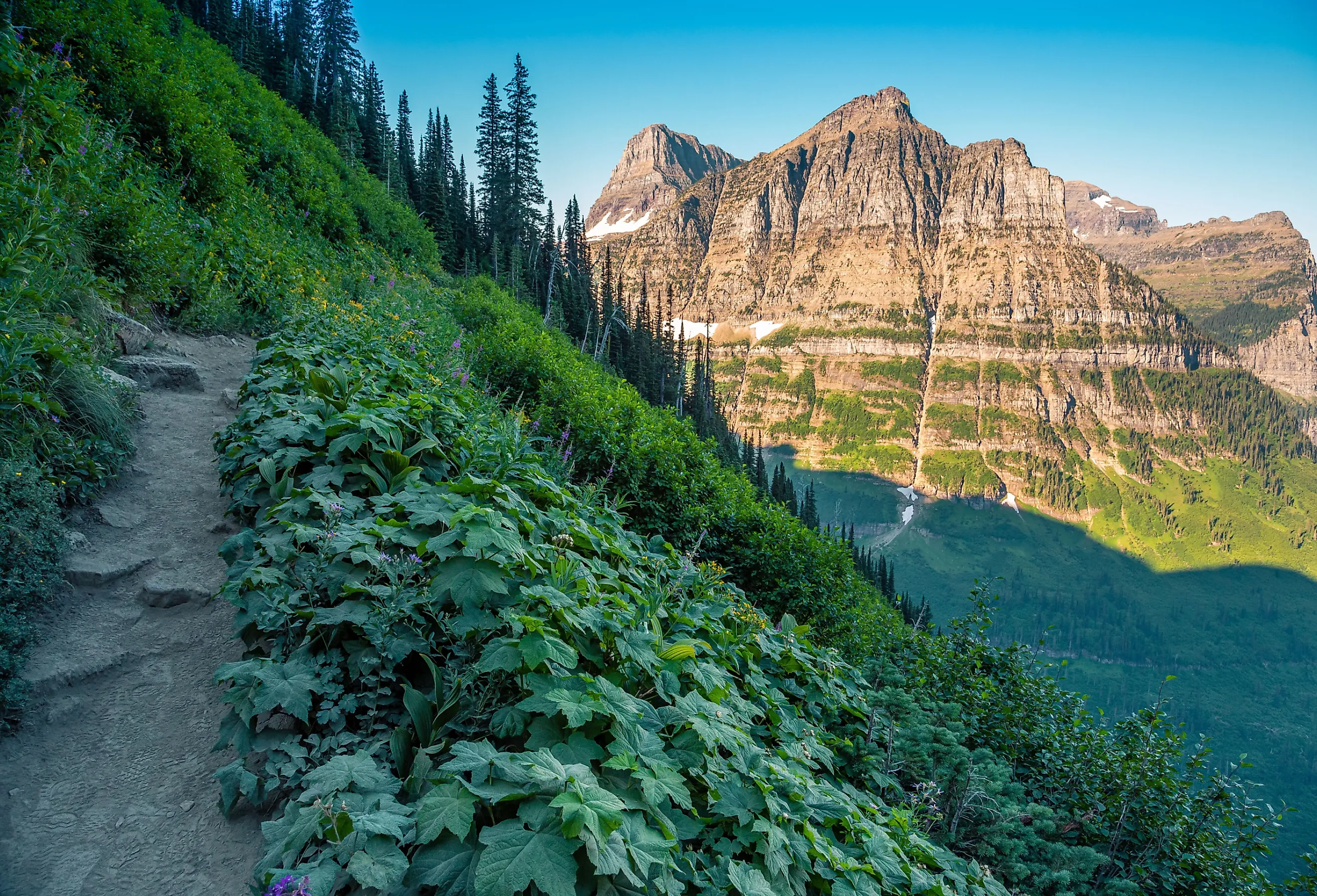
Grinnell Glacier Trail, Glacier National Park

Glacier National Park is among the richest sites for hiking and biking enthusiasts. Glacier National Park is an ideal place to spend several days, with well over a dozen diverse trails and a wealth of natural beauty. An area steeped in centuries of history, the land was once home to native tribes like the Blackfeet people, with European settlers arriving in the early 1800s.
Grinnell Glacier is the most spectacular hike, offering a first-rate view of one of the oldest glaciers in Montana. Hikers will experience the beauty of lakes Swiftcurrent and Josephine early on in the trip, with the Angel Wing cliffs casting massive shadows across the waters below. The hike itself is long, approximately 10 miles, so ensure you prepare for a challenging yet breathtaking experience.
Highline Trail, Glacier National Park

Another of Glacier National Park's spectacular trails, Highline Trail, is distinctive for its more gradual ascent and views of the Continental Divide. Many locals and hikers call the Continental Divide the Garden Wall owing to its massive selection of wildlife and plant life, calling it the wall it's home.
Following the Going-to-the-Sun-Road for most of the early stages of the journey makes this trail more secure than others. However, the roadway is pretty in its own right and gives a great view of the skyline. Several areas along the shelf are narrow and have a sheer dropoff down nearly 100 feet. Hold on to the metal wire along the cliff side and pay close attention to your footing.
Travelers will have a beautiful view of the Garden Wall Trail around seven miles up the peak. Earlier on in the hike, keep your eyes on the west to catch glimpses of Mount Oberlin, Mount Cannon, and Heavens Peak.
Beehive Basin Trail, Big Sky

Owing to its location in a place like Big Sky, the most notable feature of Beehive Basin is the majestic view of the skyline and surrounding landscape. Beehive Basin Trail is a steep incline of approximately 1,500 feet and brings hikers near the highest point of Big Sky, Montana, ending at around 9,200 feet.
The beginning of the hike is one of the most challenging parts due primarily to the immediately rough incline upwards. However, once past the initial sloping portions, the trail levels off and becomes more straightforward and less intense. While the breathtaking skyline is the most spectacular feature, it also offers a lot of diversity in plants and wildlife. Mountain goats graze along the cliff faces, and the valleys have many beautiful wildflowers in the spring and summer.
The Beaten Path, Beartooth Mountains

The Beaten Path trail is an excellent place for seasoned hikers to get a fully immersive experience in the Montana wilderness. Although it is possible to visit just for a day, travelers will not complete the 26-mile hike through the rocky terrain in 24 hours alone.
This trail boasts spectacular waterways, including small waterfalls and raging rivers full of fish. However, it is important to prepare and plan before leaving for this hike since the vast wilderness stretches for over 900,000 acres. It is worth planning to spend a few extra days to go off-path and see the beauty of this wilderness.
Stuart Peak, Lolo National Park

Stuart Peak is another ideal hiking location near Missoula, Montana. These trails aren't far from the Rattlesnake region of Missoula, making it close to the M and L trails. While these trails are close to one another, Stuart Peak is considerably more complex than the M and L pathways. Although, these trails make a great weekend trip to Missoula.
Stuart Peak offers travelers a tapestry of colors throughout spring and autumn. The mountainsides come alive with plant life, such as wildflowers and berries, during the spring and summer, but autumn is equally beautiful! Autumn months bring bright orange and red colored leaves, which paint the landscape.
Travelers can bike up part of the trail, but once the incline becomes too steep, they must hike the remainder of the trip on foot. The peak offers a splendid view of the Swan, Sapphire, and Garnet Mountain ranges, which are especially beautiful at sunset.
Trapper Peak, Bitterroot National Park

Trapper Peak pushes above 10,000 feet in the Bitterroot Mountains. It provides visitors with some of the most beautiful views of western Montana, with lovely clear lakes like Baker Lake, pine forests, and plenty of wildlife to enjoy.
The western slope is ideal for anyone hoping to get a chance to see the many cairns dotting the mountain's landscape. However, this path is steeper and more complicated than the southern slope. If you want a less cluttered walkway that is marginally less steep, then the southern route is the better option.
Trapper Peak has excellent campgrounds, which can make for a fantastic weekend trip. The trail is just over 8 miles long, but hikers can probably finish the course in a day.
Sweetgrass Trail, Crazy Mountains

Sweetgrass Trail is a beautiful trail along Conical Peak, Big Timber Creek Trail, and ends near Middle Fork Sweet Grass Creek Trail. This trail is not considered difficult, but it stretches for 13 miles through the vibrant grassy landscapes, with the occasional cow spotted along the route. The grass in the region is suitable for grazing animals, making the land look tranquil.
However, the tranquil beauty of the grassy landscape contrasts with the slopes of the Crazy Mountain Range. The slopes are rather steep and slippery, especially during heavy rainfall. Hikers should wear sturdy boots with good traction to keep their footing when traveling up and down the slopes.
Conclusion
Montana comes from the Spanish word for mountain, which makes perfect sense when scanning the state's beautifully rugged and rocky terrain. Despite its intimidating landscape, Montana is one of the best states for hiking, cycling, and backpacking. The long trails offer splendid views of the surrounding region of forests, lakes, rivers, and cliffs. There are trails in Montana for every level of hiker. Take some time to plan where you are headed, wear warm clothes, and preferably visit in the summer or early fall.