Roane County, WV, USA
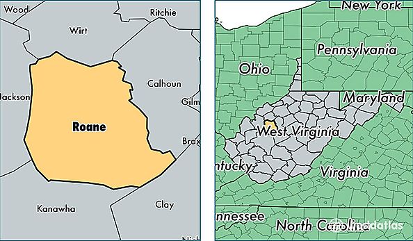
Roane County is a county equivalent area found in West Virginia, USA. The county government of Roane is found in the county seat of Spencer.
With a total 1,252.83 sq. km of land and water area, Roane County, West Virginia is the 2233rd largest county equivalent area in the United States. Home to 14,664 people, Roane County has a total 7346 households earning 28513 on average per year.
Roane County, West Virginia - Quick Facts
| FIPS Code | 54087 |
| Area Codes | 304 |
| Time Zone | EST |
| Major Cities | Spencer (population: 7,626), Walton (population: 1,664), Reedy (population: 956), Gandeeville (population: 884), Newton (population: 784), Looneyville (population: 687), Left Hand (population: 422), Amma (population: 259) |
| Land Area | 5,662 sq miles |
| Water Area | 483 sq miles |
| Household Income | $28,513 |
| Housing Units | 7,346 |
| Median Home Value | $81,900 |
| High School Grads | 75% of population |
| Holders of Bachelors Degrees | 10% of population |
| Retail Spending | $9,392 per capita |
| Food & Accomodation Sales | $7,311 per capita |