Where is Kiowa County, Oklahoma?
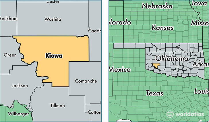
Kiowa County is a county equivalent area found in Oklahoma, USA. The county government of Kiowa is found in the county seat of Hobart.
With a total 2,669.51 sq. km of land and water area, Kiowa County, Oklahoma is the 738th largest county equivalent area in the United States. Home to 9,336 people, Kiowa County has a total 5172 households earning 36281 on average per year.
Kiowa County, Oklahoma - Quick Facts
| FIPS Code | 40075 |
| Area Codes | 580 |
| Time Zone | CST |
| Major Cities | Hobart (population: 4,206), Snyder (population: 1,649), Mountain View (population: 1,378), Lone Wolf (population: 851), Roosevelt (population: 543), Mountain Park (population: 532), Gotebo (population: 361) |
| Land Area | 3,605 sq miles |
| Water Area | 1,015 sq miles |
| Household Income | $36,281 |
| Housing Units | 5,172 |
| Median Home Value | $56,600 |
| High School Grads | 86% of population |
| Holders of Bachelors Degrees | 17% of population |
| Retail Spending | $5,955 per capita |
| Food & Accomodation Sales | $6,392 per capita |
This page was last updated on June 30, 2016.