Where is Cherokee County, Iowa?
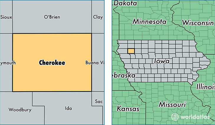
Cherokee County is a county equivalent area found in Iowa, USA. The county government of Cherokee is found in the county seat of Cherokee.
With a total 1,494.6 sq. km of land and water area, Cherokee County, Iowa is the 1851st largest county equivalent area in the United States. Home to 11,836 people, Cherokee County has a total 5757 households earning 48977 on average per year.
Cherokee County, Iowa - Quick Facts
| FIPS Code | 19035 |
| Area Codes | 712 |
| Time Zone | CST |
| Major Cities | Cherokee (population: 6,572), Marcus (population: 1,667), Cleghorn (population: 522), Washta (population: 505), Quimby (population: 500), Meriden (population: 318), Larrabee (population: 248) |
| Land Area | 4,570 sq miles |
| Water Area | 577 sq miles |
| Household Income | $48,977 |
| Housing Units | 5,757 |
| Median Home Value | $80,200 |
| High School Grads | 92% of population |
| Holders of Bachelors Degrees | 20% of population |
| Retail Spending | $11,935 per capita |
| Food & Accomodation Sales | $8,706 per capita |
This page was last updated on June 30, 2016.