Where is Ford County, Kansas?
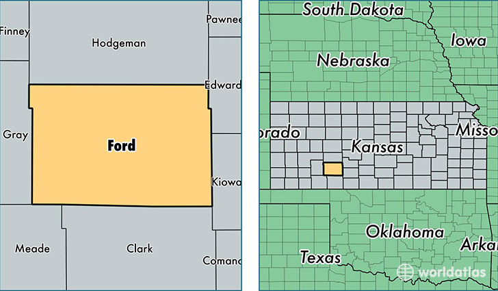
Ford County is a county equivalent area found in Kansas, USA. The county government of Ford is found in the county seat of Dodge City.
With a total 2,846.61 sq. km of land and water area, Ford County, Kansas is the 663rd largest county equivalent area in the United States. Home to 34,795 people, Ford County has a total 12076 households earning 51178 on average per year.
Ford County, Kansas - Quick Facts
| FIPS Code | 20057 |
| Area Codes | 620 |
| Time Zone | CST |
| Major Cities | Dodge City (population: 31,375), Spearville (population: 1,186), Minneola (population: 1,070), Bucklin (population: 988), Ford (population: 437), Wright (population: 355), Fort Dodge (population: 169) |
| Land Area | 13,434 sq miles |
| Water Area | 1,098 sq miles |
| Household Income | $51,178 |
| Housing Units | 12,076 |
| Median Home Value | $88,800 |
| High School Grads | 70% of population |
| Holders of Bachelors Degrees | 17% of population |
| Retail Spending | $12,121 per capita |
| Food & Accomodation Sales | $40,272 per capita |
This page was last updated on June 30, 2016.