Maps of Cape Verde

Cape Verde, officially known as the Republic of Cabo Verde, is an island country located in the central Atlantic Ocean, off the northwest coast of Africa. It comprises a group of ten volcanic islands, which are divided into the Barlavento (windward) and Sotavento (leeward) groups. The country has a total area of approximately 4,033 km2 (1,557 mi2), making it one of the smaller nations in Africa.
There are a few patterns in terrain: extensive salt flats cover Sal and Maio, while arid slopes transition into fields of sugarcane on Santiago, Santo Antao, and Sao Nicolau. The islands are hilly and mountainous, and encircled by rugged cliffs and reefs. The lack of significant rivers is due to the islands' volcanic nature and the arid climate, which limits the development of long or permanent river systems.
The Barlavento island group, located to the north, consists of the islands of Santo Antão, São Vicente, Santa Luzia, São Nicolau, Sal, and Boa Vista. Santo Antão, the westernmost island, is known for its rugged terrain and high mountains, with Tope de Coroa being the highest peak of this group at 1,979 meters (6,493 feet). São Vicente, home to the cultural hub of Mindelo, features a mix of volcanic and sandy landscapes. The uninhabited island of Santa Luzia is predominantly flat and arid. São Nicolau, with its mix of mountains and valleys, presents a diverse topography. Sal and Boa Vista are known for their flat, desert-like landscapes and extensive beaches.
The Sotavento island group, located to the south, include Maio, Santiago, Fogo, and Brava. Santiago, the largest island, hosts the capital city of Praia and is characterized by its mountainous terrain, fertile valleys, and a significant plateau. Fogo, home to the active volcano Pico do Fogo, reaches the highest elevation in Cape Verde at 2,829 meters (9,281 feet), dominating the island's landscape. Maio is relatively flat and arid, with long, sandy beaches and coastal dunes. Brava, the smallest of the inhabited islands, is known for its lush hills and rocky coastline.
Municipalities of Cape Verde Map

Cape Verde is divided into 22 major administrative divisions called concelhos or municipalities which are further subdivided into 32 freguesias or civil parishes.
The municipalities of Cape Verde in alphabetical order are: Boa Vista, Brava, Maio, Mosteiros, Paul, Porto Novo, Praia, Ribeira Brava, Ribeira Grande, Ribeira Grande de Santiago, Sal, Santa Catarina, Santa Catarina do Fogo, Santa Cruz, Sao Domingos, Sao Filipe, Sao Lourenco dos Orgaos, Sao Miguel, Sao Salvador do Mundo, Sao Vicente, Tarrafal, and Tarrafal de Sao Nicolau.
With an area of 631.1 sq. km, Boa Vista is the largest municipality by area and Praia is the most populous one which also serves as the national capital.
Where is Cape Verde?

Cape Verde is an African island country located about 570 km off the western coast of Africa in the central Atlantic Ocean in the Northern and Western Hemispheres of the Earth.
Regional Maps: Map of North America
Outline Map of Cape Verde


Key Facts
| Legal Name | Republic of Cabo Verde |
|---|---|
| Flag |
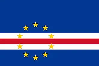
|
| Capital City | Praia |
| 14 55 N, 23 31 W | |
| Total Area | 4,033.00 km2 |
| Land Area | 4,033.00 km2 |
| Water Area | N/A |
| Population | 549,935 |
| Currency | Cabo Verdean escudos (CVE) |
| GDP | $1.98 Billion |
| GDP Per Capita | $3,603.78 |
This page was last updated on November 13, 2023