Gulf of Manfredonia
Gulfs are large inlets of a sea or an ocean surrounded in three directions by landmasses. The Gulf of Manfredonia, also known as Golfo di Manfredonia in Italian, is an inlet of the Adriatic Sea on the eastern coast of Italy. The gulf has been named after the bustling seaside town of Manfredonia in the Foggia province of Southern Italy’s Apulia region.
Geography Of The Gulf Of Manfredonia

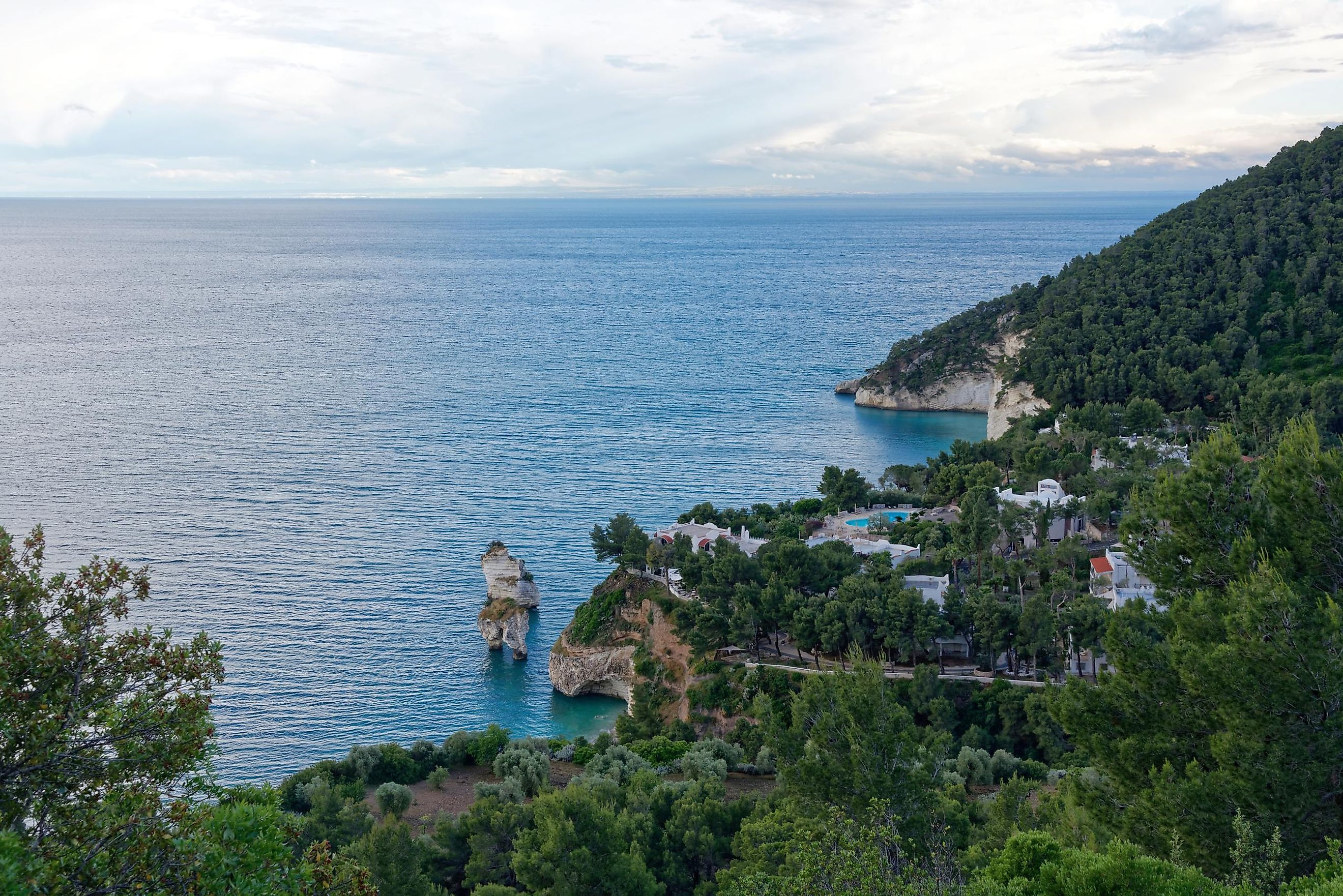
Bordered by the Monte Gargano peninsula in the north and the Apulian coast in the south, the Gulf of Manfredonia is a shallow gulf in the southwestern section of the Adriatic Sea. This gulf is placed immediately south of a protected area and tourist resort of the Gargano Promontory. Also bordering the gulf on the Italian coast is a salt marsh named Saline di Margherita di Savoia. The gulf’s bathymetry has revealed maximum water depths at about 90 m and a smooth seafloor surface without any notable morphological features. However, seismic studies have revealed the presence of the Gondola Fault Zone beneath the sedimentary cover.
The Gulf of Manfredonia acts as a changeover zone between the northern and southern Adriatic circulation. A cyclonic current with seasonal variability characterizes the southern Adriatic Sea’s offshore circulation, while the winds blowing from the north-northwest to south-southeast direction, which generates cyclonic and anticyclonic gyres, represents the inner circulation of the gulf. The gulf being a sheltered area has eutrophic waters compared to waters with a low nutrient concentration in the southward areas along the Apulian coast. Therefore, it is to be noted that the general circulation in the Adriatic Sea, coastal morphology, and land inputs significantly affect the Gulf of Manfredonia’s hydrological and biochemical characteristics.

The Gulf of Manfredonia receives inflows from many rivers, including Carapelle, Cervaro, and Ofanto. The 110 mi long Ofanto River rises at an elevation of 2,346 ft on the Irpinia Plateau and drains into the gulf between the towns of Barletta and Margherita di Savoia. Despite the Ofanto River’s length and extent of drainage basin (1,070 sq. mi), the average discharge at the river mouth is only 15 cubic meters per second. The 61 mi long Carapelle River, which drains into the Gulf of Manfredonia via the Saline di Margherita di Savoia, has an average discharge of 2.10 cubic meters per second. The Cervaro River is active only during winter and has an extremely low flow.
Climate Of The Gulf Of Manfredonia
As per Köppen climate classification, the town of Manfredonia, which borders its namesake gulf to its east, experiences a humid subtropical climate, with warm, humid summers and cold, windy winters. The hot season lasts from June 14 to September 10, where July is the hottest month having an average high temperature between 86°F and 69°F. The cold season lasts from November 20 to March 23, where January is the coldest month having an average low temperature between 42°F and 53°F. Manfredonia receives an average yearly precipitation of 27.8 inches.
History Of The Gulf Of Manfredonia

The Greeks initially settled the present-day Manfredonia area. In due course, the Samnites occupied this flourishing Greek colony, which was then reconquered by King Alexander I of Epirus in 335 BC. The Romans conquered the port of Sipontum in 189 BC, after which the Slavs destroyed it in AD 663. The Siculo-Normans made Sipontum the administrative seat of one of their counties in 1042. After the 1223 earthquake led to the stagnation of water in the lagoons, Sipontum became quite unhealthy and was eventually abandoned. Between 1256 and 1263, King Manfred constructed the modern city of Manfredonia, several miles north of the Sipontum ruins. In 1528, the city resisted an attack led by the French military leader, the Viscount of Lautrec. However, the city was destroyed by the Turks in 1620, who only left intact the city’s medieval castle and the Romanesque church of S. Domenico.
Ecology Of The Gulf Of Manfredonia

Bordering the Gulf of Manfredonia, the Saline di Margherita di Savoia is a Ramsar wetland that supports salt-resistant vegetation and messy reed and sedge beds that serve as crucial habitats for over 30,000 waterbirds. The wetland also serves as an important stopover point for migratory birds from their breeding sites in Northern Europe to their African wintering quarters. In addition, the wetland hosts regular visitors like Pygmy Cormorants, Great White Egrets, Great Bittern, White Stork, Black Stork, Greater Flamingo, Wood Sandpiper, Northern harriers, short-eared owls, and many more.
Moreover, the Gulf of Manfredonia also serves as a neritic foraging area for the loggerhead sea turtles of the Adriatic Sea. Studies have also revealed that the density of turtles in the Gulf of Manfredonia is also one of the highest in comparison to other Mediterranean areas. In addition, the areas along the gulf coast support many bivalve mollusks like Chamelea gallina, Acanthocardia tuberculate, Venus verrucosa, and Laevicardium oblungum. Several fishes, like anchovy, sardine, swordfish, albacore, and large hake, are also found here.
In recent times, the Gulf of Manfredonia is severely threatened due to the discharge of untreated sewage into the waters from the adjoining industrial and agricultural areas. Nevertheless, the Gulf of Manfredonia is an important water body in the region, and appropriate measures must be taken to prevent pollution of the gulf waters.


