What Are The Major Rivers Of West Africa?
West Africa refers to the westernmost part of the continent of Africa. The region has a total area of approximately 1,974,103 squares miles and had an estimated population of 362 million in 2016. Politically, West Africa includes 16 countries: Benin, Burkina Faso, Cape Verde, Ivory Coast, The Gambia, Ghana, Guinea, Guinea-Bissau, Liberia, Mali, Mauritania, Niger, Nigeria, Senegal, Sierra Leone, and Togo. Additionally, the region also includes two British Overseas Territories: Saint Helena and Ascension and Tristan da Cunha. Geographically, West Africa is predominantly plains. It also features numerous rivers. Major rivers include the Niger, Senegal, Gambia, and the Kolenté (Great Scarcies).
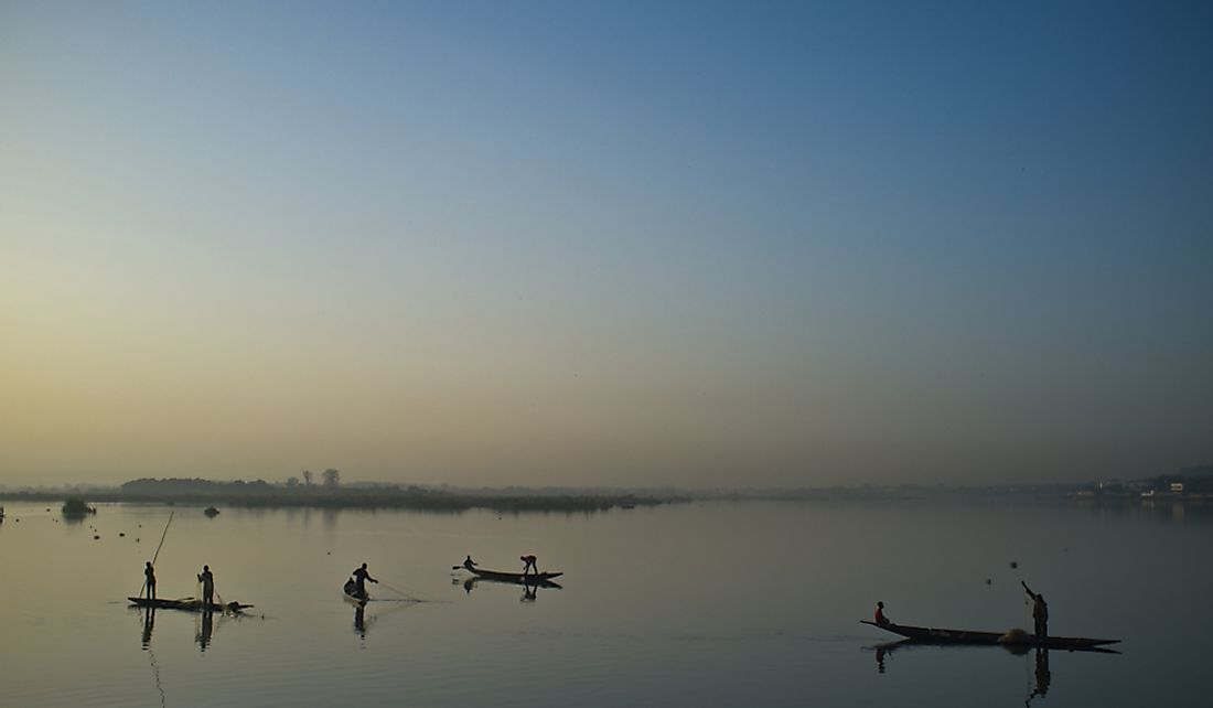
Niger River
The Niger River is one of the longest rivers in Africa, with a length of 2,600 miles. In fact, the Nile and the Congo (Zaire) are the only African rivers longer than the Niger. The river has a number of names depending on the local languages within a particular region. Some of these alternate names include Jeliba/Joliba, Orimiri/Orimili, Isa, Isa Beeri, Oya, Kwara, Maayo Jaaliba, and Egerew n-Igerewen. Draining a basin with an area of about 817,600 square miles, the Niger starts flowing from the Guinea Highlands in southeast Guinea, which is relatively close to the Atlantic Ocean. The river's course runs in a horseshoe shape through a number of countries, namely Mali, Niger, Benin, and finally Nigeria. In Nigeria, the river ultimately drains into the Gulf of Guinea, which is part of the Atlantic Ocean.
The course of the Niger River is somewhat unusual, in that its source in the Guinea Highlands is only 150 miles away from the Atlantic Ocean, but rather than flowing into the ocean, it flows into the Sahara Desert, the ancient city of Timbuktu, and finally into the Gulf of Guinea. However, this course is explained by the fact that the Niger River was formed through the joining of two ancient rivers: the Upper Niger and the Lower Niger. The Upper Niger started flowing from the western side of Timbuktu, while the Lower Niger began south of Timbuktu. The Lower Niger emptied into the Gulf of Guinea, while the Upper Niger emptied into a lake that is now dry on the northeastern side of Timbuktu. Over time, erosion and other factors caused the Upper Niger and Lower Niger to join.
Another unusual feature of the Niger River is the Inner Niger Delta. The delta is formed at a point where the altitude and velocity of the river decrease, which has created a marshy area full of streams and lakes as large in area as the country of Belgium. Fishing and agriculture are common and productive practices in the area, especially during the flooding season.
Senegal River
The Senegal River has a length of about 675 miles and serves as part of the border between Mauritania and Senegal, before finally draining into the Atlantic Ocean. The headwaters of the river come from two rivers that originate in Guinea, namely the Bafing and Semefé (Bakoye) rivers. The two rivers make up a small part of the border between Guinea and Mali but eventually meet at the small town of Bafoulabé, Mali. The Senegal River then flows west through Talari Gorges, Gouina Falls, and Kayes. Along its course, it picks up water from other rivers like the Kolimbine and the Karakoro. Additionally, two major dams, the Maka-Diama Dam and the Manantali Dam, have been constructed along the Senegal River, as well as a hydroelectric power plant, the Félou Hydroelectric Plant, which was built between the two dams in 1927.
Gambia River
Previously known as the River Gambra, the Gambia River runs for about 700 miles, from Guinea’s Fouta Djallon plateau before draining into the Atlantic Ocean. From its source, the river flows west and passes through Senegal and the city of Banjul, which is the capital of The Gambia, and drains into the Atlantic. The mouth of the river is located near Kunta Kinteh Island, which is now classified as a UNESCO World Heritage Site. Interestingly, the river is associated with the small nation of The Gambia, which only consists of the river's downstream half and its two banks. The river is a rich source of oysters, which are a traditional delicacy in The Gambia and are used for making oyster stew. The only endemic species in the river are three frog species and one fish species.
Sanaga River
Formerly known as the Zannaga River, the Sanaga River flows for about 370 miles. Beginning in the Central African country of Cameroon, the river rises at the Adamawa Plateau, which is the confluence of the Lom River and the Djerem River. In addition, other tributaries include the Uem River, Mbuku River, Tete River, Ligene River, Mbam River, Jape River, and Dorong River. The river drains a basin with an area of about 51,348 square miles and eventually empties into the Bight of Biafra. The course of the Sanaga River forms the boundary between two major ecoregions, the Cross-Sanaga-Bioko coastal forests and the Atlantic Equatorial coastal forests.
Volta River
The Volta River is a major river that flows for about 930 miles, from Burkina Faso’s Bobo-Dioulasso highlands into Ghana, and finally into the Gulf of Guinea. The name of the river stems from a Portuguese word that means "twisting" or "turning." The Volta has a drainage basin of around 157,179 square miles and is divided into three major parts: the Black Volta, Red Volta, and White Volta. The Black Volta forms the border between three countries, namely Ivory Coast, Burkina Faso, and Ghana. Along its course in the southern parts of Ghana, the river forms the Lake Volta reservoir, which is one of the biggest reservoirs in the world.


