Tibetan Plateau
Plateaus are defined as extensive flat uplands that rise sharply above the surrounding region on one side. Plateaus are found on every continent and occupy about one-third of the Earth’s land surface. Along with mountains, hills, and plains, plateaus are one of the four major landforms on Earth.
Contents:
Where Is The Tibetan Plateau?

Covering an area of about 2,500,000 sq. km and with an average elevation of more than 4,500m, the Tibetan Plateau (also referred to as the Himalayan Plateau/Qinghai-Tibet Plateau) is considered as the world’s highest and largest plateau. This vast elevated plateau covers a major portion of the Tibet Autonomous Region and the Chinese provinces of Qinghai, the western part of Sichuan, the southern part of Gansu, the northwestern part of Yunnan, and the Ali area of the Xinjiang Uygur Autonomous Region. The plateau also covers parts of the Indian Union Territory of Ladakh, the Lahaul and Spiti district of the Indian State of Himachal Pradesh as well as the Kingdom of Bhutan.
Geography

The Tibetan Plateau has a length of about 2,500km (from east to west) and a maximum width of about 1,000km (from north to south). The plateau is surrounded by several high mountain ranges and is therefore sometimes referred to as the “Roof of the World”. The Tibetan Plateau is bordered by the Kunlun Mountains and its associated mountain ranges in the north; the Himalayan and the Karakoram Mountain ranges in the south and southwest; and the Qilian Mountains in the northeast.
The Kunlun Mountains separate the Tibetan Plateau from the Tarim Basin; while the eastern part of the Tarim Basin is separated from the Tibetan Plateau by the Altyn-Tagh Mountain range. The Qilian Mountains separate the Tibetan Plateau from the Gobi Desert and the Hexi/ Gansu Corridor. The Himalayan Mountains form a barrier between the Tibetan Plateau and the alluvial plains of the Indian subcontinent. The Hengduan Mountains connect the Yunnan-Guizhou Plateau with the southeastern parts of the Tibetan Plateau.

The Tibetan Plateau is also referred to as the world’s “third pole” as it holds the largest storage of freshwater outside the Arctic (North) and the Antarctic (South) polar regions. The Plateau serves as the source of several major rivers of Asia including the Mekong, Salween, Yangtze, Huang He, Tarim, Brahmaputra, and the Indus Rivers. Besides this, there are several glaciers and brackish lakes in the Tibetan Plateau.
Geology

The formation of the Tibetan Plateau is quite similar to that of the Himalayas. The uplifting of the metamorphic and sedimentary rocks that created these mountain ranges also brought about the creation of the Tibetan Plateau. It is believed that this formation dates back to about 70 million years ago, as a result of the continental collision between the Indo-Australian Plate and Eurasian Plate. About 50 million years ago, this fast north-moving Indo-Australian Plate had gradually compressed and narrowed the Tethys Sea. Due to the increased compressive forces, masses of granites and basaltic rocks from the earth’s mantle were pushed upwards into the weakened sedimentary crust. In the next few years, the Tethys Sea completely narrowed and its sea bottom was gradually pushed upwards by the Indo-Australian Plate, resulting in the formation of the Tibetan Plateau. According to Geologists, the Indo-Australian Plate is still being pushed horizontally beneath the Tibetan Plateau, which is leading to the continuous rising of the plateau at a rate of 5mm per year.
Climate
The Tibetan Plateau experiences a typical high-altitude arid climate. The annual average temperature ranges between 5.6°C to 8.8°C. The Himalayas acts as a formidable barrier to the rain-bearing winds from the south and therefore the plateau receives low annual precipitation of 100 to 300mm, which mostly falls as hail. Extensive parts of the plateau are covered by permafrost. Occupying the northwestern part of the plateau, the Changtang region is the highest and the coldest part of the plateau, which experiences an annual average temperature of -5.6°C and during winters the temperatures here fall below -40°C.
Flora And Fauna

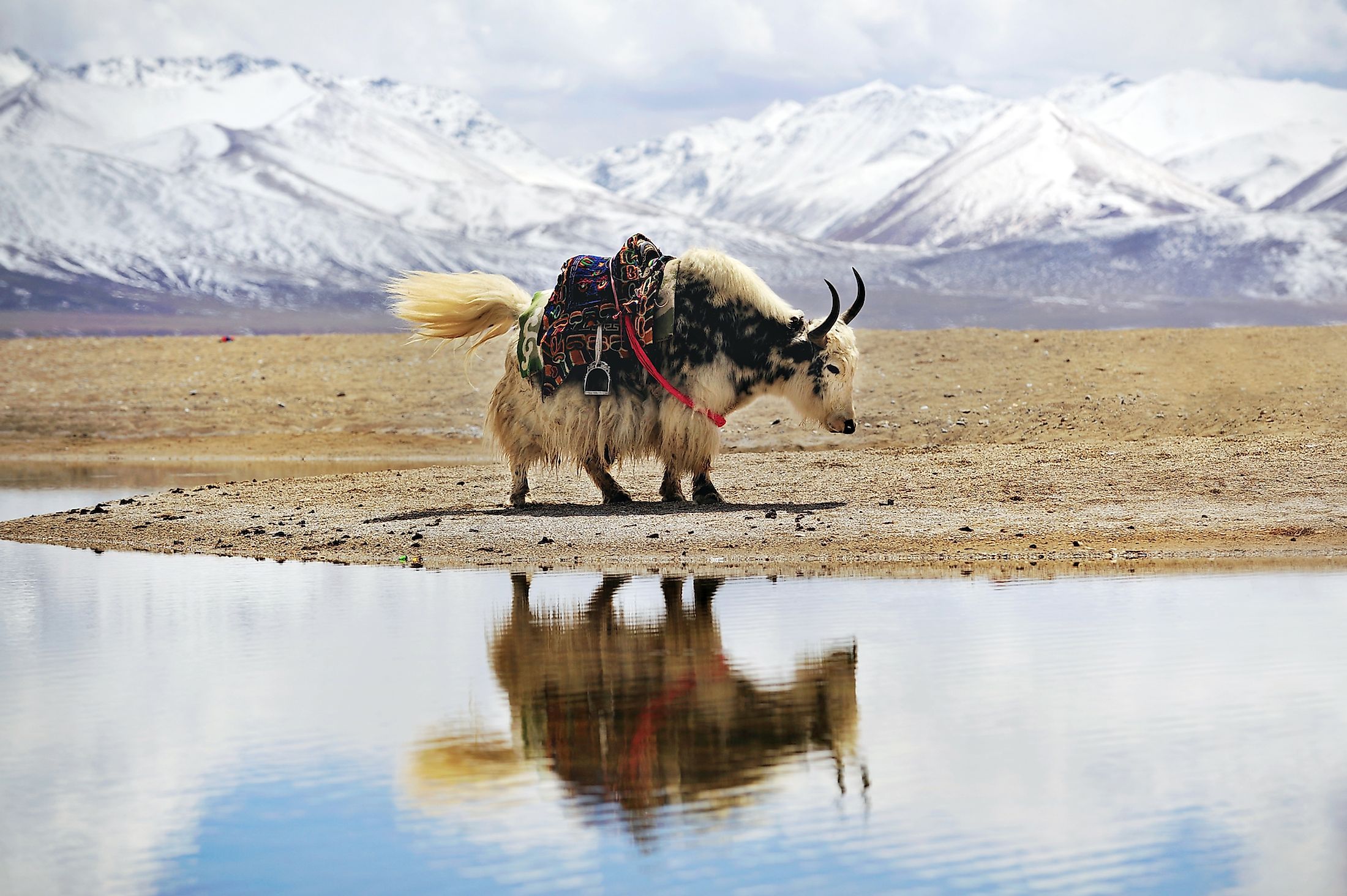
The montane grasslands is the major ecosystem that is found in the Tibetan Plateau. Some portions of the plateau are covered by alpine-tundra vegetation, while other parts that are influenced by monsoons are covered by forests and shrublands. Some notable faunal species that are found here include the Tibetan wolf, wild yak, wild donkey, snow leopard, water buffalo, etc. Birds like geese, cranes, hawks, and vultures are found. Some snakes are also found in the plateau region. The Himalayan jumping spider (Euophrys omnisuperstes) is a significant arachnid that is found in the Tibetan Plateau region. As per WWF, about 17 ecoregions are found on the Tibetan Plateau.


