What Is The Source Of The Dnieper River?
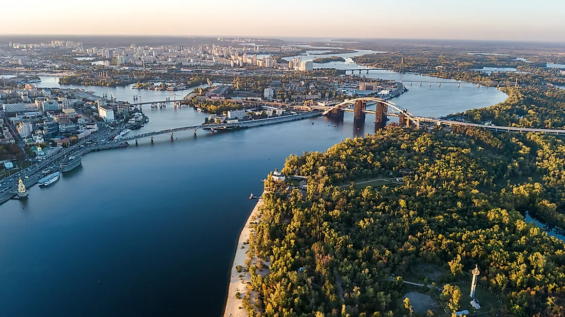
The Dnieper River is the fourth longest river in Europe. It runs a total length of 1,368 miles extending from the uplands of Russia’s Valdai Hills where it flows in a southerly direction through western Russia, Belarus, and Ukraine before emptying into the Black Sea. The River is usually divided into three parts; the upper portion reaches as far as Kiev, the middle portion generally refers to the area between Kiev and the Ukrainian city of Zaporizhzhya, and the lower portion is comprised of the area between Zaporizhzha and the river’s mouth at the Black Sea. Approximately 300 miles of the waterway is located in Russia, 430 miles are in Belarus, and 680 miles within Ukraine. The Dnieper River is significant not only due to its dams which provide hydro power but also for facilitating trade and providing a waterway in which to transport goods to and from various European nations.
Due to its sizeable length, the Dnieper River has as many as 32,000 tributaries including the Sozh, Desna, Trubizh, Bilozerka, Drut, Berezina, and Prypiat Rivers. The mouth of this important waterway is located at the Dnieper Delta while the river basin in the Ukraine and Belarus measures some 194,595 square miles. The Dnieper River passes through numerous urban centers such as the Russian cities of Smolensk and Dorogobuzh as well as Mogilev in Belarus and Kiev, Cherkasy, Dnipro, and Zaporizhia in Ukraine.
The River’s Source
The source of the Dnieper River can be traced back to Russia’s Valdai Hills which rise to an elevation of 720 feet. The river originates from a diminutive peat bog located on the hill’s southern slope. This northwestern region of central Russia is located near the city of Smolensk and some 150 miles west of Russia’s capital city, Moscow. The Valdai Hills are located at the intersection of several of the countries key rivers including not only the Dnieper but also the Volga, Lovat, and Daugava. This area also includes the drainage basins of the Black, Caspian, and Baltic Seas.
The Valdai Hills
The geography of the Valdai Hills is characterized by glacial deposits of hard rock and other assorted materials. The highest point in this area rises to a height of 1,138 feet near the town of Vyshny Volochyok. Among the lakes in this region of Russia include Lake Brosno, Lake Peno, Lake Seliger, and Lake Volgo.
Fishing in the Dnieper River has become an important part of the economy for various communities situated in the Valdai Hills. This recreational activity is also responsible for attracting increasing numbers of visitors which has resulted in making it a popular destination for tourists from near and far. The Dnieper River contains a diverse array of marine plants and animals. Among the most sought-after fish in the river include pike, carp, barbel, catfish, and perch.
History
The historical importance of the Dnieper River is undeniable especially in relation to the key role it has played in the establishment of various settlements in the eastern regions of Europe. During ancient times the Greeks referred to the river as the Borysthenes. In the 4th and 5th centuries various routes along the Dnieper were developed in order to link members of the Slavic population with those inhabiting the Baltic or Mediterranean areas thus enabling commercial and cultural exchange.


