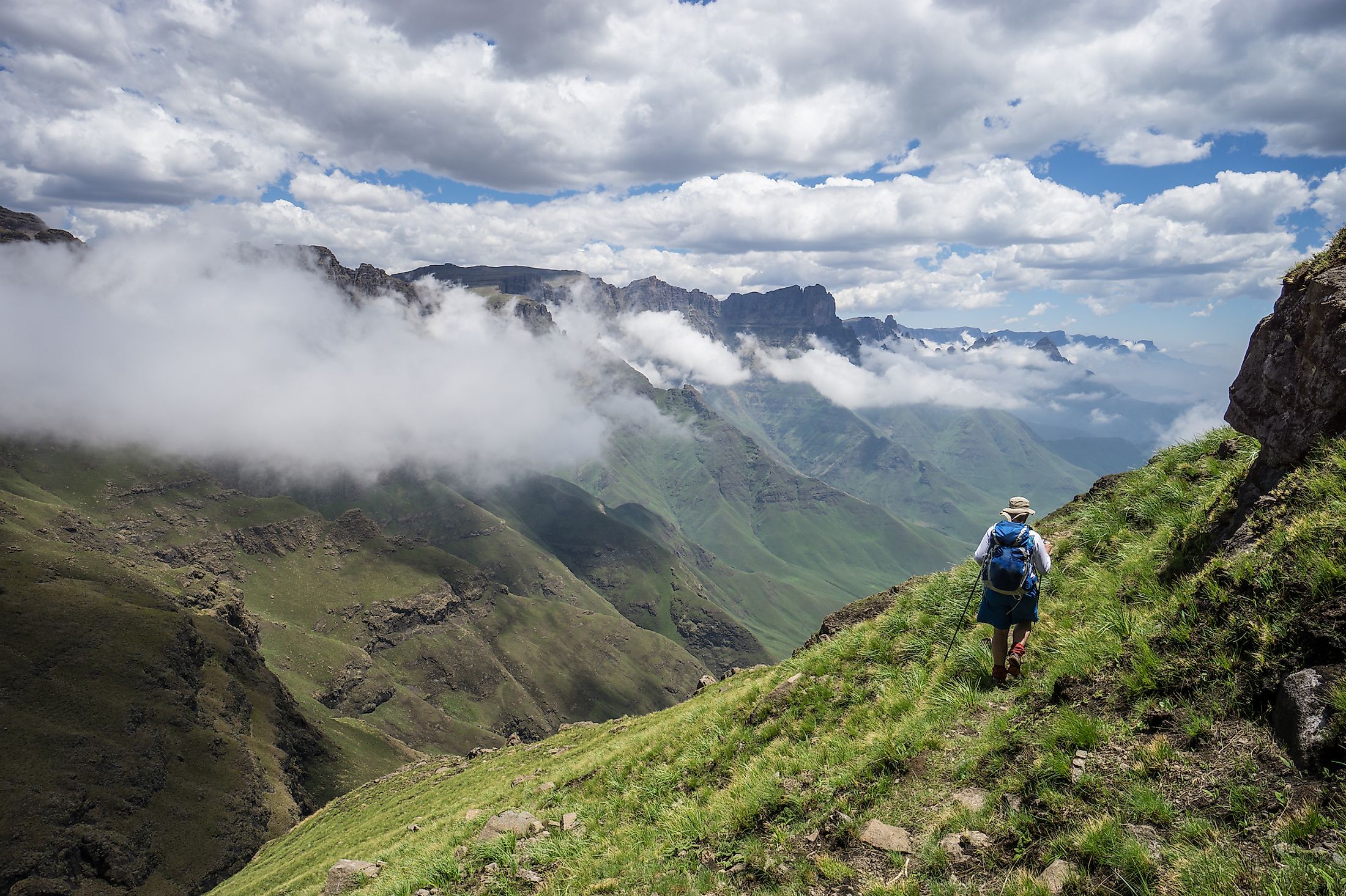
Drakensberg Mountains
The Great Escarpment is one of Africa’s major topographical features and a prominent natural landmark in Southern Africa. The Escarpment, which encloses the high central plateau, borders the ocean and surrounds Southern Africa on three sides; south, east, and west. Different names are used to refer to the different portions of the Great Escarpment. The eastern section, which is also the most well-known part, is often referred to as the Drakensberg. The Drakensberg consists of Southern Africa’s highest mountain range, with several peaks rising to more than 3,480m above sea level. The mountain range spans over 1,000km from northeast to southwest and is characterized by fascinating natural beauty. It contains cave and rock art dating back to thousands of years.
Location

Drakensberg Mountains is the eastern section of the Great Escarpment extending roughly southwest to northeast for about 1,125km. The range runs parallel to South Africa’s southeastern coast, separating the extensive high central plateaus of Southern Africa from the coastal land. The range begins in Mpumalanga and Limpopo provinces in the northeast and extends downwards, successively forming borders between Mpumalanga and KwaZulu-Natal provinces, then Free State and KwaZulu-Natal. Thereafter, it runs on the KwaZulu-Natal Province and Lesotho border, then between Lesotho and Eastern Cape. In Mpumalanga, the Escarpment comprises features like Three Rondavels, Blyde River Canyon, and God’s Window.
Geography

The Drakensberg Mountains span more than 1,000km and feature several jagged peaks, which have earned the mountain range the name “Barrier of Up-pointed Spears.” The Drakensberg is the Great Escarpment’s most elevated section, with peaks rising to 3,482m above sea level. Drakensberg’s most elevated section (in southern and eastern Lesotho) is characterized by a sandstone base capped by eroded basalt. The broken blocks form steep eastern scarp of 3,000-3,300m along the KwaZulu-Natal Province-Lesotho border and 2,400-3,000m southern scarp along the Eastern Cape-Lesotho border. Below the east and south scarps are sandstone terraces consisting of several scenic national parks and game reserves.
Drakensberg’s highest peak, Thabana Ntlenyana, rises 3,482m above sea level, making it Lesotho’s and Southern Africa’s tallest mountain. The Wolkberg, Limpopo Province’s highest elevation at 2,200m, is Drakensberg Range’s northeastern termination. Other peaks rising more than 3,000m include Mafadi, Makoaneng, Njesuthi, Giant’s Castle, Champagne Castle, Popple Peak, and Ben Macdhui. The Drakensberg is South Africa’s main watershed and the principal source of the Orange River.
Formation and Geology

The Great Escarpment resulted from the continental crust bulging in Southern Africa caused by mantle plumes over 180 million years ago. Later, rift valleys formed on both sides of the bulge were flooded, with their walls forming the Escarpment that surrounded Southern Africa. As the southern, Indian, and Atlantic Oceans widened, the Southern African subcontinent became dormant tectonically, with no volcanic or earthquake activities. However, erosion occurred uninterrupted and continues to date. Sediments eroded from the high central plateau have been deposited on the continental shelf surrounding the subcontinent.
Southern Africa’s eastern section has experienced further uplifting, resulting in most plateaus rising above 1,000 meters despite the extensive erosion. The Escarpment is highest on the east and slopes towards the south and west. The Drakensberg’s upper surface has been erosion-resistant, resulting in the high and jagged appearance. Lesotho Drakensberg comprises deep erosion gulleys forming the deep erosion valleys that are major tributaries that flow into the Orange River.
Ecology

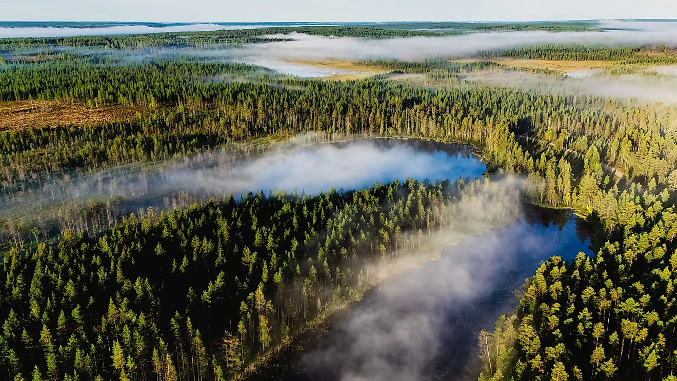
Covering approximately 11,125 sq.km area, the Drakensberg Range is one of the most striking and richest habitats in Southern Africa. It hosts a wide range of flora and fauna, including some of the subcontinent’s endangered species like lesser kestrel and Cape vulture. From about 2,500 meters, the Drakensberg Mountains are treeless, an ecoregion described as “Drakensberg alti-montane grasslands and woodlands” by the World Wide Fund for Nature. The steep slopes, located far from the equator, offer cool habitat, with high rainfall resulting in many streams and rivers, including tributaries of the Orange and Tugela Rivers. The mountains also host Tugela Falls, the world’s second-highest fall, with a water drop of 947m.
Several plant species cover the Drakensberg Mountains, including some threatened species. The main floras on higher peaks (above 2,500) are tussock grass, shrubs, and creeping plants. The lower slopes contain grasslands, conifers, mainly Podocarpus. Grasslands host most of the endemic species, with grasses including oat grass. On higher elevations, plants vary with rock composition and hardness.
Drakensberg Range is home to over 299 avian species, accounting for more than one-third of all Southern Africa’s non-marine bird species. Mountain pipit is the only bird endemic to the high mountains. Other species found on high peaks include Bush blackcap, Rudd’s lark, yellow-breasted pipit, and Drakensberg rockjumper. Lesser kestrel and Cape vulture. Mammals on high peaks include eland, klipspringer, and mountain reedbuck. However, most wildlife inhabits the lower slopes, including black wildebeest, white rhino, reedbuck, gray rhebok, chacma baboon, and oribi.
Conservation

Drakensberg Range is a popular tourist destination, with resorts, hotels, and hiking trails on the slope. Some parts of the range are designated national parks and game reserves. The uKhahlamba Drakensberg Park is a UNESCO World Heritage Site covering about 2,428 square kilometers and includes the Royal Natal National Park, which hosts some of the Escarpment’s highest peaks. The KwaZulu-Natal-Lesotho border has up to 40,000 cave paintings known as San rock art. The cave paintings were done by the San people, commonly known as Bushmen.