Glacial Landforms: What Is A Kame Delta?
A Kame delta, also referred to as Morainic or ice-contact delta, is an icy land that is formed when melted water flows around or through a glacier and deposit materials (sediments) called kame deposits. Once it reaches the proglacial-lake located at the terminus of the ice, it deposits the sediments, and after the ice has melted an asymmetrical triangular shape glacial landform (Kame delta) appears. The edges of the delta tend to subside once the glacier beneath it starts melting. As the ice is melting some glacial tills are deposited on the lateral subsiding sides of the delta.
What Is Kame?
Kame is an irregularly shaped mound or hill or a glacial landform which is made up of till, gravel and sand. These sediments accumulate in depressions on the retreating ice which is deposited on the land after the ice has melted. The term ‘’kame’’ is a unique alternate of the word comb which refers to the crest.
What Is Glacial Till?
Glacial till are unsorted sediments which are derived from entrainment and erosion of different materials caused by the moving polar ice. The tills are usually deposited some few distances down the ice to create a ground, medial, lateral and terminal moraines. There are two classifications of tills, the first deposit of sediments are deposited directly by the glaciers. The second glacial till is collected by the water as it moves up and down the streams or rivers.
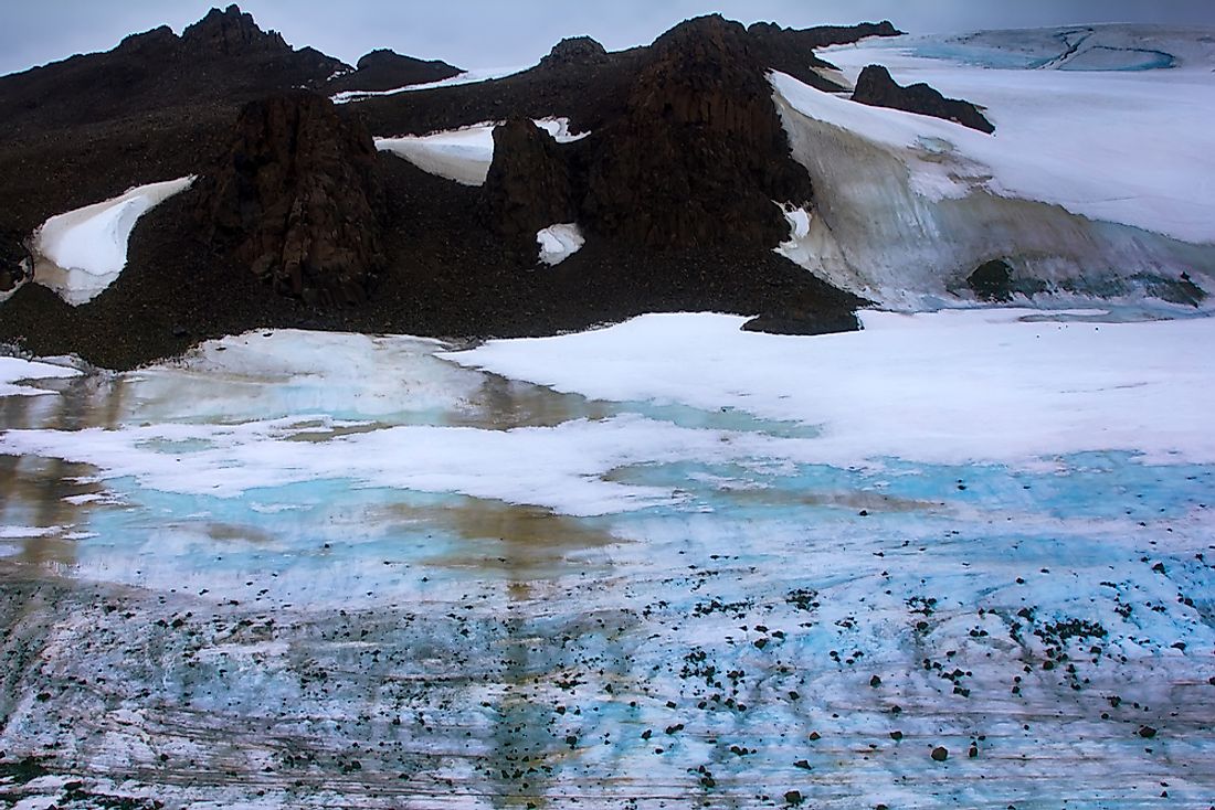
How Are Kame Deltas Formed?
While the stream and river flow into the pro-glacial lake, it deposits numerous sediments of gravel, sand, and silt in the lake. Since the sediments are slowly deposited, the moving water will sort the stratigraphy of the sediment beds. The sediment beds will have a distinct variation in particle size, and the velocity of water determines the arrangement of the sediments. With time the residue will continue building up until it grows out of the Proglacial Lake. The amount of time taken for the kame to build out of the lake depends on the depth of the lake plus if the ice is melting steadily.
After the Kame delta has grown out of the lake, the water starts depositing the sediments against the toe or terminus of the glacier which will result in the flat-topped triangular-shaped mound. The part which slopes down into the lake will be the more extended section of the triangle. The steeper part is the one that is on the terminus of the glacier. Once the ice starts retreating the ice below the delta will melt thus exposing the fault lines of the Kame delta.
Fonthill Kame
One of longest kame deltas in the world is Fonthill Kame. Fonthill is the highest point in the Niagara Peninsula located in Ontario. The Fonthill is about 246ft high above all surrounding area which makes it the highest peak in this region. The length of the kame from west to east is 4 miles and width from north to south is approximately 2 miles long. The Fonthill kame plays a significant role in influencing the climate of this region since it blocks the coming wind. Other kame deltas are in the Chenango River located in New York, the Tree River in Nunavut, Canada, and in Glacial Park in Ringwood, Illinois.


