Bering Strait
Straits are common geographical features in almost all the world's oceans or open waters. A strait is a narrow waterway or channel connecting two large water bodies. It can also be described as a water channel that separates two large landmasses. A strait allows for an exchange of water between two open water bodies and may also act as a boundary between the two landmasses.
There are dozens of straits separating open water bodies, such as oceans, seas, and gulfs. The Pacific Ocean has at least 19 straits of varying length and width. One of the major strategic straits in the Pacific is the Bering Strait, separating two of the world’s largest countries: the United States and Russia.
Where Is The Bering Strait?

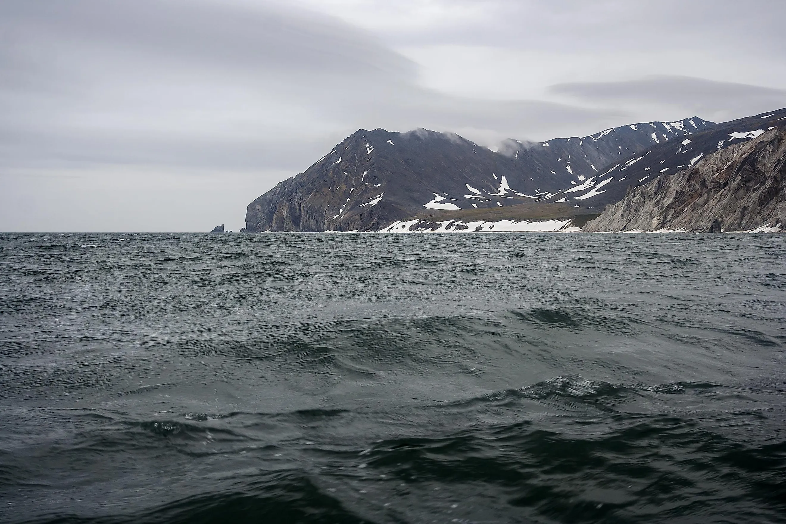
The Bering Strait is the Pacific’s northernmost part and separates Asia and North America, particularly Russia and the United States. It connects the Bering Sea to the Chukchi Sea of the Arctic Ocean. At the strait’s narrowest point, Asia (Russia) and North America (the US) are just 85 km apart. The narrowest point is between Cape Prince of Wales in Alaska and Cape Dezhnev in Russia. The international boundary between the two countries passes through the Bering Sea and Strait. Both the Bering Strait and Sea were named in honor of Vitus Bering.
Geography

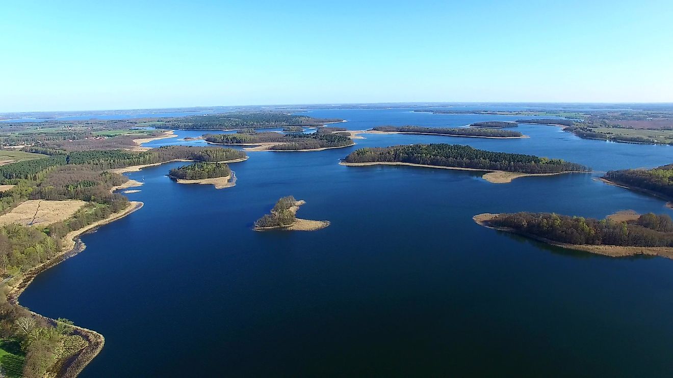
The Bering Strait is relatively shallow, with an average depth of 50 m. It is only 90 m deep at the deepest point. It has been theorized that the Bering Strait was once a land bridge between North America and Asia during an Ice Age. During that period, the sea level fell significantly, creating a land bridge, possibly enabling plants and animals to move in either direction. In winter, the strait experiences severe storms, with ice covering most parts of the Bering Sea. In midsummer, the ice remains drift into the strait.
The Strait has numerous islands, including the Diomede Islands and St. Lawrence Islands. The two Diomede Islands are located in the middle of the strait. The Big Diomede Island belongs to Russia, while the Little Diomede Island is on the US side. The International Date Line runs between the two islands, leaving the American and Russian sides on different calendar days. The Russian side is 21 hours ahead of the American side, 20 hours ahead during daylight savings time. St. Lawrence Island is the US's sixth-largest Island.
Brief History And Population

In the mid-16th century, European geographers posited that a strait, which they named the Strait of Anián, separated North America and Asia, but no one had ventured so far as to confirm this strait's existence. A century later, Semyon Deznyov crossed the strait, but news of his expedition did not reach European geographers. In 1728, Vitus Bering, a Danish cartographer, entered the strait. Four years later, Mikhail Gvozdev, a Russian exploration commander, crossed the strait for the first time from Asia to North America. He was among the first Russians to sight the Alaskan shores.
Many scientists believe that people migrated from Asia to North America by foot across the Bering Strait during the most recent ice age. However, not many people settled around the strait. The area is generally sparsely populated, only dotted by small villages and settlements. The most populous American towns include Teller (230 people) and Nome (3,800). Russian towns include Lavrentiya (1,460) and Lorino (1,300). St. Lawrence Island has about 1,000 people, while Little Diomede Island is home to some 135 people.
Bering Strait Crossing
Since its discovery, humans have crossed and continue to cross the Bering Strait from either direction. However, in 2012, Russia declared its strait’s coastal area a closed military zone that can only be accessed by special permit. Any unauthorized person who crosses the strait onto the shores may be arrested and deported.
However, several people have successfully crossed the strait, even without boats. In 1913, Max Gottschalk crossed it from Russia to Alaska using a dogsled. In 1987, Lynne Cox, an Olympian swimmer, swam about 4.3 km between Alaska and the Soviet Union. Her action was commended for easing the tension between the US and the USSR during the Cold War. In 1998, Dmitry Shparo and his son skied across the frozen strait. French adventurer Dimitri Kieffer and Briton Karl Bushby walked across the frozen strait in 15 days in 2006.