Maps of Congo

The Republic of the Congo, situated in Central Africa, shares its borders with Cameroon to the northwest, the Central African Republic to the northeast, the Democratic Republic of the Congo to the south and east, Gabon to the west, and Angola's exclave of Cabinda to the southwest. The country also has a coastline along the Atlantic Ocean to the west. Covering a total area of approximately 342,000 km2 (132,047 mi2), roughly 70 percent of the Republic of Congo is covered in rainforest.
High and Low Points: The highest point in the Republic of the Congo is Mount Nabemba, located in the Sangha Region in the northern part of the country, with an elevation of 1,020 meters (3,346 feet). The lowest point is the Atlantic Ocean coastline, at sea level.The following five regions are categorizations of the country's geography:
Coastal Plain Region: This region, along the Atlantic coastline, consists of a flat, sandy coastal strip. The width of this plain varies, extending up to 50 kilometers inland in some areas. The region's elevation is generally low, transitioning from the coastal beaches to inland lagoons and swampy areas, particularly near the mouth of the Congo River. The coastal plain serves as a natural bridge between the ocean and the interior landscapes.
Niari Valley: Located in the southwestern part of the country, the Niari Valley is a significant geographical feature. This wide and fertile valley is characterized by rolling hills and is a key agricultural area for the Republic of the Congo. The region's elevation gradually rises from the coastal plains, forming a transitional zone between the lowlands and the Mayombe Massif to the west.
Mayombe Massif: Southwest of the Niari Valley lies the Mayombe Massif, a mountainous region that extends into neighboring Gabon and Angola. This region is known for its dense forests and steep hills, with elevations reaching up to 800 meters above sea level. The Mayombe Massif forms a natural barrier along the country's western border.
Central Plateaus: Dominating the central portion of the country, the Central Plateaus are characterized by their undulating terrain, with altitudes generally ranging from 300 to 700 meters above sea level. This region is marked by a series of plateaus interspersed with valleys and occasional hills, contributing to a varied topography. The plateaus are mostly covered in savanna grasslands, with patches of forests in the valleys and lower areas.
Cuvette Region: The Cuvette Region, located in the northern part of the country, encompasses the Congo Basin. It is a vast depression characterized by its tropical rainforests and numerous rivers and streams. The elevation here is lower, making it one of the most important drainage areas for the country's river systems. The Cuvette Region is crucial for the hydrology of the Republic of the Congo.
Major Bodies of Water: The Congo River, the second-longest river in Africa, is the most significant waterway, forming the southern border with the Democratic Republic of the Congo. This mighty river and its tributaries, including the Ubangi and Sangha rivers, are vital for transportation, fishing, and as freshwater sources. The Congo River's vast drainage basin covers a significant portion of the country.
Administrative Departments of Congo Map

The Republic of the Congo has 12 departments as the top-level administrative division. In alphabetical order, they are: Bouenza, Brazzaville, Cuvette, Cuvette-Ouest, Kouilou, Lekoumou, Likouala, Niari, Plateaux, Pointe-Noire, Pool, Sangha.
These departments are further divided into districts and communes.
With an area of 66,044 sq. km, Likouala is the largest department and Brazzaville, the national capital, is the most populous one.
Where is Congo?

Congo or the Republic of the Congo is located in Central Africa in the Eastern Hemisphere of the Earth. With the Equator passing through the country, it has territories in both the Northern and Southern Hemispheres. The four sovereign nations of Gabon, Cameroon, Central African Republic and the Democratic Republic of the Congo bound the country to the west, northwest, northeast, and southeast respectively. Cabinda, an exclave of Angola, lies to the south of Congo. The country also has a coastline on the Atlantic Ocean to the southwest.
Congo Bordering Countries: The Central African Republic, Angola, Gabon, Cameroon, The Democratic Republic Of The Congo.
Regional Maps: Map of Africa
Outline Map of Congo


Key Facts
| Legal Name | Republic of the Congo |
|---|---|
| Flag |
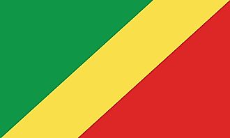
|
| Capital City | Brazzaville |
| 4 15 S, 15 17 E | |
| Total Area | 342,000.00 km2 |
| Land Area | 341,500.00 km2 |
| Water Area | 500.00 km2 |
| Population | 5,380,508 |
| Major Cities |
|
| Currency | Cooperation Financiere en Afrique Centrale francs (XAF) |
| GDP | $10.82 Billion |
| GDP Per Capita | $2,011.07 |
This page was last updated on November 20, 2023